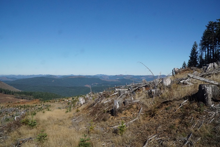
I had mapped out three different routes to the summit “trailhead” and opted to drive up from the south off Nestucca River Road. Turn north at an unmarked road/intersection .7 miles west of the NW Boundary Road/Nestucca River Road intersection. Most roads in this area are unsigned. It is highly recommended to take a map and GPS for directional references. Drive for approximately 15 miles on well graded roads through typical forested areas, old clear-cuts and new logging operations. Once onto Toll Road heading east, turn right at an intersection near a map marker labeled BM 2776. Turn right onto this road and continue for approximately a ½-mile. There will be an old summit road blocked by large tree stumps. This is the old summit road and can be hiked to the summit or just bushwhack less than a quarter mile straight up the hill. Single vehicle parking is available at the summit road as well as additional parking a few hundred feet further up the road.
The reason I chose this route was due to reports on both Peakbagger and Summitpost about Weyerhaeuser gates blocking other routes.
I took the “north” route home which was MUCH easier, shorter and a perfectly graded road. The route to the summit begins in Yamhill. Head West on Pike Road (north end of Yamhill). At 4.7 miles Pike Road becomes NW Turner Creek Road. Continue on NW Turner Creek Road for 8.4 miles and take a hard left onto NW Flora Mainline. Continue on NW Flora Mainline for 9.3 miles and turn left at the intersection near BM 2776 on the topo map. See remaining ½-mile directions above.
There is an access gate at some point where the paved road ends and the gravel road begins. The gate can be closed at any time without notice but is typically open during weekends throughout deer hunting season. Because of this, the optimum time to attempt the peak is a weekend during deer season (note my activation date) when the access gate is most likely open and while logging activity is minimal.
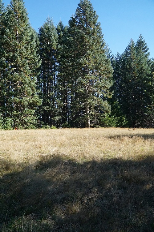
The summit is a large beautiful meadow, though surrounded by trees rendering no views. This would be a perfect place for multiple activators with lots of room for HF wire antennas. I passed droves of hunters during the drive up and heard multiple gunshots while on the summit. I worked 2 meters, made the minimum 4 contacts and quickly departed for self-preservation!