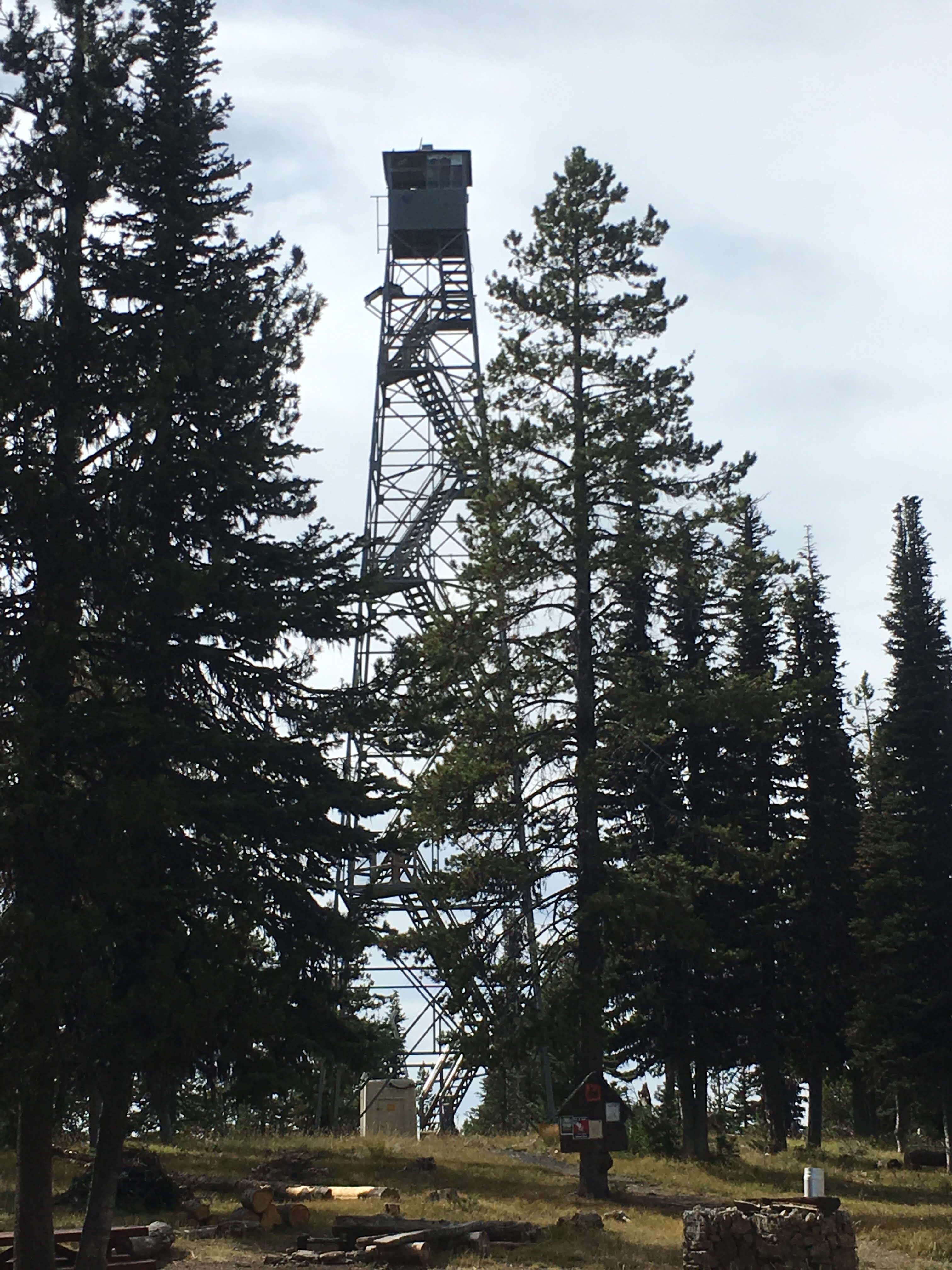
Tower Mountain really does have a tower on it. The 92'-tall Aermotor steel lookout tower was built in 1935. It is still standing and accessible today. Your level of enjoyment with the activation will likely increase if you are able to use the tower in your activation. This peak is the highest and most prominent point in Umatilla County, Oregon, but the summit is tree lined so getting up the tower gets you above the trees.
Although it can be a drive-up summit, it would make a great mountain bike activation from the North side by parking where the off-road section starts. There are several opportunities to park on the way up so you can decide on a good hiking distance that works for your level of fitness. I parked 2.5 miles from the summit on the North side. Directions are provided below for both South and North access.
Per https://www.summitpost.org/tower-mountain/747434. No special permits or fees are required to drive to the summit of Tower Mountain. The North Fork John Day Ranger District headquarters is in nearby Ukiah, OR. The ranger district headquarters number is (541) 427-3231. The ranger district is open Monday-Friday but closed on weekends and holidays. I called ahead and confirmed the tower would be manned on the day I activated (Sept ’19 PNW SOTA VHF long distance event).
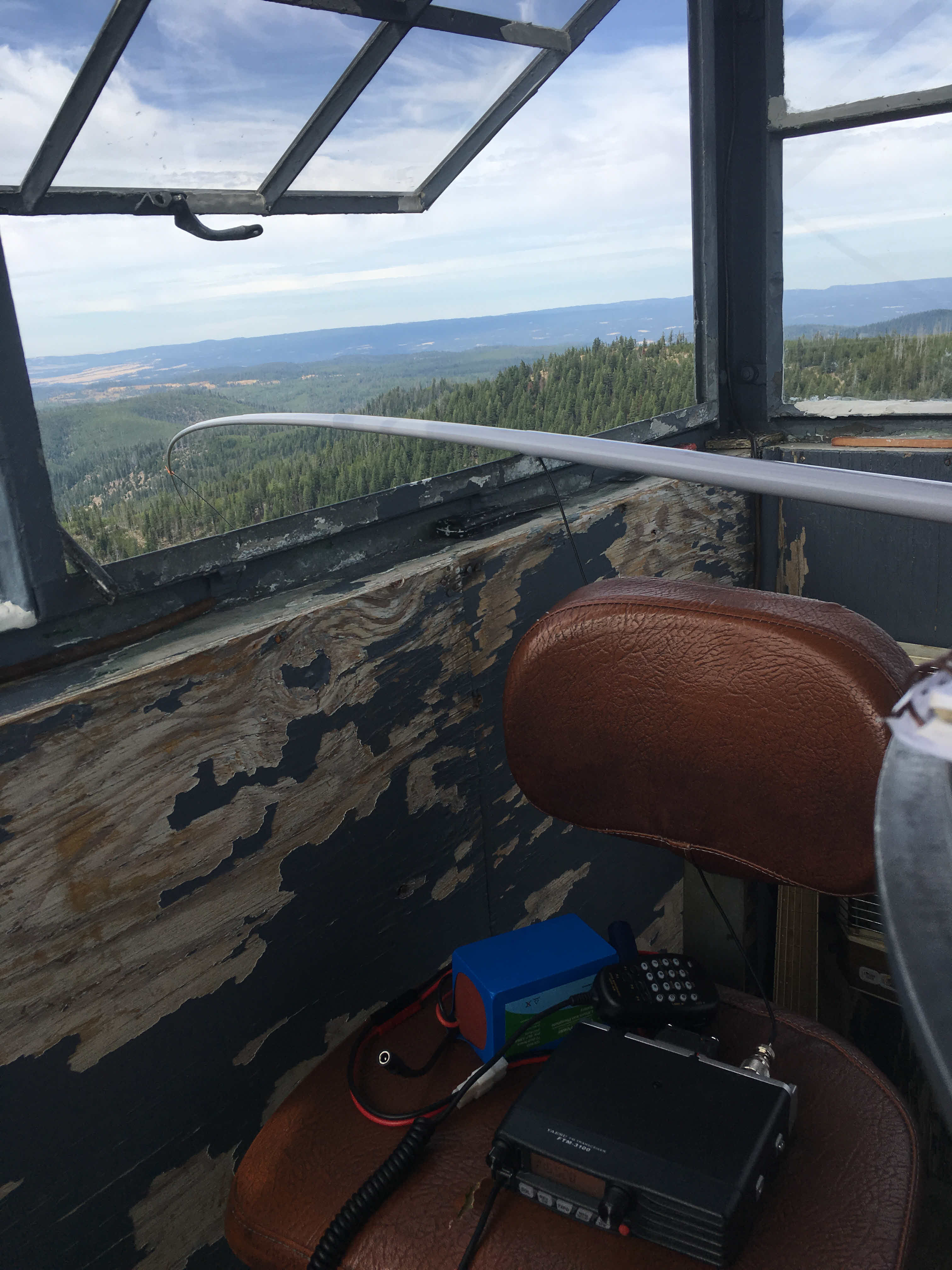
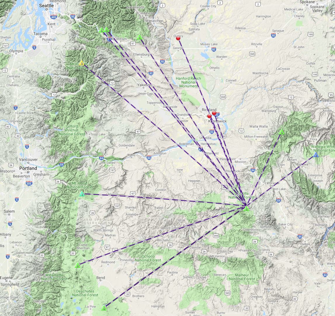
There is a flat spot within the activation zone that would allow an HF set up, if tower access is an issue. For a VHF activation, the trees block line of sight, so not sure how well that would work. On my activation, I went up the tower explained ham radio, SOTA and the long-distance event going on that day to the ranger and he was very gracious and let me operate from the top of the tower. We had a great time! This was first activation of this summit, so not sure how “activation fatigue” would wear on the rangers there. The lookout station on the tower has no deck, so you’ll need extend something out the window. The tower and the lookout station are all metal. I extended a telescoping fiberglass pole out the window for my activation (pic below). There are small landings on the stairs leading up the tower. I think an activation would be feasible from one of them. On the day I was there it was 20+ mph wind, so it would have been challenging to operate from one of the landings.
I accessed the summit from the North side and found that traversing forest road NF-5169 was suitable for high clearance vehicles only and quite narrow in spots for my F-150. It would make for a great mtn bike ride though!
Here is the route I took from the North:
- I-84 towards Pendleton; I-84 exit 252 for OR-244
- At 22.5 miles, turn left onto NF-5160. (recommend park here for Mtn Bike ride in) NF-5160 is a well serviced wide gravel road.
- At 6.6 miles right on NF-5169. There is a sign, and you almost don’t believe it as the road immediately gets pretty sketchy. Stay on this road for 3.8 miles
- Turn left on NF-5226. From this point it is 3.5 miles to the top. As you approach the top it gets very rutted and rocky.
I exited to the South on my way out so I could scout that route out. This side is more approachable. A couple rutted sections, but the ranger in the tower claimed he had actually taken a Prius up this route! I think a Subaru Outback would do fine.
Directions from the South:
- I-84 towards Pendleton; I-84 exit 209 for Hwy 395
- Hwy 395 south for 50 miles; exit left for Hwy 244 East, go 1 mile
- Turn right at Camas St, this is USFS Road 52. Stay on this road for 23 miles
- Turn left on NF-5226. It is marked with small sign. This is end of pavement.
- Summit will be 8 miles up road NF-5226