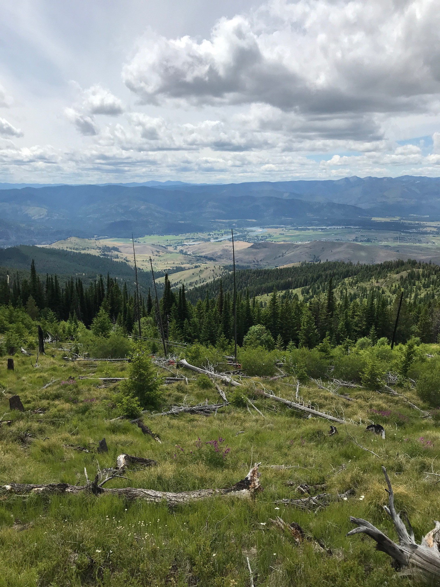
I was not fortunate to get any contacts nor activate this peak today. This was mostly due to my current limitations in radio gear. I used a Yeasu FT-2D at 5 watts with a 42 inch tape measure type of antenna. Although well within the exposed activation zone, the forested summit prevented me from reaching out to the northeast where I easily picked up two contacts earlier from Mount Baldy a few hours prior. I was calling on 146.52 MHz FM voice. I had a great line of sight to five other summits in the Plains, Montana area. Mount Baldy, Sacajawea Peak, Big Hole Peak, Henry Peak and Patricks Knob. Someone with a transciever that used a more penetrating band on CW should be able to reach out from here.
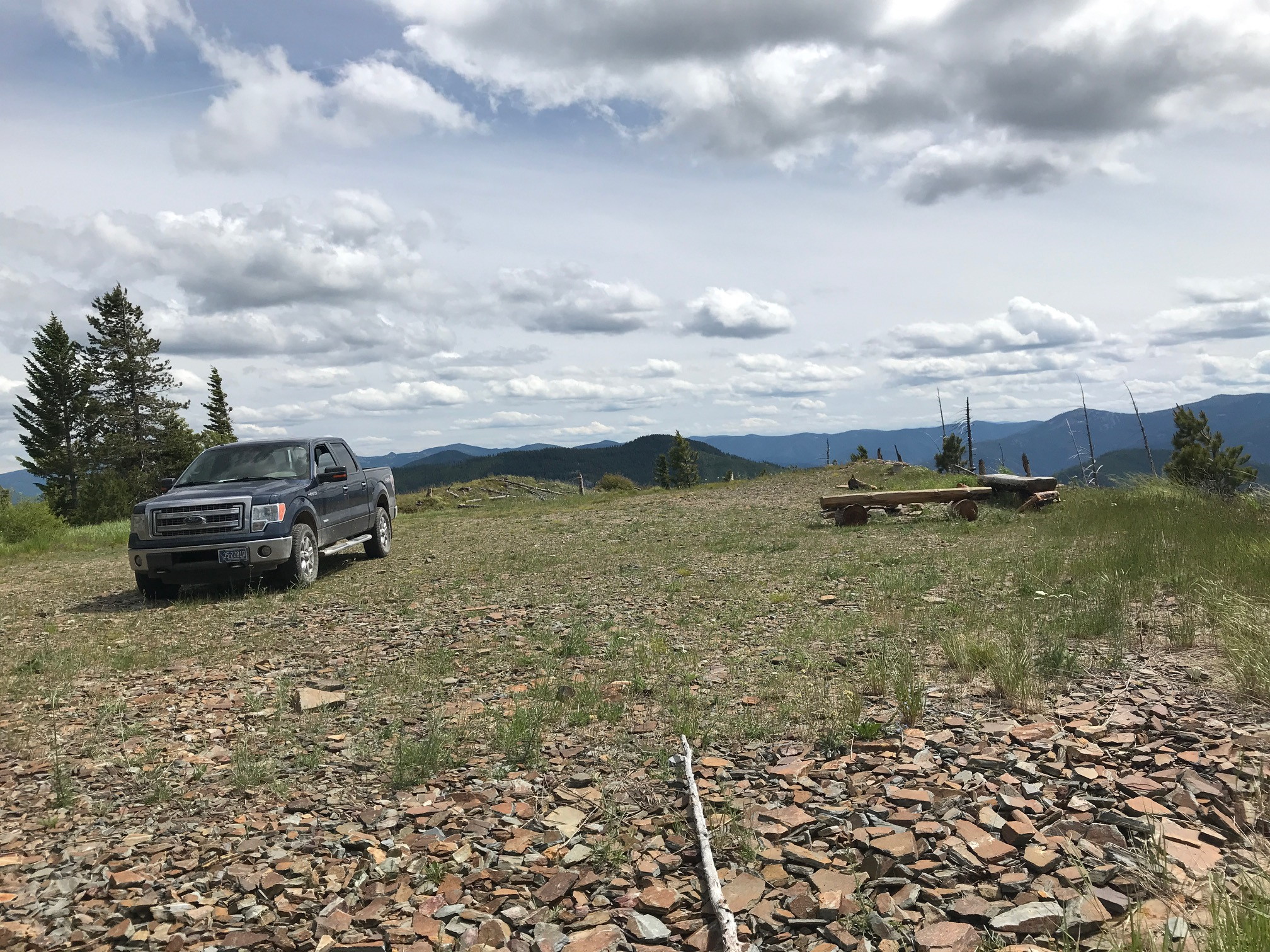
Refer to the link below for a map showing the route I will now describe. This is not a tough summit to ascend. Take Forest Road 661 (Henry Creek) that starts just 2.6 miles east of Downtown Plains, Montana. Take Forest Service Road 440 from there and then Forest Service Road 17382 from there to the end. The road ends at a large open area with plenty of parking, a great view of Plains below, a campfire area and benches. Four wheel drive vehicles are not required.
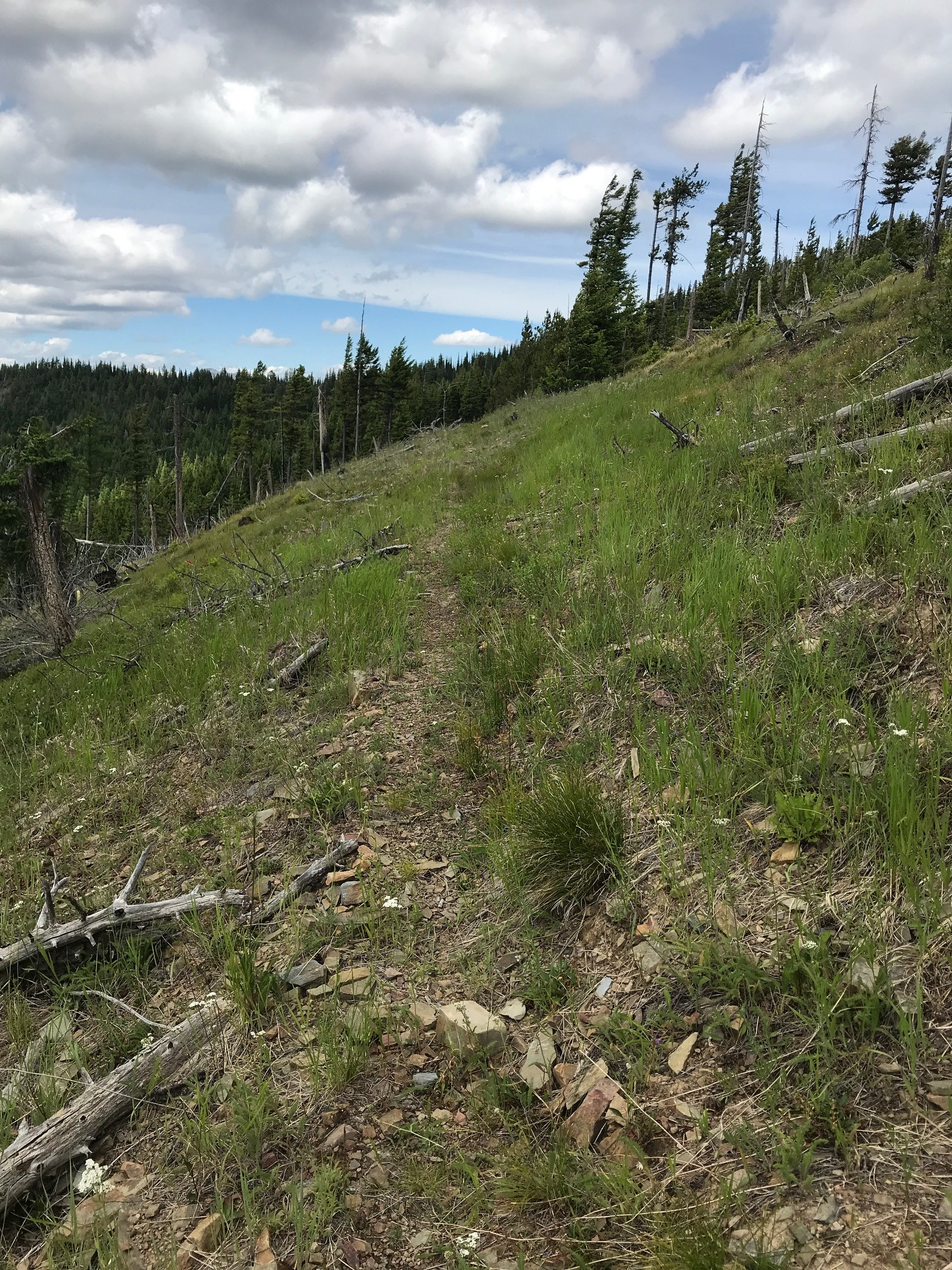
The trails marked in blue are almost non-existant. Vary narrow and hardly used at all. The easiest one to find is the west-most trail which parallels the ridge for about half a mile. Before you reach the end of the trail you need to bushwhack cross country up a steep incline to get to the exposed activation zone. This leg is marked on orange on the map. I stopped there and did not continue to the top as it looked like the summit was heavily forested. You may find different.
And as always, if you plan to activate any of the peaks in the Plains, Montana area, let me know. I can at least chase you from downtown on most peaks around here.
Map of route see link below.