The Nestucca River Byway is a very secluded and off-the-beaten-path route through the North Coastal Range, between HW6 to the North and HW18/HW22 to the South. It's paved from Carlton at least as far West as the turnoff South to Willamina, but not maintained in the winter, so the sign says when approaching from the East from Carlton.
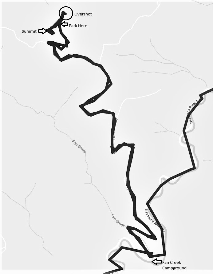
The turn from Nestucca River Byway onto the gravel road heading North toward Dovre Peak is directly across from the small Fan Creek Campground. The road is gravel but shouldn't be a problem for any but the lowest clearance vehicles. I initially drove past the trailhead to the summit, since the road is rather straight and flat at that point.
Walking up the motorcycle trail it took just a minute or two before turning left to bush whack for perhaps another minute to the summit, which wasn't too difficult. The summit is a ridge with a length of perhaps 30 meters, easily navigable. I set my telescoping fiberglass pole against some tree branches with small pulley attached (didn't need to add guy wires), hoisted my 2m J-Pole, then 10m J-Pole (no luck--band wasn't open), then dipole set for 20m (big contest was going, so no chance to get through with my QRP radio) and then to 17m where I immediately made a contact to Arizona (my only HF contact). I did get a summit-to-summit with KJ7UTC (nearly my own callsign!) and a 2-summit chaser on VHF, making three total. Thanks everyone!
In the heat of summer, it would be a very nice drive from Willamette valley or from just south of Tillamook.
Here's a time-lapse of the walk up to the summit (after retriving my HT from the truck).
It was early March and the road had potholes, but nothing too bad.