Anderson Butte is a beautiful, year-round hike with incredible views of higher peaks throughout the Siskiyou, Coast, and Northern California ranges. There are multiple parking/trailhead options with access to both the peak and the Jack-Ash trailsystem connecting the Applegate Valley, Jacksonville, and Ashland.
Getting to Anderson Butte is relatively straightforward with well-written instructions from Siskiyou Upland Trail Association (SUTA). We started at Griffin Gap trailhead (BLM Map), but we wouldn't park here again. While this is a giant pullout, it is also a busy (but illegal) target shooting location on the weekends. You can also avoid 2 miles round trip of road walking by starting at the Greenstone Trailhead instead.
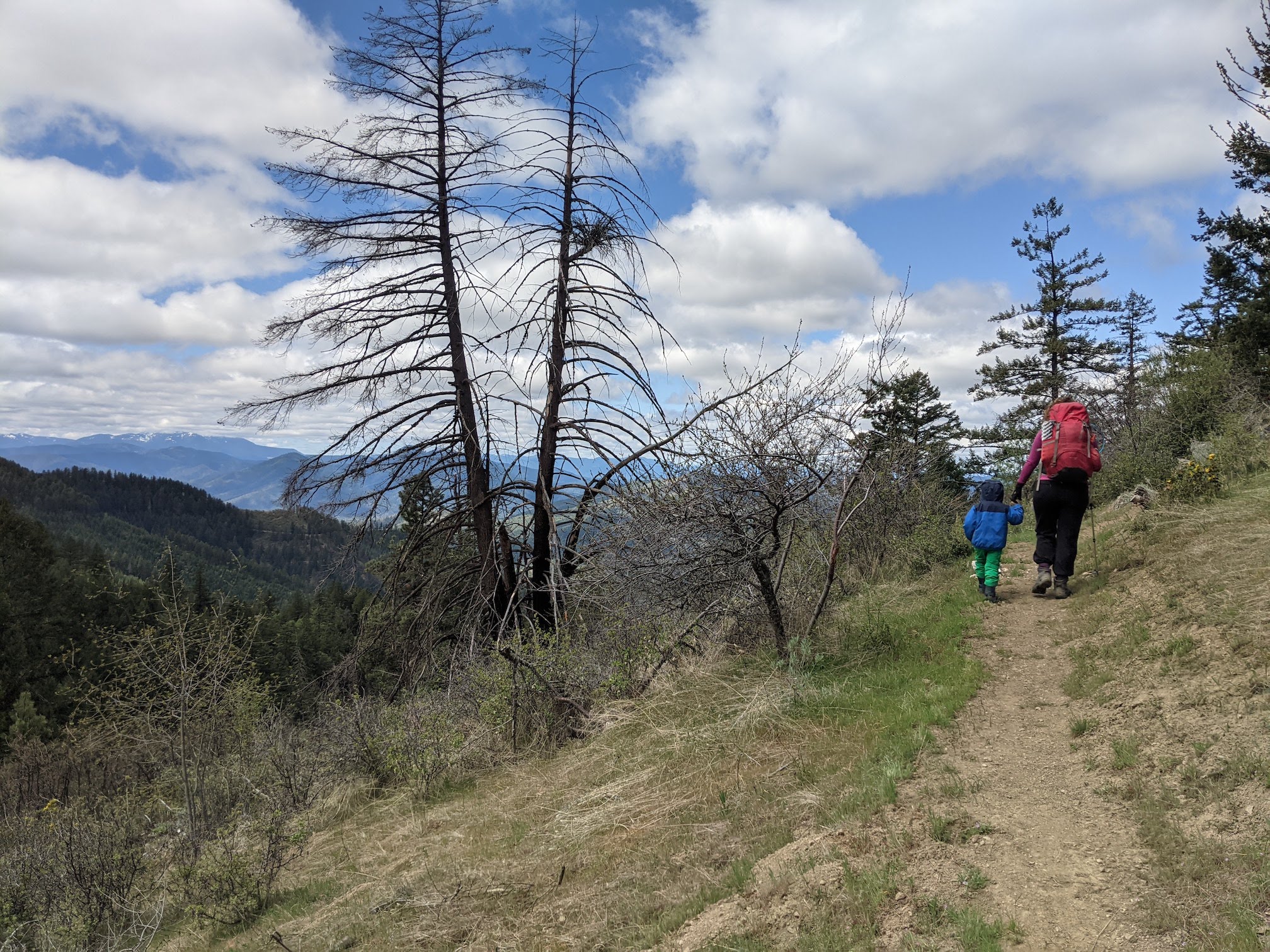
At Greenstone, you start up an old fire road, which gains gradually, but then turns into single-track. This area was burned sometime in the last decade, so you've got an open feeling forest with some remaining old growth trees and an undergrowth of Oregon Grape, Sweet Peas, and Siskiyou Iris. The trail has long switchbacks which makes the 1100' elevation gain very managable; our 3.5-year-old did it with minimal whinging.
Once you top out on the ridge, there is a sign warning of cliffs for the next 0.5 miles, but this area didn't strike us as particularly exposed. Before the sign on your left, you can take a social trail which heads to the top of Andersone Butte. After about 5 minutes it turns into a fire road which slowly winds its way around to the top. That's not the way we went.
We chose to go direct to the top via the ridge. Routefinding is super simple and scrapy bushes/trees are avoidable. We did treat our clothing for ticks and found no evidence of them post-hike.
The summit itself is flat and an easy place to set up an antenna with a mast, anchoring off of the old fire lookout's foundation. There are some trees nearby within the activation zone—but you'll lose the views. The area is significantly impacted from camping and target shooting, but the vista is incredible, especially in spring when the high mountains are still snowcapped.
We decended via the previously mentioned social trail and connected back up with the switchbacked single track for a quick descent back to the car. Descent took just over an hour.