Triangulation peak is a great SOTA activation site. The trail (#3373) comes off
of FS road 2233. FS road 2233 intersects Hwy22 just east of Idanha. See any of
the hiker websites to find exact directions. The trailhead did not indicate what
trail it was but from the map its obvious.
The road to the trailhead is somewhat rugged. 4WD is not necessary, but I wouldn't
take a prized sports car up there. This road becomes gated later when snow starts
falling as this area is a mecca for snowmobile folks.
The hike starts and stays pretty level of the first mile and a half, then steepens
near the summit. The hike is through a typical "wet side" forest with really
beautiful scenery. The trail is pretty well maintained and easy to follow. We
crossed three seeps that still had water despite the dry summer. This was quite a
surprise. The trail was marked as 4.6 miles out and back. We were on the summit
in 1hr, 20 minutes of easy walking.
Even though late in the season (9/4) there were plenty of bugs. DEET was more
than sufficient to keep them away. We experienced lots of yellow jackets but they
were not aggressive.
The summit has many short trees to attach a support mast to. There is sufficient
rock debris to build a wind shelter as well. Wind was nonexistent this day (hence
the bugs) and a small scrub fir supported my EFHW mast with ease. A dipole could
probably be erected as well.
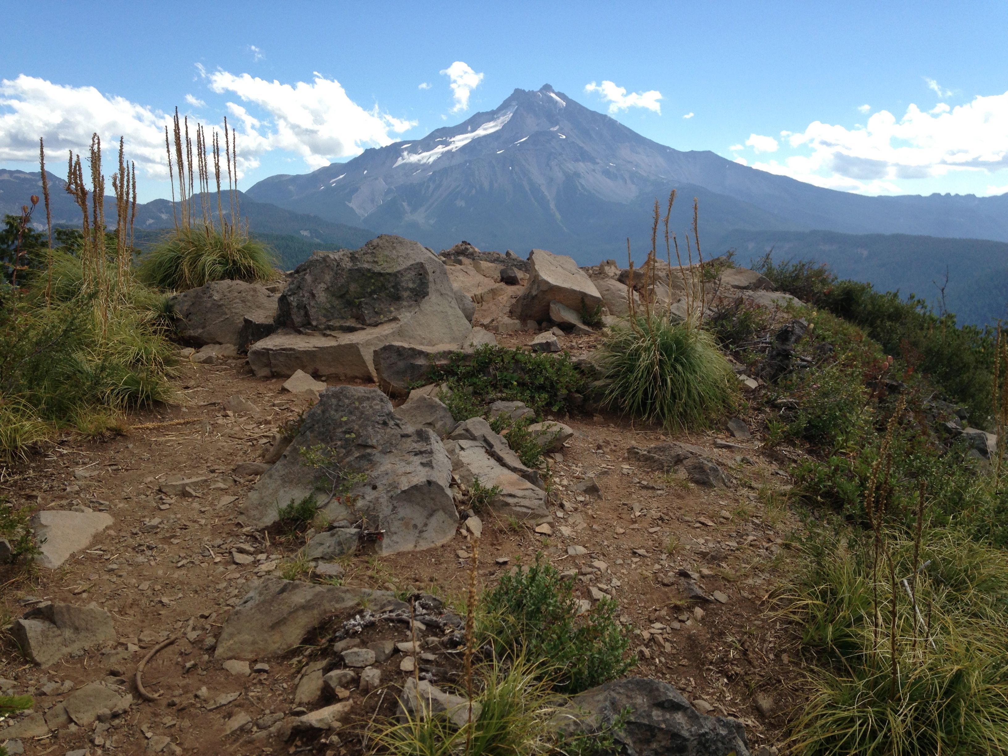
The views of Mt. Jefferson are awesome. Unfortunately, it was somewhat cloudy
so we did not get too many full views of Jeff.
Even on short notice (~12hrs) the contacts came fast and easy. Reports were OK
with 229 and 339 RSTs from the east coast. In about 25 minutes the bucket was
empty and I pulled the plug. Kudos to the chasers. You guys are awesome.
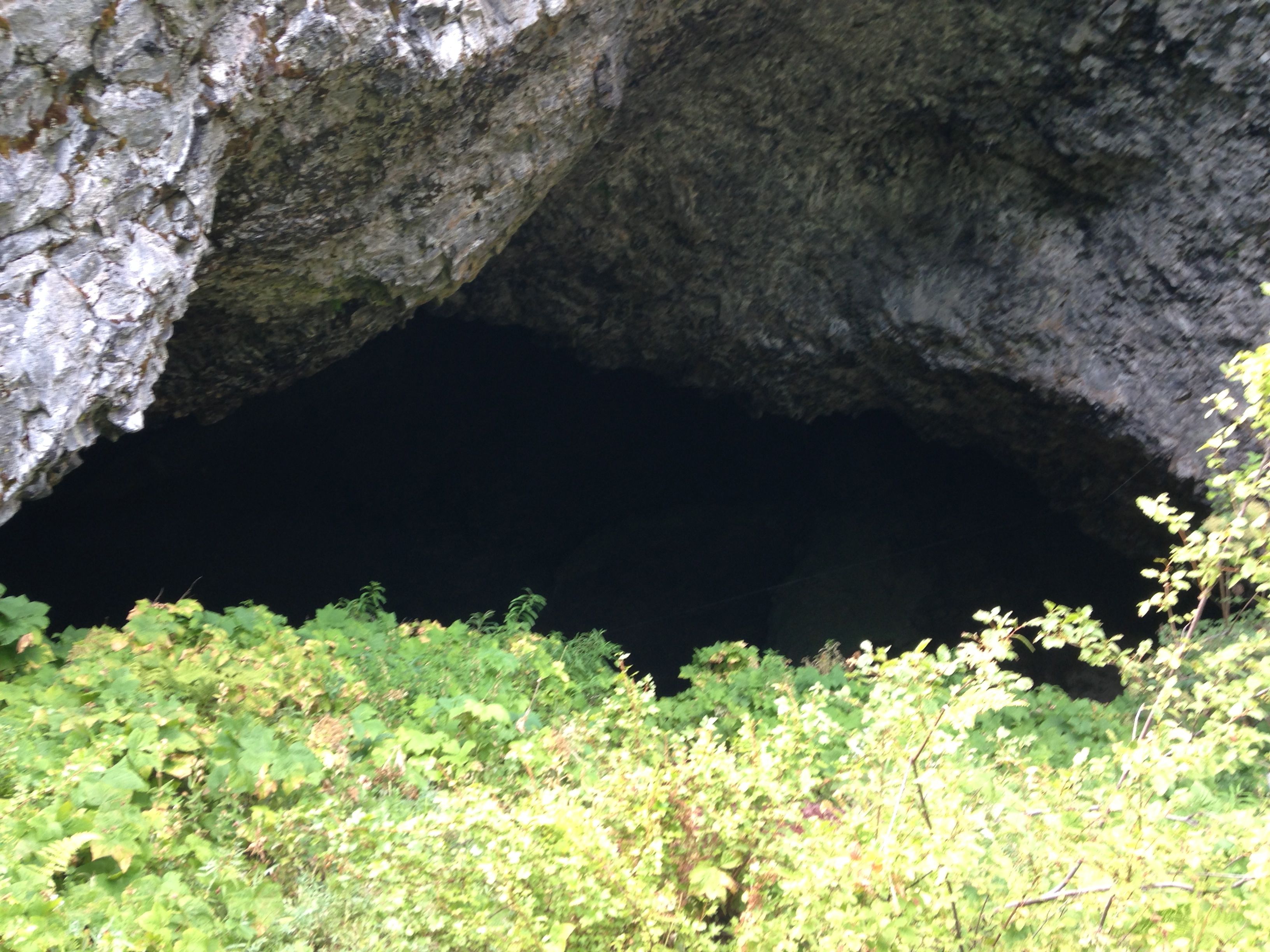
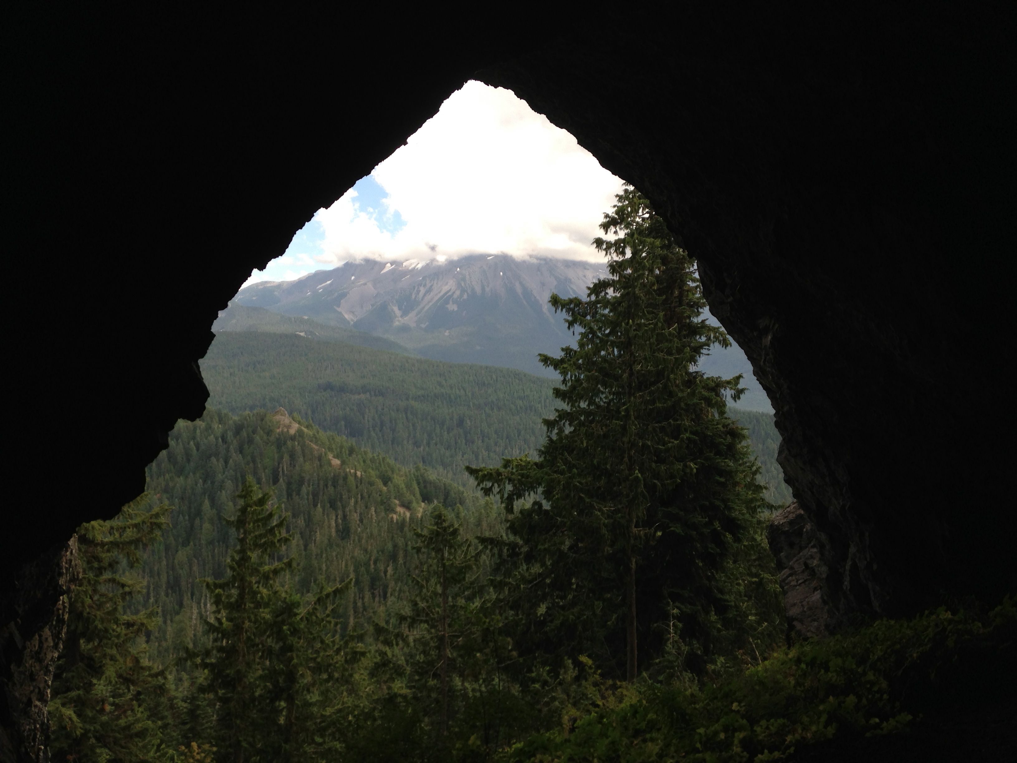
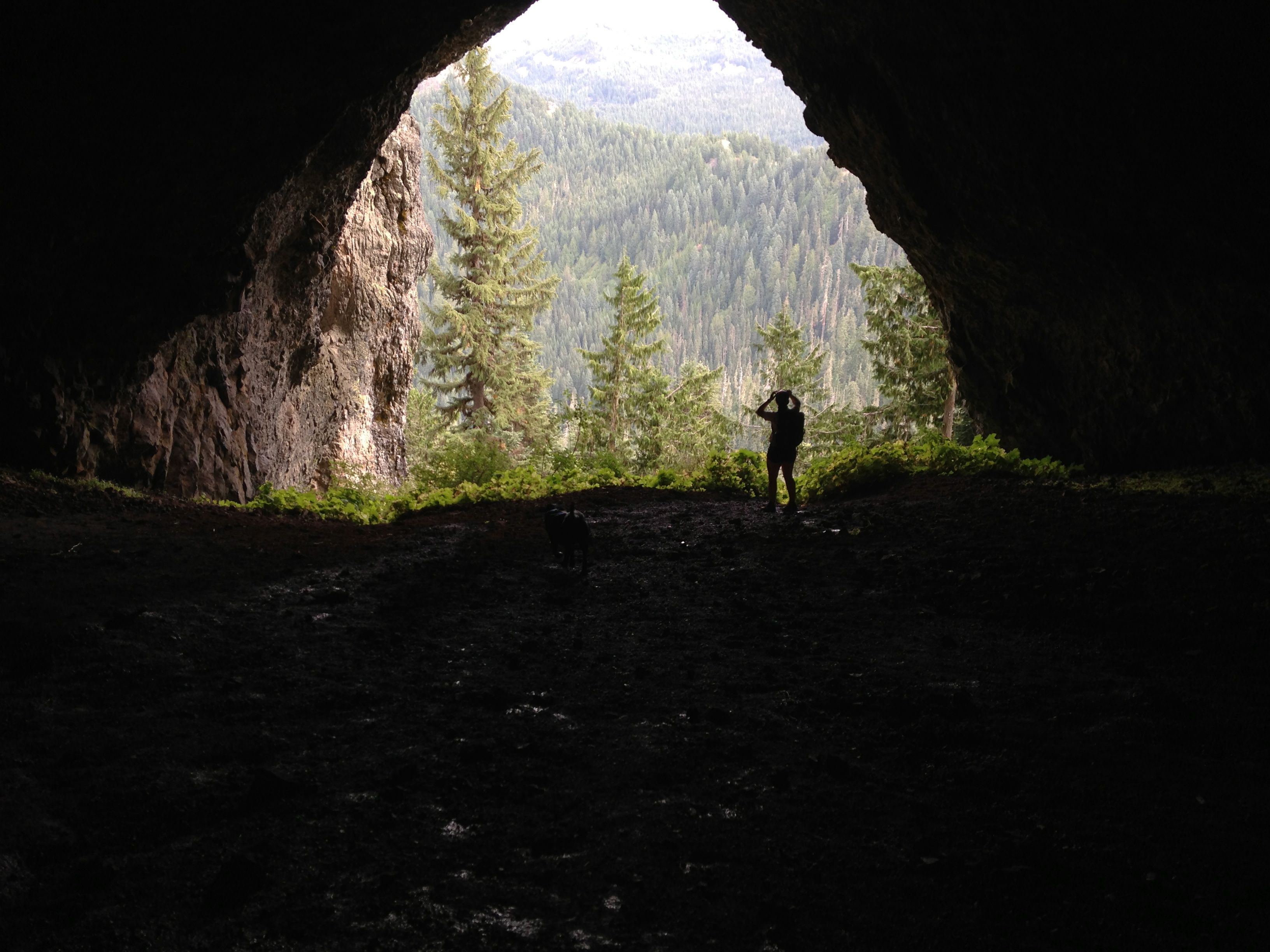
We went down from the summit to the point at which the trail turns down the
hill to the left. If you continue straight, you hit a few campsites and then
the trails converge to a single, very steep trail down to Boca Cave. This is
well worth the trip to see. Many pictures of Mt. Jefferson taken from Boca
cave are on the web. Take a look.