Since the weather has continued warm and wet, I thought I'd go grab some solitude
and winter bonus points. I had been eyeing three summits close to each other and
to OR HWY 22. These peaks are Coffin Mountain, Buck Mountain and Bachelor Mountain.
I hoped to summit all three this Saturday but only managed two due to a number
of equipment problems.
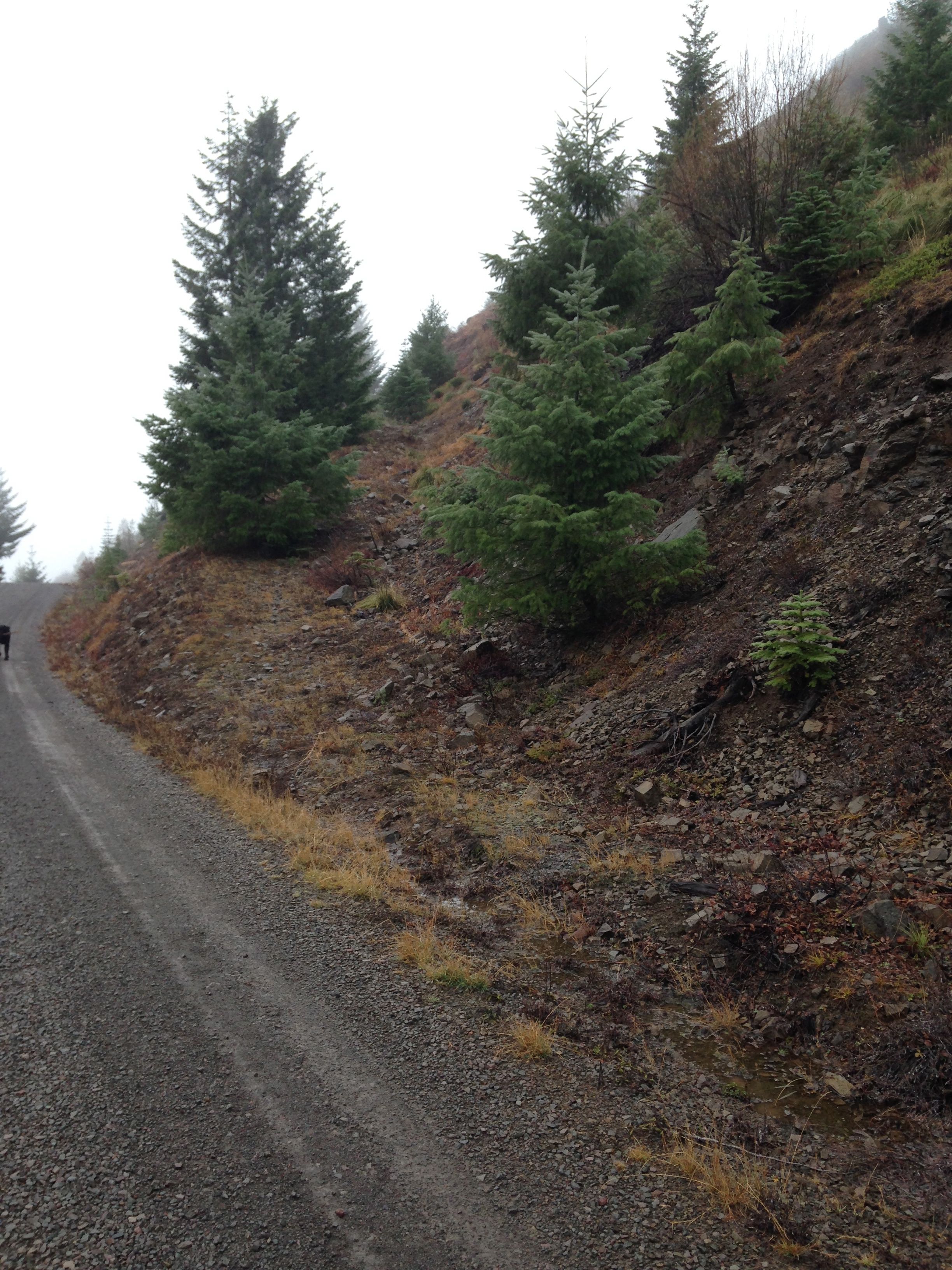
To reach Coffin mountain, follow OR 22 east from Detroit Oregon. About 19 miles
east of Detroit, turn right onto FS 11 also known as Straight Creek Rd. It is
also marked as RD 2683 and known as the Quartzville Creek Scenic Byway. Once turning
onto FS 11 stay the main road for about 4.2 miles then turn right on road #1168.
(Don't take the first turn for road #1168.) Follow road #1168 for 4 miles where
you intersect with road #450. Turn left on #450 and within 100 yards, you find
the trail head for Coffin Mountain Lookout trail #3392. There are no facilities
at the trail head.
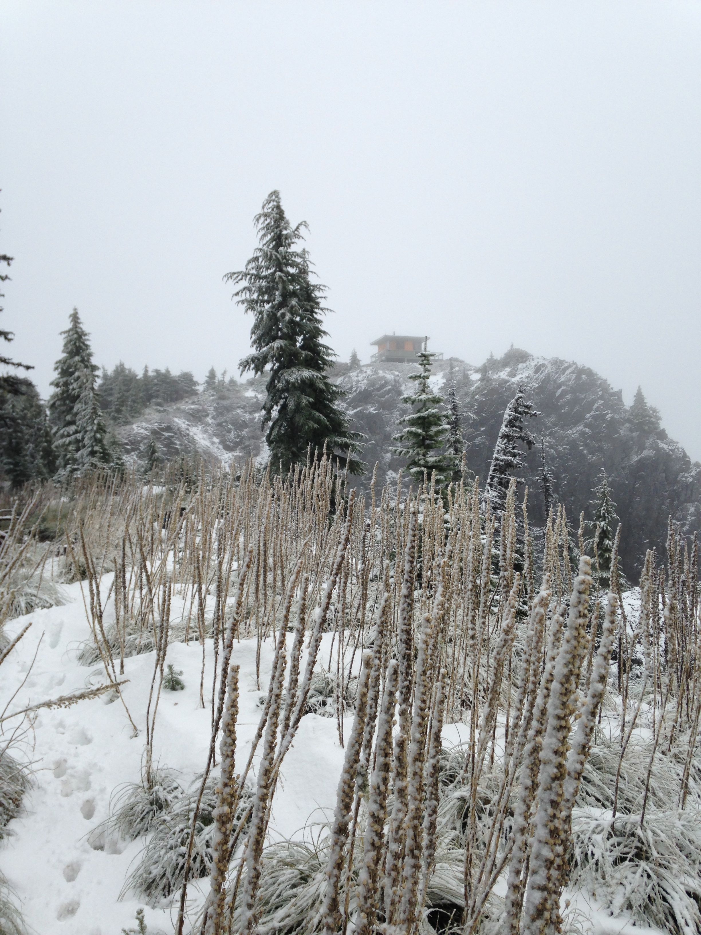
The trail to Coffin mountain is well graded and is easily followed. It follows the
ridge edge to the summit for 1.5 miles. Elevation gain is about 1000ft. On this
winter day it took me 45 minutes to attain the summit. The trail is exposed most
of the way to the top. I'd suppose its a beautiful view but I could'nt see much.
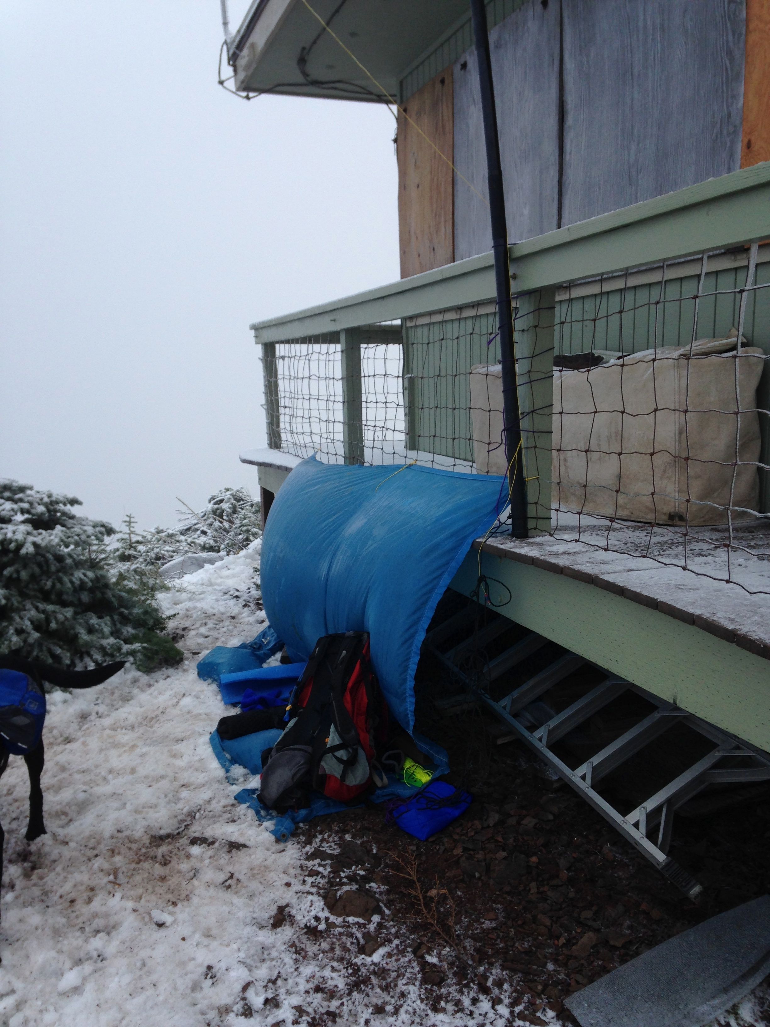
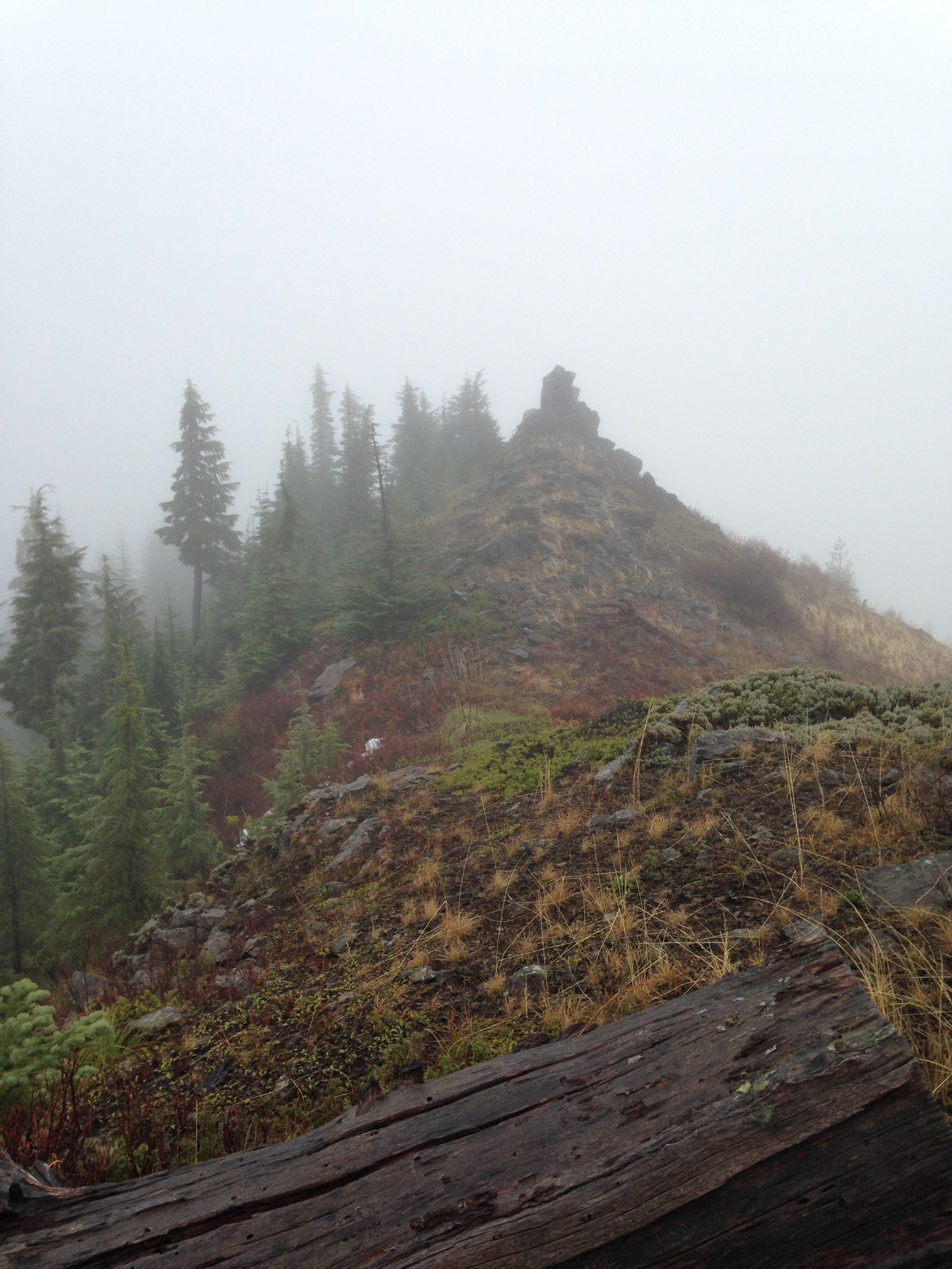
At the summit is a lookout building which is manned during the fire season. On this
day, it was completely boarded up. I was thankful it was raised only a few feet
from the ground as it provided a wind break.
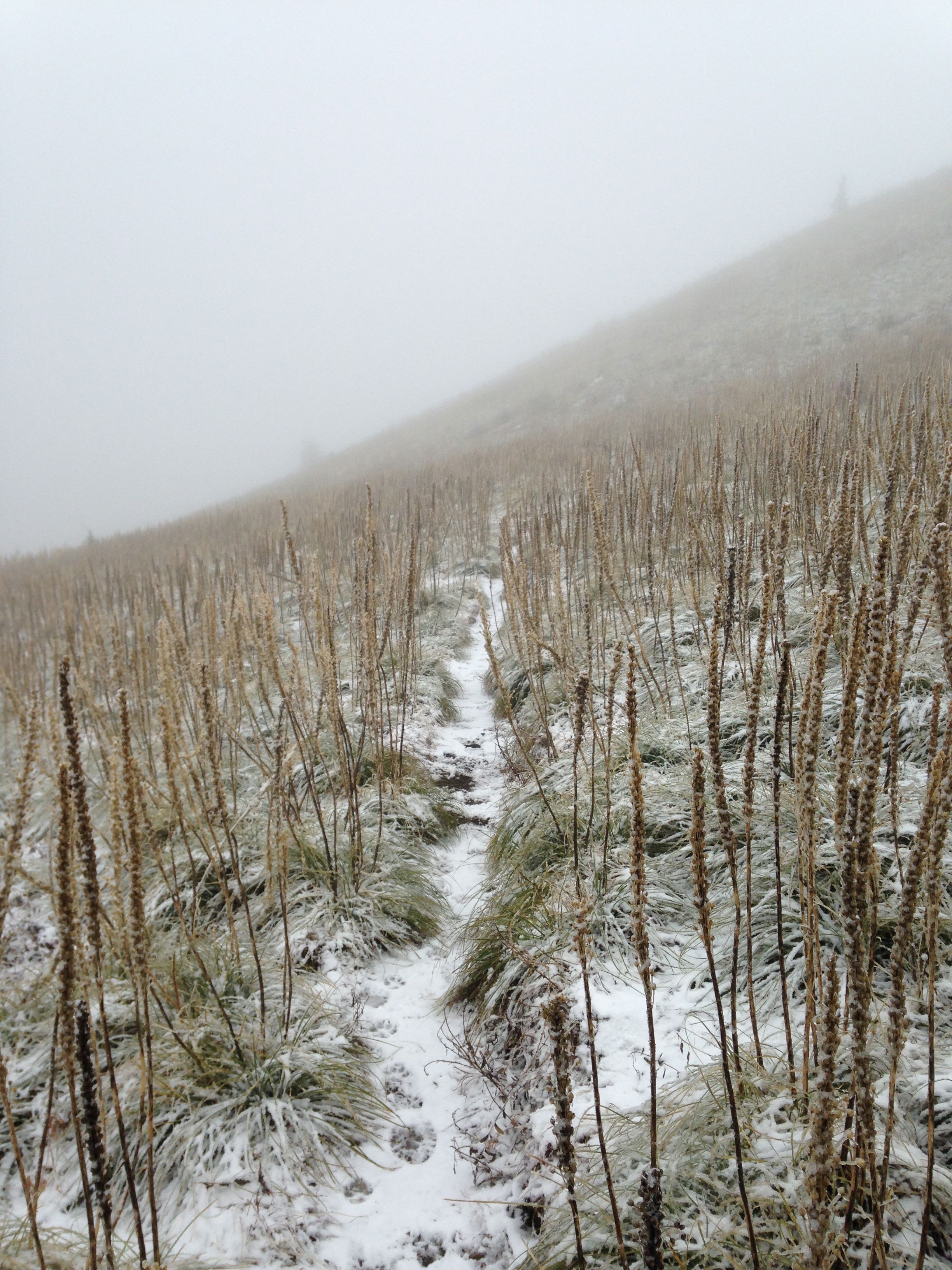
This day was pretty nasty weather-wise. I arrived at the trail head for Coffin
Mountain about 9am. It was 35 degrees and a light mist was falling with a slight
breeze. The trail opens up into large areas of bear grass. This morning, the
bear grass was frozen in the mist and was quite pretty. Ascending the mountain,
the temperature dropped quickly and the winds began to increase. I could
hear the wind roaring in the trees hundreds of feet up the slope.
Reaching the summit there was maybe 3-4 inches of snow with some isolated mounds
that were maybe a foot deep. Winds were strong with sustained gusts that made me
loose my balance at times. This was not going to be a easy activation. The summit
building provided some protection on its north side from the southern winds. I
put up a tarp with the help of some 2x6s under the building. A frozen mist was
blowing at the summit that stung when it hit my face.
The DK9SQ mast was put up to its full 10m in the wind by fastening it to the
railing posts. The mast vibrated in my hand and made a strange roaring sound.
I set up the rig and was on the air pretty quickly. After a quick CQ, my key
or keyer began to act up. I could not get it to behave. If I closed either
paddle, random characters came out. I reset the rig. Still not working. Chasers
are frantically calling and I'm just trying to figure out what's going on.
Can't imagine what they were thinking. I'm sure they were wondering what I was
up to!
What finally worked was to short one contact with the small hex key that was
stored in the paddlette key. With bare hands I could tap out morse if I hit
the contacts just right. I was probably managing 7-8 WPM. Thanks to all the
patient chasers, I finally emptied the pileup and had to quit as my hands
were well past having any feeling. Packing up was slow and painful.
Dropping the 10m mast, each section shed piles of ice. Some of the sections
were really hard to get back down. Finally the EFHW wire dropped down and
it was twice its normal diameter with a thick coating of ice. I had to peel
the ice off it to coil it up for leaving. I wondered if the ice had detuned
the antenna causing high SWR and voltages at the rig causing it to malfunction.
After a quick trip back to the trail head, I powered up the rig and all seemed
well. So I headed back up the road to catch the shorter Buck Mountain peak.
It looked like a short walk so if the rig did malfunction, it was not a big
loss.
Now, off to Buck Mountain... W7O/WV-012
The trail (if it can be called that) for Buck Mountain is actually a old
abandoned road that goes most of the way to the summit. It is 0.7 miles
back towards HWY 11 off road #1168. This road is just before a very wide
corner which is probably a pull-off or viewpoint as you are directly
under the Buck Mountain summit. The road has dirt/rock berms in it and
trees are now growing in the middle of it. Take this road, which is found
on some older maps till it dead ends not far from the summit ridge. Then
go east, directly up the ridge, and continue to the far end of the ridge.
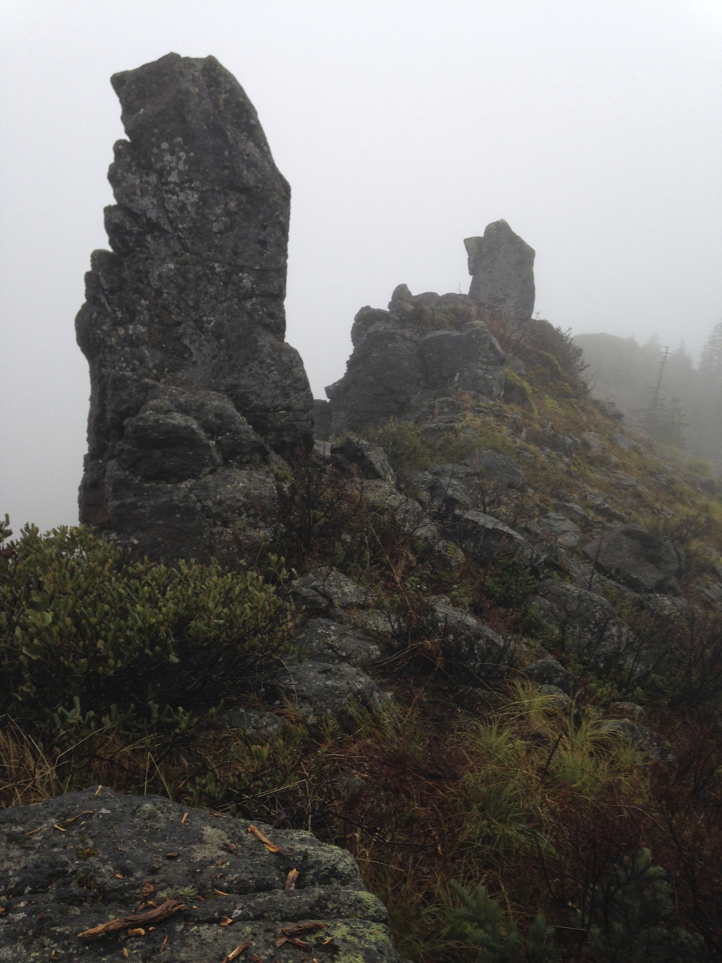
This is where the actual summit is. There are several "peakettes" that are
not at the summit. I stopped where there are three chimney sized rock
pillars separated by 50ft each. These mark the approximate summit.
Setting up here was better as the altitude was lower and the knife edged
ridge provided good wind protection. Once on the air with three contacts
in the log, I hear a "whump, whump, whump" from the mast. The top sections
had loosened and dropped down the tube. The EFHW dropped to my feet. I
put up the mast again an noticed that once piece did not seem to fit right.
Again the mast fell. Finally I attached the midpoint of the antenna wire
up as far as the mast would hold together and ran the rest of it to one
of the top of a nearby rock chimney in an inverted L shape.
Got back on the air again and emptied the well. Signal reports were a
little poorer but not a lot. The top of the L was maybe at 12 feet. Sill
the ugly contraption worked. Again, a quick trip back to the rig and home
as it was already 2pm.
Back at home I examined the DK9SQ mast. The fourth section from the top
had cracked lengthwise. It was probably a result of the ice and wind
loading on Coffin mountain. There are no replacement parts and the mast
is no longer made. Goodbye dear friend, you served me well. Hello SOTA
pole.
I still wonder what caused the keying problems on Coffin mountain. At home
I found that all my equipment was very wet and that the key seemed to have
lost its spring. Not sure why. Time for a new paddle too.
Tough trip. Learned a lot. Broke some stuff. Guess this is why there is a
three point bonus for winter activations!