I had been wondering about the peak Thomas Cairn for awhile after
elk hunting in the Snow Peak area in Linn county this year. Although
it was not eligible for winter points, I just had to get up there
and see what it looked like up close.
Thomas Cairn is in an remote part of Linn county closest to the
town of Scio. I got there by first going to Scio then taking Oregon
226, 6.75 miles to the Camp Morrison Road. This turnoff is easily
identifiable by the Hannah covered bridge there.
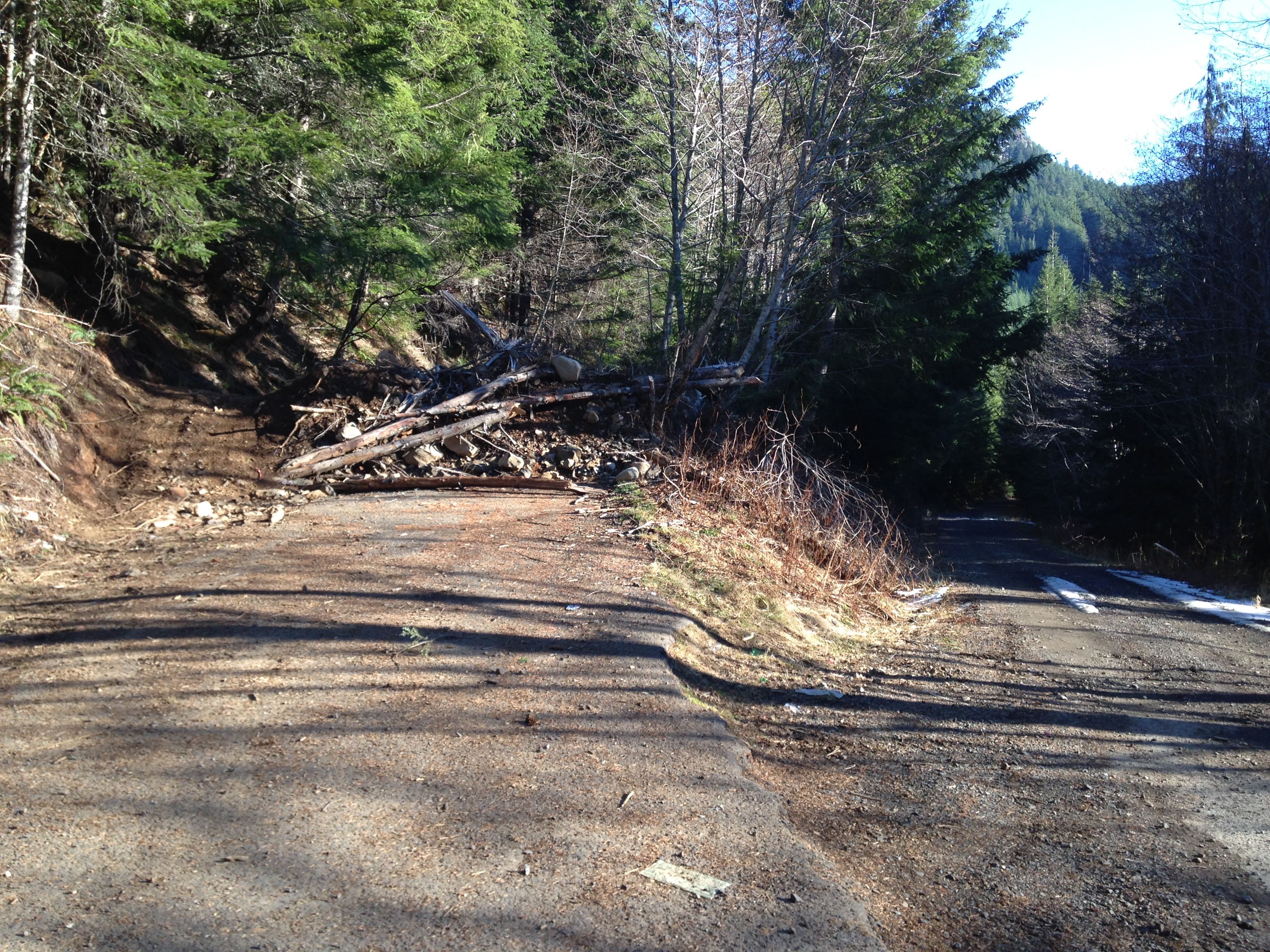
Follow Morrison Camp road for 4.7 miles to a unmarked, nondescript
concrete bridge on the right crossing Thomas creek. Take this rough
road about 6.4 miles to a turnoff that has a big dirt/debris pile in
front of it. Beware of log trucks on this road. This is an actively
logged area. This is where you park. Leave room for the 4-wheelers
to get by.
I won't give detailed directions from here but understand that this
is an unmarked, rough, abandoned road not suitable for casual hikers.
I know this statement just made Thomas Carin irresistible for some of
you. Competence with map/compass/GPS are necessary for this peak.
Take the road up towards the unnamed peak (ele 4104) but do not
go up that peak (like I initially did!). Instead, skirt around it
past a small pond that leads to Indian Prairie. Go straight past the
pond and ascend steeply. Take the switchback towards the Carin. This
leads to a dead end about 0.25 mi from the peak and 250ft below it.
If you have a topo map in front of you, what I just said will be pretty
obvious.
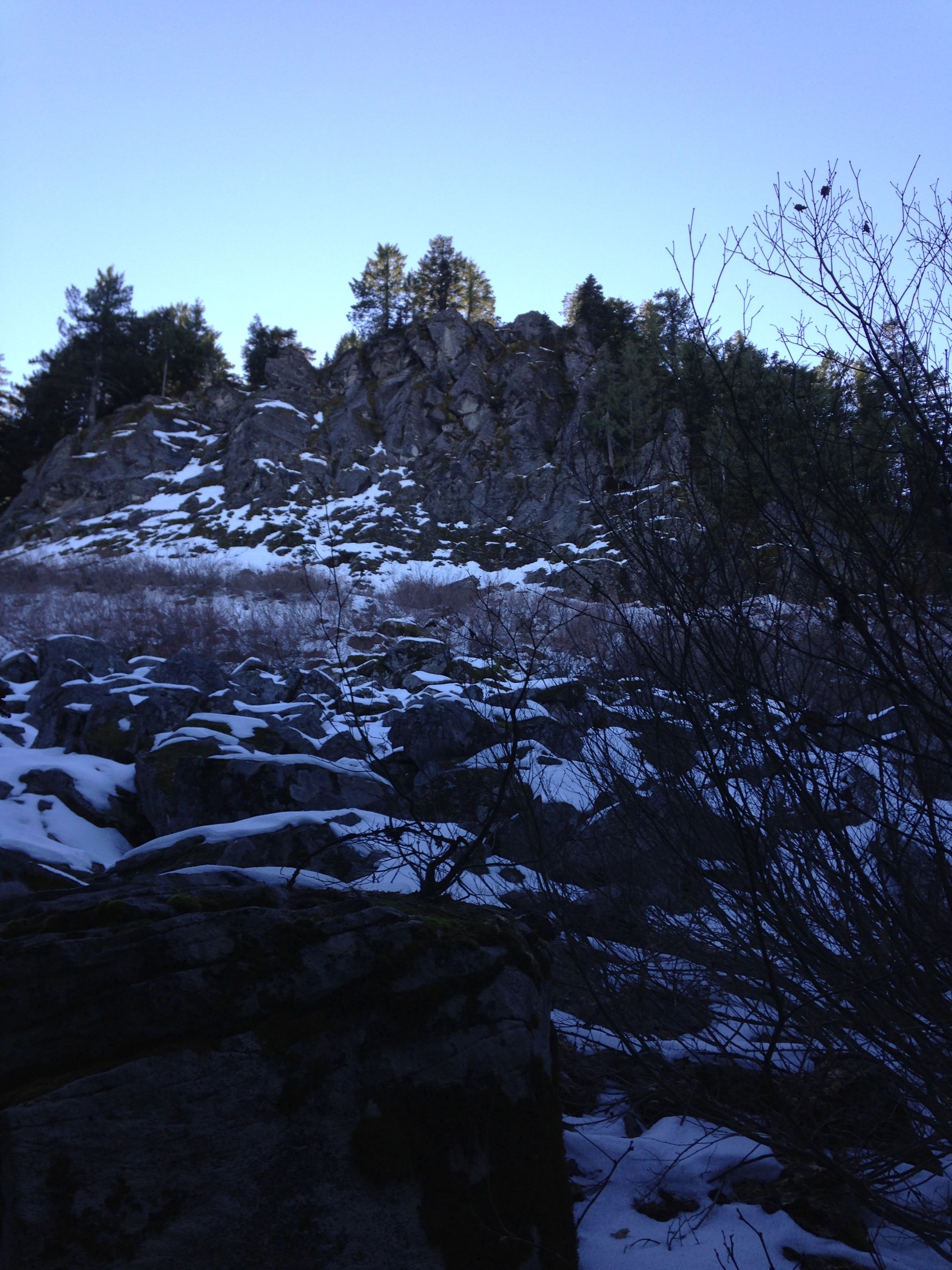
Navigate directly up the spine of the ridge in very thick hemlock and
fir timber and stay to the right (west side) avoiding the sheer cliff.
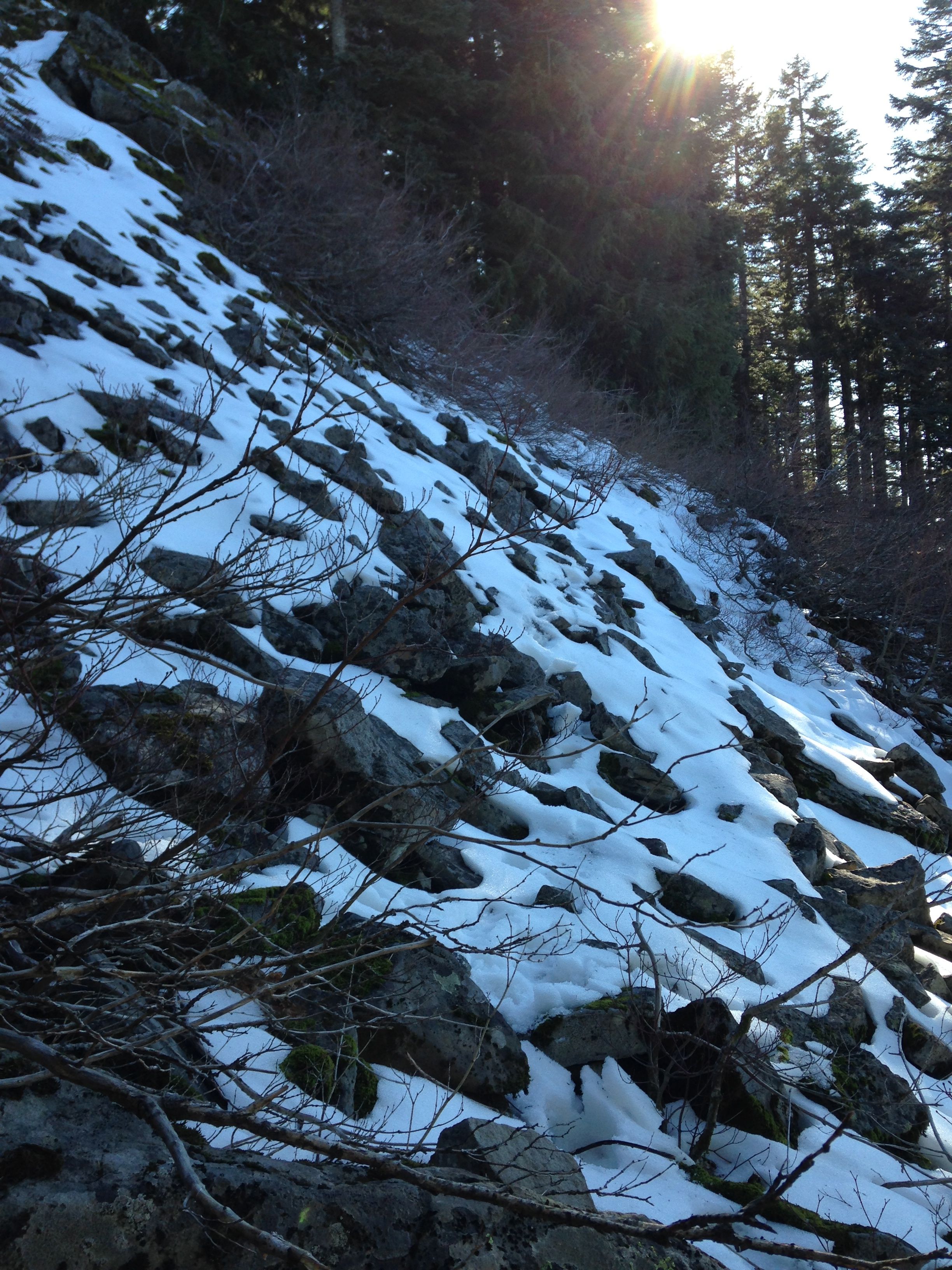
Cross through a short (100ft) talus field towards the wooded and less
steep portion of the peak. Care is needed here. It was a bit unnerving
but slow and careful does the job. A fall here could cause considerable
injury.
Once back in the trees, round the peak towards the south side and ascend
in the trees to the summit. The summit will be towards your left. Its knife
edged with a drop off of about 100ft so take care and move slowly.
I figured that Thomas Cairn would have a cairn at the top to mark the
summit or something like that. In reality Thomas Cairn _is_ a cairn.
The summit is essentially a pile of rocks!
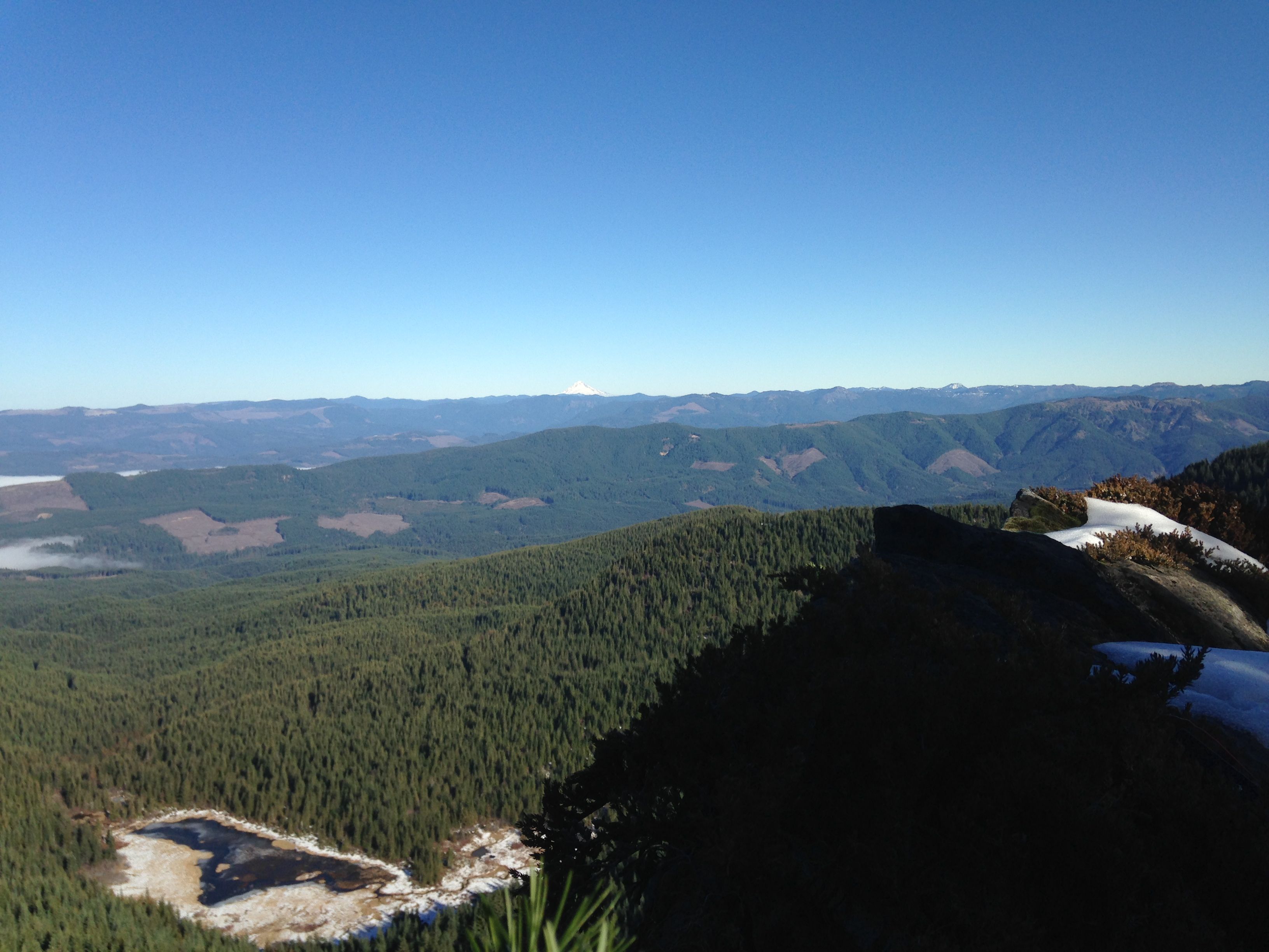
The peak has a few 30ft trees as well as a few short stubby ones. The views
are very good to the north and east. St. Helen's and Adams were visible.
Cell coverage was spotty. I used my 10 meter pole and 20m EFHW here with
great results. Good grief, this thing works well!
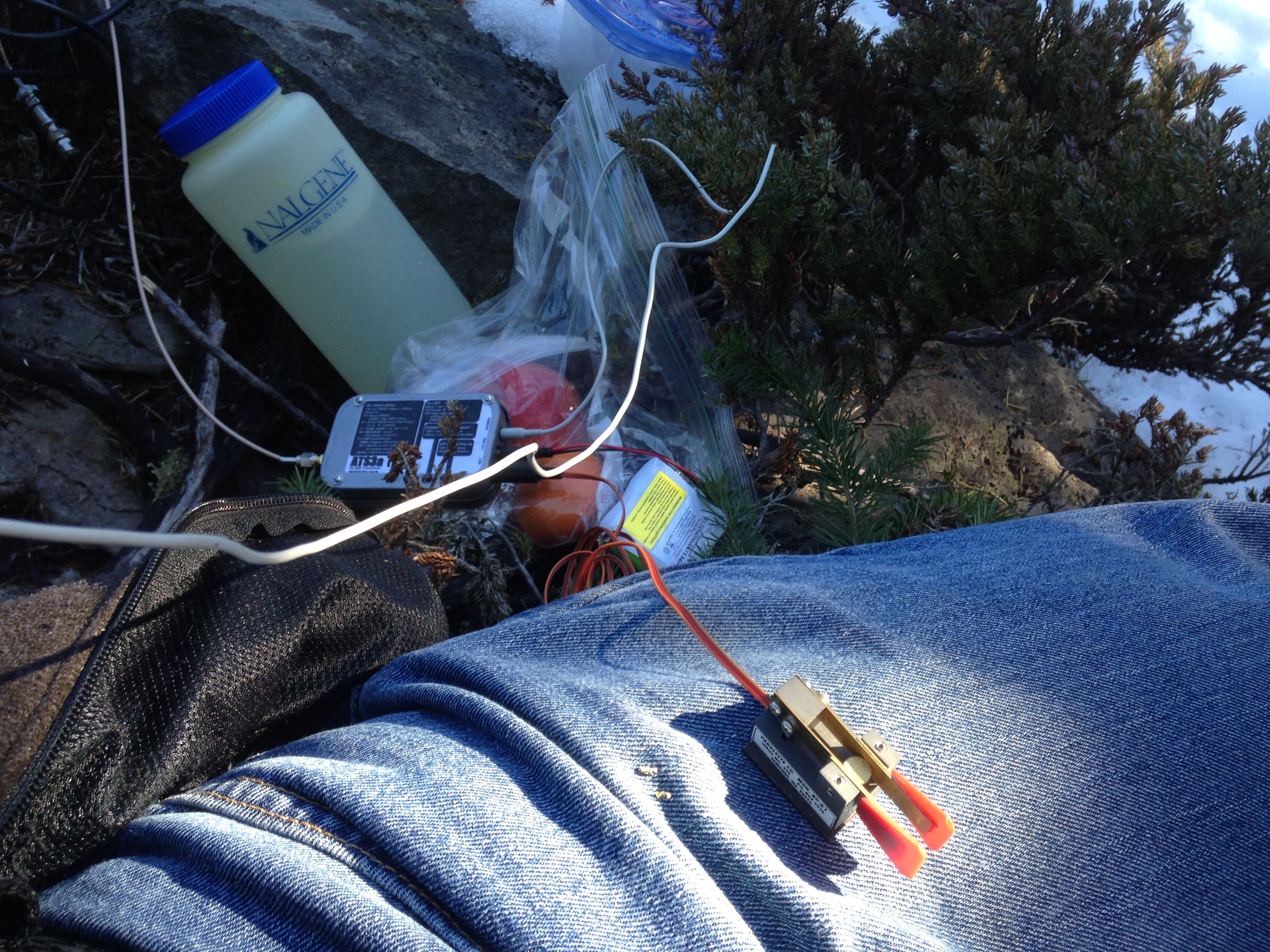
I took my new (used) ATS3-A for its maiden voyage. This was a fine way to
break it in! I got a non-working one for free and fixed it up with proper
keying shape, a non-thumping xmit/rcv switch too. Its all packaged in a
industrial strength survival food grade tin from Country Comm. Its heavier
than a altoids tin by 1oz but is very sturdy. This plus a 11.1V Li-Ion pack
and I had a very compact setup.
This day, the band seemed hot and signals were very strong. My antenna
setup was worse than usual with the vertical wire partly in a tree limb,
some shrubs and finally across some brush to the tuner in the snow. Definitely
not optimal but worked great.
After 30 minutes of operating, the well was dry and we packed up and
carefully headed back down. From the summit back to the rig only took
about 1:45.
I doubt that I will return to Thomas Cairn for a while. For a summer trip,
the terrain would provide ample habitat for unsavory creatures that fly
and sting or slither and bite. There is a lot of trash unfortunately along
the way. If I do come, I will bring a garbage bag. Funny note, on this
day I saw at least a half dozen snow mosquitoes.
Still, it was a great day out escaping the persistent fog of the valley.
The hiking was good but challenging. I got may glasses slapped off several
times. Almost lost them once. Sure beats a day at work!
A big thanks to the chasers!