Turn east off of Fields-Denio Road at 42.1606, -118.6033 onto Whitehorse Ranch Lane.
Turn north off of Whitehorse Ranch lane onto an unmarked road at 42.2577, -118.3200
Turn left at an obscure point at 42.2819, -118.3588
Make a hairpin right turn at 42.2622, -118.3870
Park near a locked gate at 42.2619, -118.3895
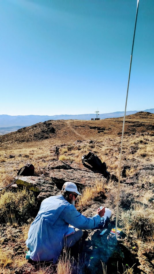
Hike up the road for just over a mile and turn left at the saddle away from the radio installation. A short rock scramble is required here to get up to the broad mesa that is Buckskin Mountain.
Elevation gain is 700 feet.
High clearance and 4x4 required for this route. You could get a lot of the way in a high clearance 2wd or awd vehicle, but there is a steep loose section that requires low range or lack of concern for your vehicle.
There are no trees on summit, plenty of rocks. Bring your own antenna support.
Be sure and rinse the dust off at Willow Creek Hot Springs since you are in the area. We spent two nights there.
Note that we did this one from the hot springs because google maps said it was a 30 minute drive and a short walk. It did not know about the gate and routed us on a private road (or at least one that was posted private and did not have a BLM number on the paper map.) The route described does have BLM numbers for the roads, but they are not signed on the ground. They are also double track that is faint in places. There were two unlocked, unposted gates on this route one of which was open.