Peak 2020 is relatively easy-to-access summit near the city of Tillamook on BLM land. It's nearly or fully drive up depending on your transport. From the look of the area, it's probably a known go-to spot for offroaders and hunters in the local forest who want a good view and a place for an evening fire.
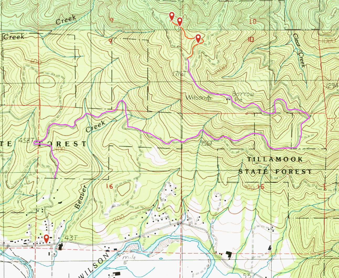
Get yourself to the corner of Sollie Smith Road North and Aldercrest Road. If you've ever visited the Tillamook Cheese factory and gone back home "the back way" up Latimer Road onto Wilson River Loop to Hwy 6, this is very close to the bridge turn. Proceed North on Aldercrest Road 1/2 mile until the pavement turns to gravel and continue up into the hills. The rest of the route is mostly the "main road"; I took the routing provided by Gaia and it was accurate. Starting from the transition to gravel:
- Stay right at .4 miles
- Fork right at .5 miles
- Fork left at 2.1 miles
- Fork left at 2.7 miles
- Fork left twice at 3 miles
- Stop at about 4.2 miles, (45.49696, -123.78092)
This track is the purple one in the image below.
These forest roads are a little rough in spots but passable even in a passenger car, just be wary of occasional sharp rocks and thin passageways between foliage. Depending on how recently the BLM crews have cut back the bushes you may get some near misses or scrapes. There were a few spots that I would worry about getting stuck in mud if there's been recent or heavy rain, but during the summer it's pretty clear.
At the 4.2 mile mark you can park, or proceed slightly farther up the path to the right (this is the red track). There is at least one more good parking spot turnoff before the road gets a little thinner again. ATVs, motorcycles, or vehicles where the paint job is of no concern can drive the route all the way to the summit. The complete track is only 1/2 mile, and is not marked on any maps I found.
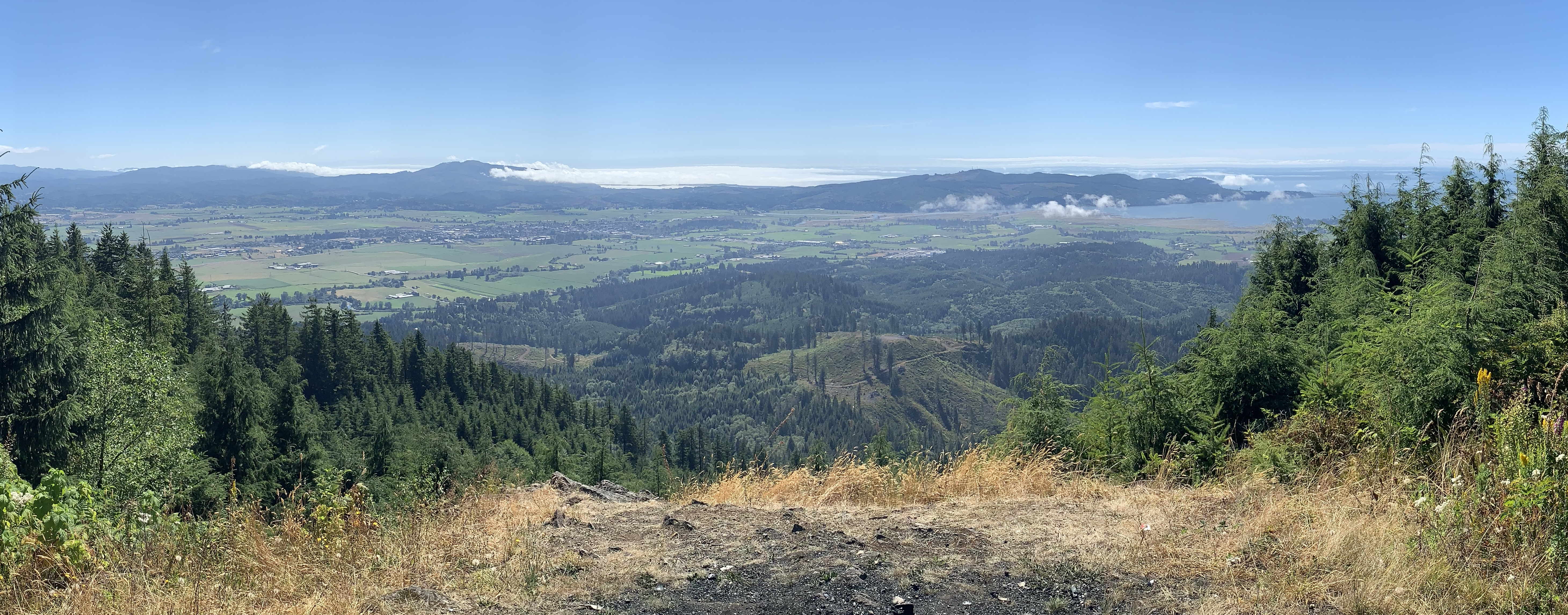
The road terminates within the AZ in a wide open area, although to get to the summit proper requires another short bushwhack up through the forest. The images below show both the open with a fantastic view of Tillamook and the ocrean, and alternately the true summit which has nothing of note to see. Unless you want to operate in shade with the bugs, consider setting up in the bald and enjoying the view while activating.