Shafer Butte is an excellent activation not far from Metro Boise - about an hour up Bogus Basin Road will get you there - and another 1.25 miles or so and 700 feet of hiking will gain you the summit proper. Or consider that there is a ski lift a few feet away from the summit - buy a lift ticket and climb a little and earn the bonus points for a "ski" activation during the winter.
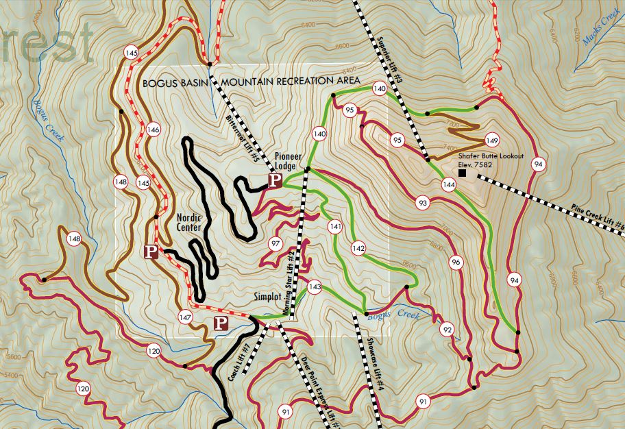
Shafer Butte is accessed through the Bogus Basin Ski Area. Bogus Basin Road tops out at about 6760 feet at Pioneer Lodge - near the Pioneer Condos - the highest point that can be driven. Behind the lodge find the ski run called out as the Lodge Cat Track on maps (www.bogusbasin.org/assets/content/docs/BogusBasin-Alpine-Map.pdf) that leads off to the left on the north side of Shafer as perhaps the easiest summer access to the summit. This is also indicated as Lodge Trail 140 on a map found here: www.ridgetorivers.org/media/214483/57070_ShaferMap.pdf.
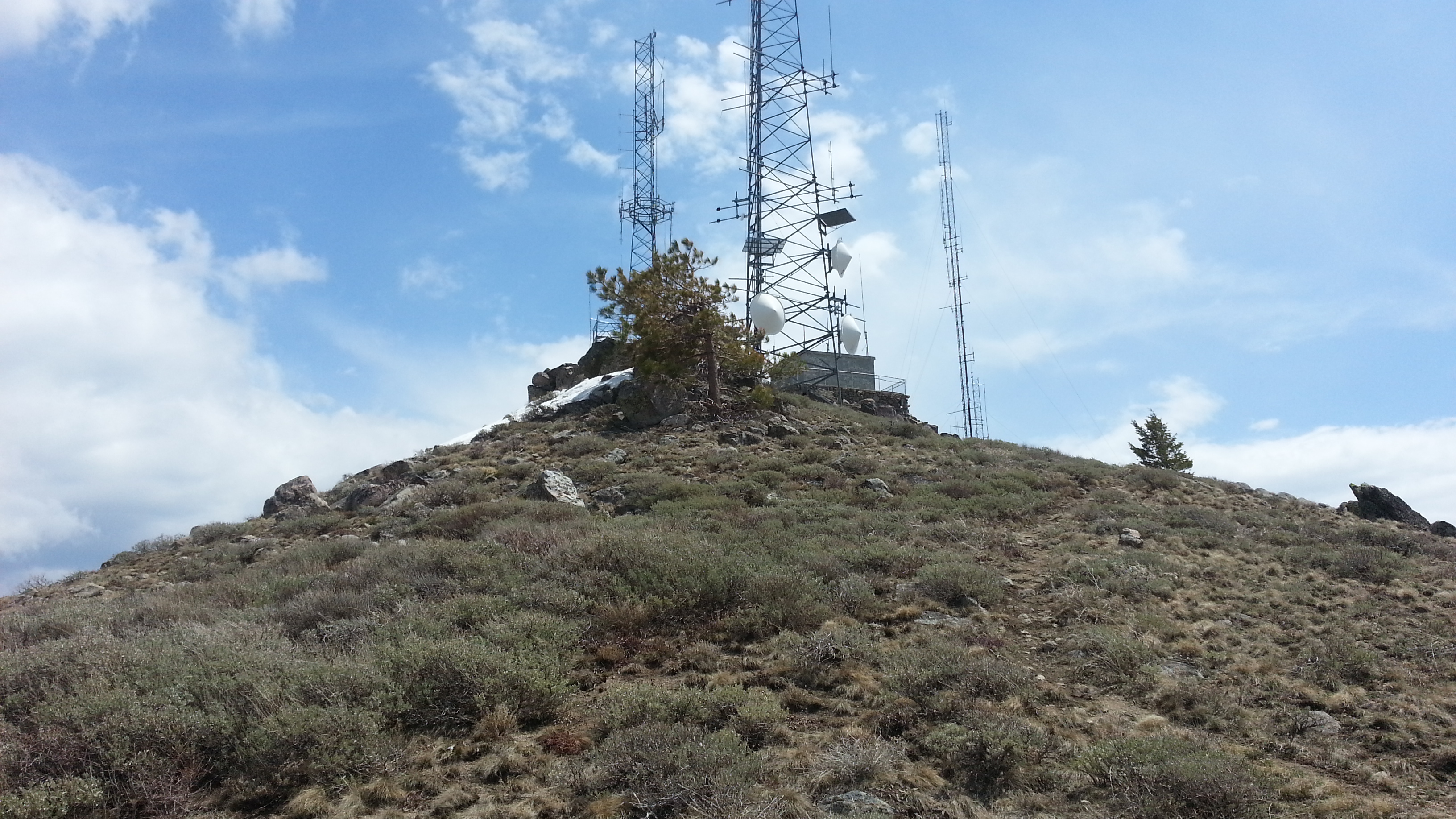
Continue around on this cat track until you can see the summit a quarter mile up slope and then head there directly - essentially following the ski lift. I kicked steps in the snow from here up as this was the easiest for my May activation. There are several trees for antennas and some rocks for sitting in the activation zone below the radio installations on the summit itself. I didn't notice any RFI from these sources. Note that the 146.84 MHz Boise repeater is located here.
You could use this opportunity to activate Mores Mountain-W7I/BC-070, a short distance to the north for a ten point day (or sixteen if you're in bonus season!)