The name Multorpor comes from Multnomah County + Oregon + Portland. Although the peak is actually in adjacent Clackamas County.
Multorpor Mountain is in the permit area of Ski Bowl on the south side of Highway 26 in Government Camp. In February, this was a cross-country ski activation, climbing uphill through Ski Bowl runs using climbing skins. In 2012 this was permitted - you should check to be sure that it still is. It is unlikely that snowshoes would be allowed during the active ski season. http://www.skibowl.com/winter/ An Oregon SnoPark Pass is required for the Ski Bowl parking lot and anywhere else in the snow zone.
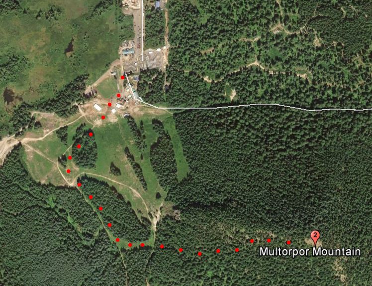
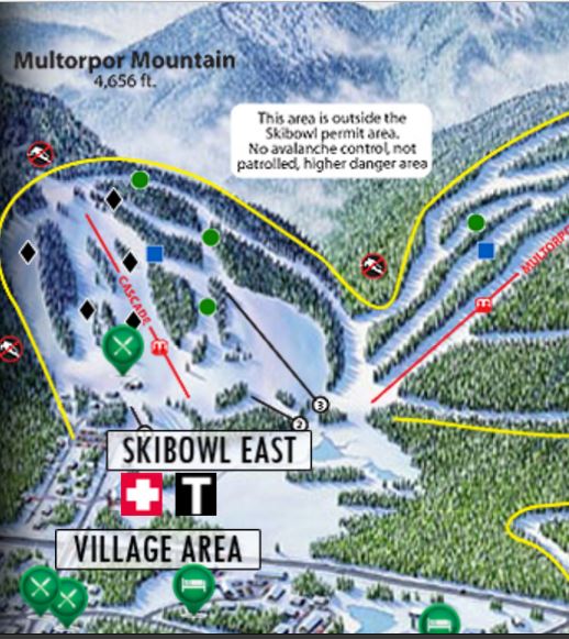
From Government Camp Loop on the north side of Highway 26, cross the overpass to the eastern part of Ski Bowl. Starting at Skibowl East, ski up the trail that will access the west ridge of Multorpor. Before the ski lift terminal at the top, head into the woods along the summit ridge. A GPS would ensure that you found the Activation Zone. The area is heavily treed but small clearings will give you some room to set up.
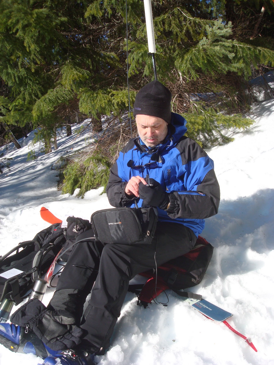
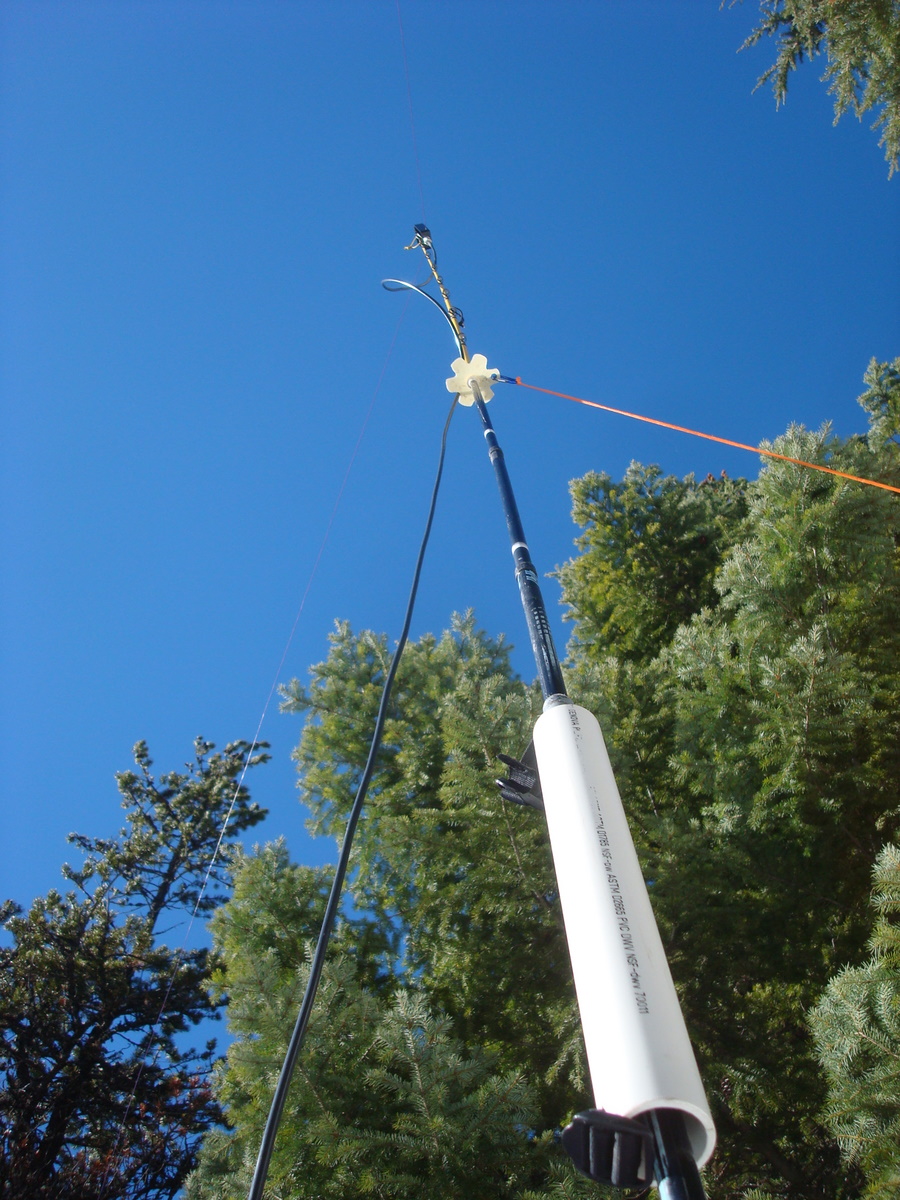
The Multorpor antenna mast shown below is two ski poles with a piece of PVC pipe to connect them, and a section of fishing pole at the top to give three more feet or so. This was the only time this antenna mast was used - telescopic fishing poles are 'advanced technology' by comparison. The operating position looks comfortable enough, but I was sitting on the avalanche shovel in my pack and after an hour I realized I should START OUT being more comfortable - so that there are no regrets about where I sat down.