As part of our annual summer trips Paula, N6VGW and myself (WA6ARA) try to go different routes and have fun along the way. As part of our 2014 excursion we stopped by Crater Lake in Oregon for a few days. While there we did a a couple of Summits On The Air, or SOTAs. These were Wizard Island and Mt Scott. While Mt Scott has been activated often, Wizard Island had never been activated. Wizard Island, is in the middle of Crater Lake so you can’t walk there, it is a boat trip and reservations are usually needed. So Paula and I paid the boat fee and headed off to Wizard Island.
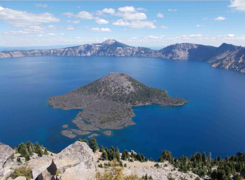
This is a hiking trip, you first hike down the Cletwood Cove Trail to the lake. As it turns out, this hike is the steepest in the park. So we hiked down some 700 feet to the boat docks. Not bad going down anyway. And a nice boat ride brought us to the dock on Wizard Island. Wizard Island is a second volcanic cone that has grown out of Crater Lake. The rocks, soil, everything is volcanic in nature.
The initial hike up the Wizard Island is a scramble over volcanic rocks and lava flows. There is a trail, sort of, to follow. As you go the rocks get smaller to almost resembling soil and the trail actually becomes more defined. Walk, walk, walk, about 700 feet up!
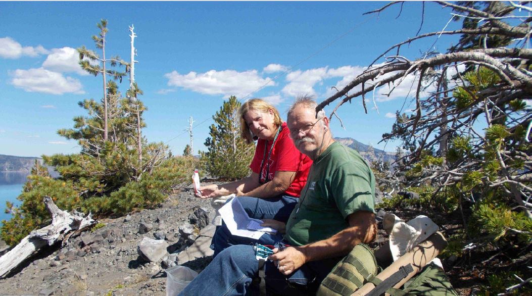
Once at the top you are on the edge of small caldera. Time to set up the station. The trusty KX3 was brought along as the rig along with the portable vertical I have been using. We set everything up along the edge. I was concerned we would have a hard time making contacts, being surrounded by the rim of Crater Lake. But the QSOs rolled in, no problem at all. The interesting part was we became a point of interest for the tourists visiting the top along with us. We were asked the typical questions which Paula handled as my PR representative. And then the photos started. Several just had to have a photo of these guys hanging on the side of a peak and using Morse code to talk to the world. After all was done, we climbed back down (700 ft), met the boat, back to the docks and then a steep, long climb back up to the road, another 700 feet up.
We also did Mt Scott. As I mentioned, it had been activated many a time, so nothing special there. It is a nice 1400 ft climb, good trail and beautiful views from the top. What made it interesting was after we got down, we drove to the village store for fuel and a well desired ice cream. On our trip back to the camp site we passed the Mt Scott trailhead and we were called on 146.52 from Etienne, K7ATN, another SOTA activator. Turns out he had seen our car earlier (he saw my callsign license plate) and was now on top of Mt Scott! We had a good chat and invited him to our camp after he got down. We had a nice eyeball QSO with Etienne and Paula fed him a much needed dinner.
We stayed at Lost Creek Campground operated by the Park Service that is first-come, first served: https://www.nps.gov/crla/planyourvisit/lost_creek.htm. There is also Broken Arrow Campground at the south end of Diamond Lake is a convenient and plesant place to stay compared to the concessionaire-operated campground: https://www.recreation.gov/camping/campgrounds/231979.