Rock Butte is a short bushwhack with no views or other redeeming qualities in the Activation Zone. It's just past Timothy Lake east of Mount Hood. If you walk the last bit of road, it should be easy to travel in a passenger car.
Proceed east on Highway 26 (more like south here) past Frog Lake SnoPark and Campground about 4.3 miles. Don't be tempted to turn at Clear Lake Campground - it won't take you to Clear Lake Butte. Turn south onto NF-42 and proceed past the SnoPark and continue south on NF-42 for about 12 miles to Timothy Lake. Note that this road will take you past the gate where you can start on the way to W7O/CN-059 - Clear Lake Butte after about 2 miles. This might be a fun second activation before or after Rock Butte. Well, it may be best to try it after the bushwhack required for Rock Butte.
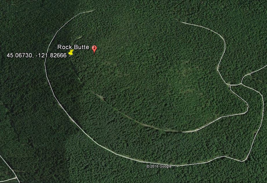
You'll continue to near the Timothy Lake dam where you'll turn south on Road 5740 (it's actually signed). The paving continues most of the 3 miles you'll travel on 5740 to a right turn onto an unlabeled road. You continue 0.9 miles, encountering three left turns fairly close together - take the third one. You may want to park here as it will be difficult to turn around on this road. Proceed west on this road for about 0.9 miles to a point that is about 0.1 miles from the summit and the underbrush is somewhat limited - we found 45.06730, -121.82666 to be a spot that isn't too bad. Continue uphill, steeply in places, until you can find yourself any kind of small clearing in the AZ. A GPS will help you be certain you've found the summit in the trees and brush.