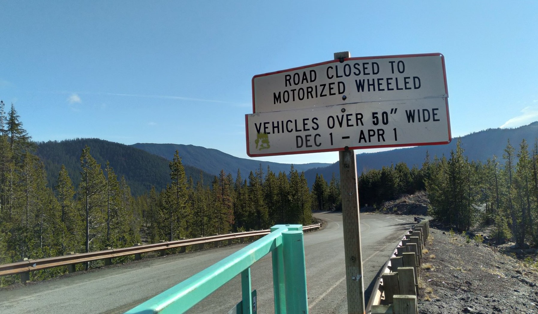
UPDATE Dec 2021 - Badger Butte (and other summits in the area) are not accessible from Dec 1 to April 1 due to closure of NF-48 and other routes to vehicles more than 50 inches wide. SO - if there's snow and you've got a snowmobile, have at it. See the photo below.
Badger Butte is a four-point summit east of Mount Hood. It's a bit of trouble to reach and the last bit to the summit is cross-country, but only a half mile through fairly open forest. There are no views at the top to reward you - just contacts on the air with your fellow SOTA folks. Note that some GPS will take you via NF-4891 and Bonney Meadows Road - you and your vehicle will not like that route. Not at all.
Head out Highway 26 towards Mount Hood and continue to the Frog Lake Buttes Sno-Park. About 6.3 miles past FLB, turn north onto NF-43. After 6.0 miles you'll turn right onto NF-48. In 6.5 miles you'll turn left (north) onto NF-4860 and go about 8.0 miles to the coordinates below. This road was quite variable in condition - high clearance is required the last mile or so. You will probably rely on a GPS to get you to this summit - just be sure that it takes you the easier path outlined above and not the way we went.
Start towards the summit from near 45.2855°, -121.5496° (about a half mile from the peak) and head cross-country to the summit. (I believe we parked earlier where there was a good spot to pull off the road - there aren't many.) Marking the location of your vehicle will be rewarded by not wandering around wondering where you left it. From the coordinates above it's just about half a mile in a straight line up to the summit. There you'll find lots of trees for stringing antennas. We had it easy with the CQ WW VHF Contest going by making some 2m SSB contacts. 2m FM contacts may prove very challenging.