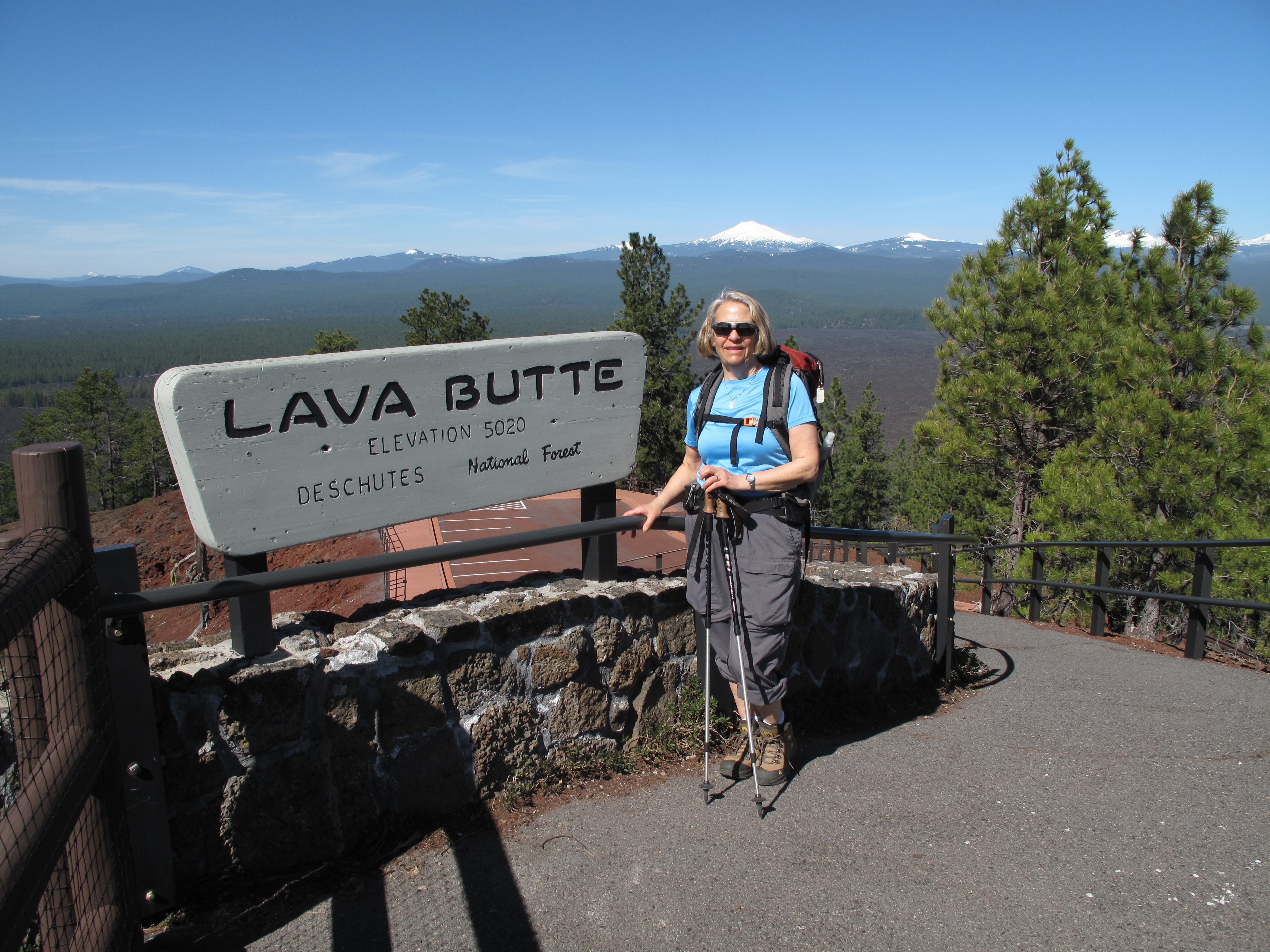
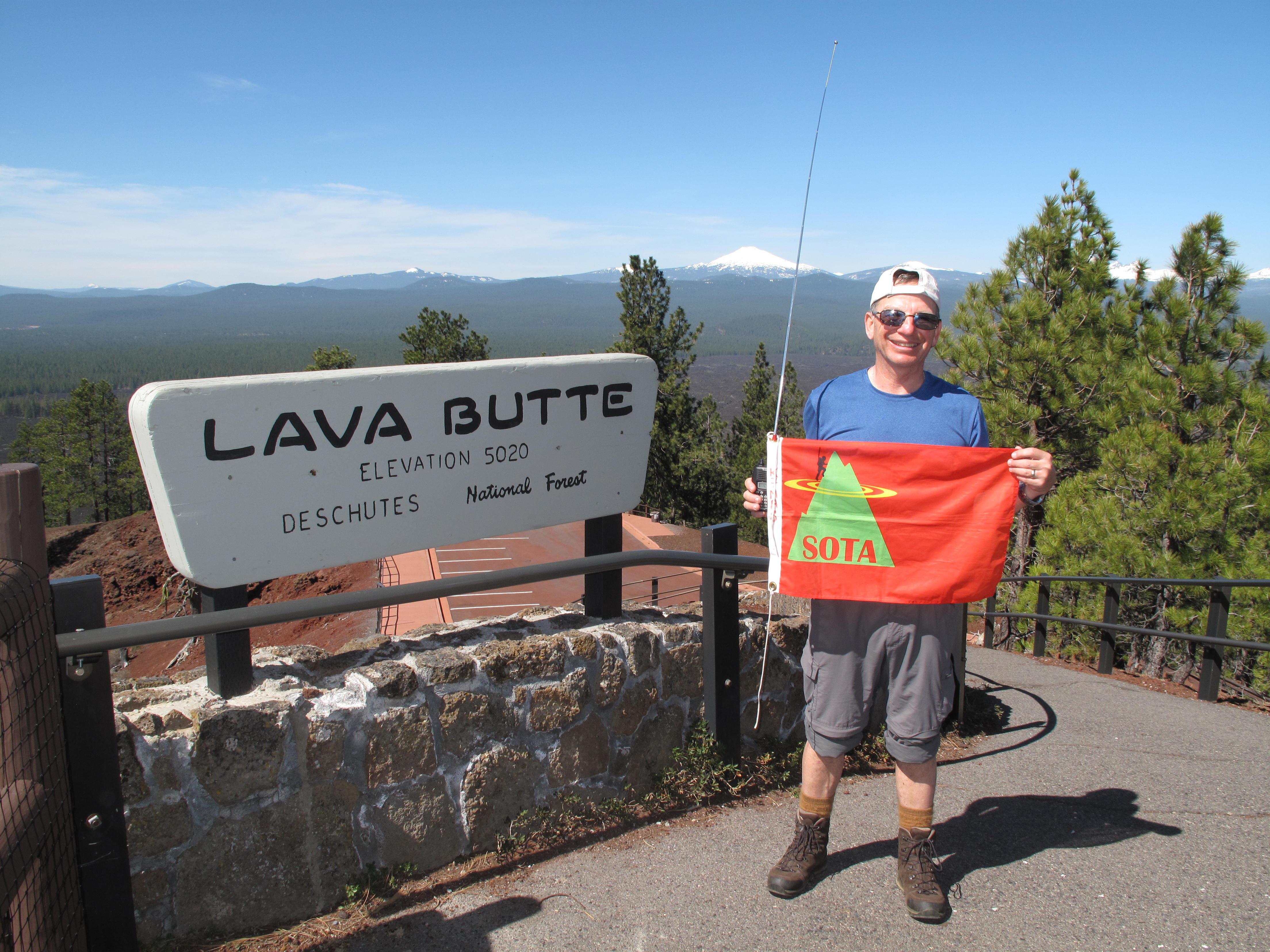
3 X 3 X 3 X 3 X 3 = Three Activations in three days with three, 3X3 (weak signal) contacts, amongst about 50 contacts overall. During an early Spring vacation in the Bend, Oregon area, we enjoyed all that Central Oregon is famous for! Good spring skiing, snowshoeing, hiking, SOTA Activations, and a sampling of several of the more than 80 breweries that exist in the greater Bend area. This report, number 3 of 3, deals with the Activation of Lava Butte, 5,020 feet, 1,530 meters." src="file:///C:/Users/Mark/AppData/Local/Temp/msohtmlclip1/01/clip_image001.gif">
Our base of operations was a rental home in Sun River. We have been vacationing in Central Oregon this way for over 35 years, averaging a trip to Bend / Sun River every 2 – 3 years.
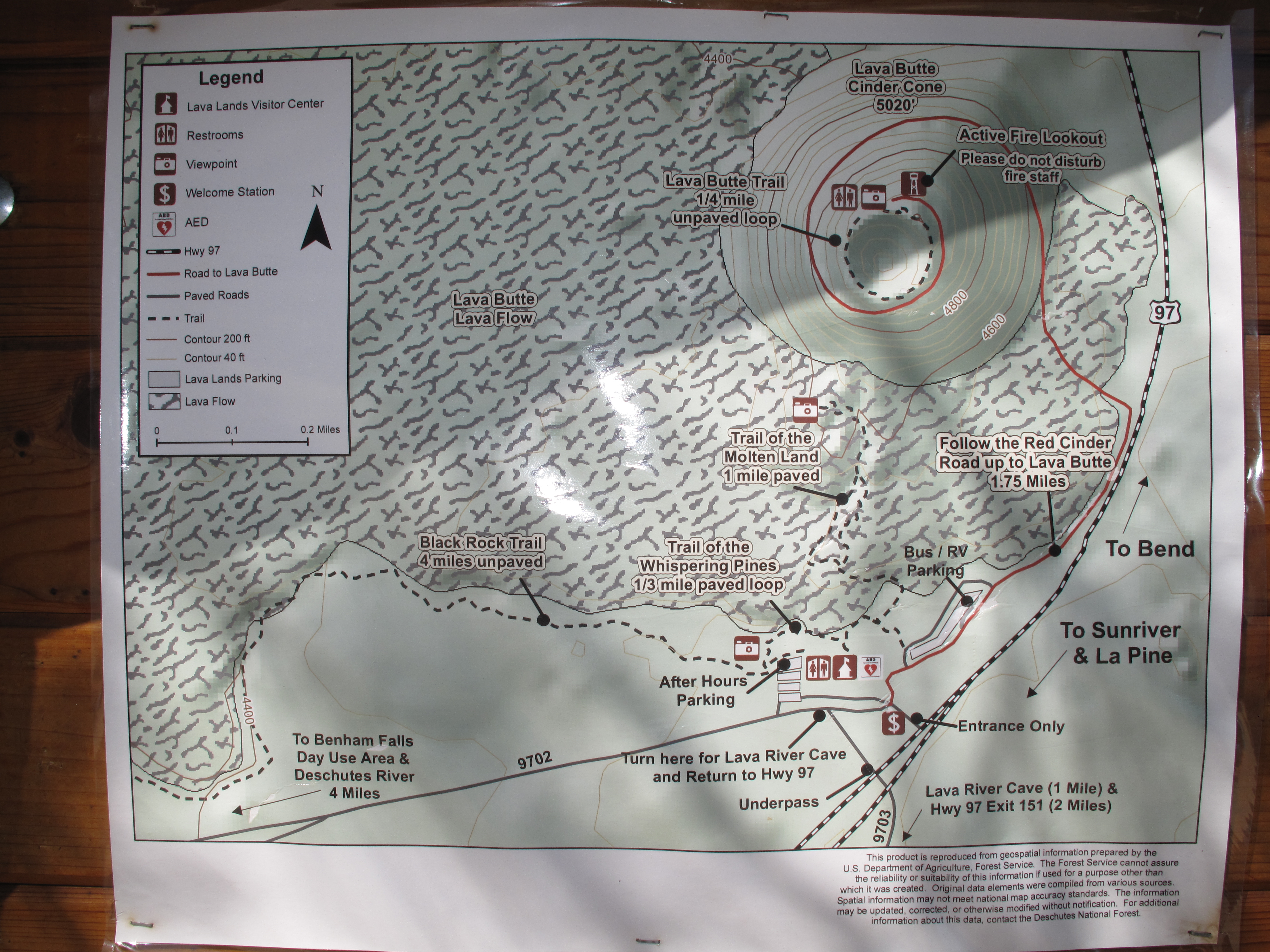
Lava Butte, W7O/CE-188, is a 4 point SOTA Summit in Central Oregon, between the city of Bend and the planned community of Sun River. Access is very easy, any time of year. This is because it is located directly adjacent to US Highway 97, the main Central Oregon highway that provides access from the Washington border at Columbia River to the California border near Dorris.
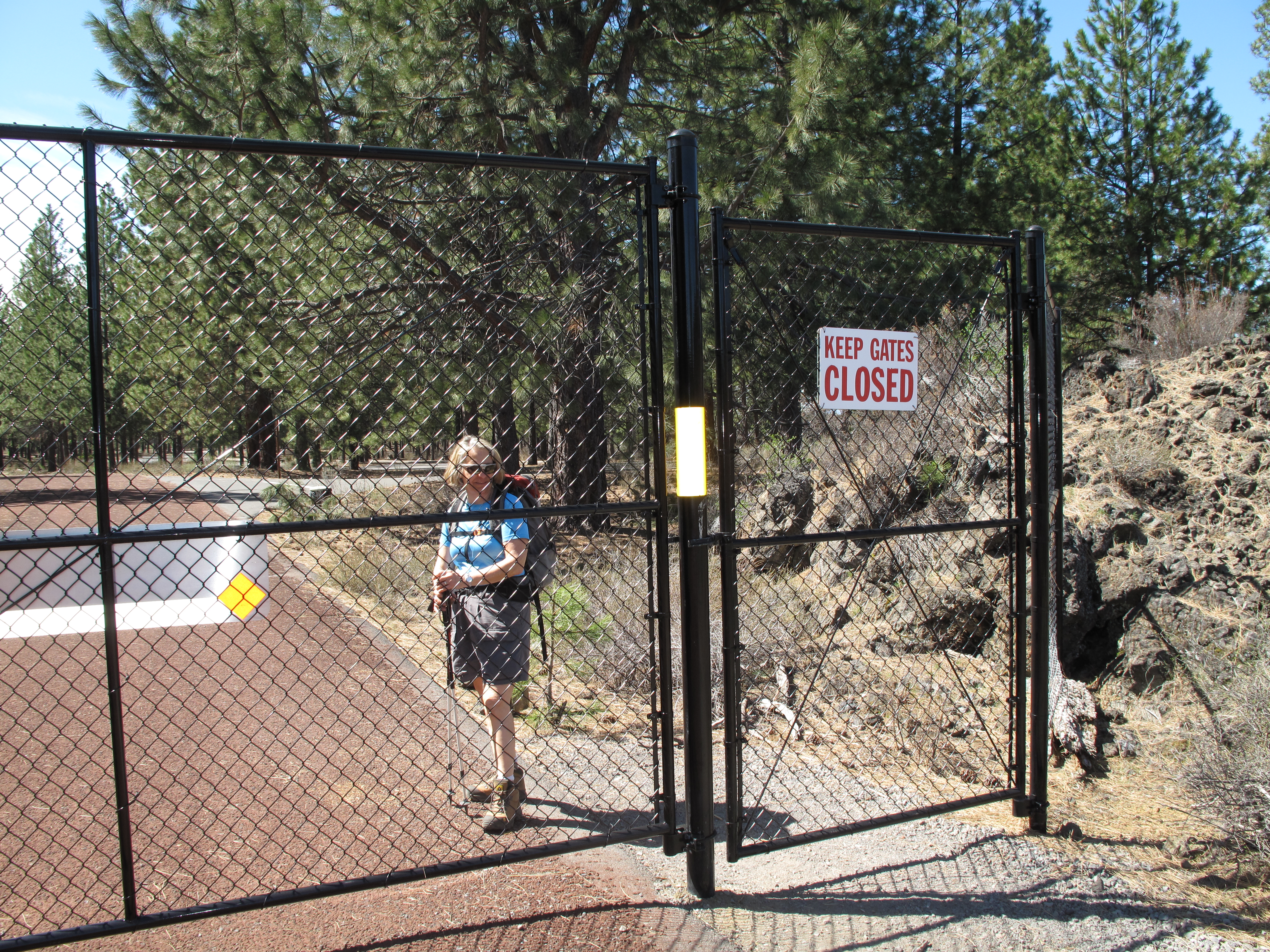
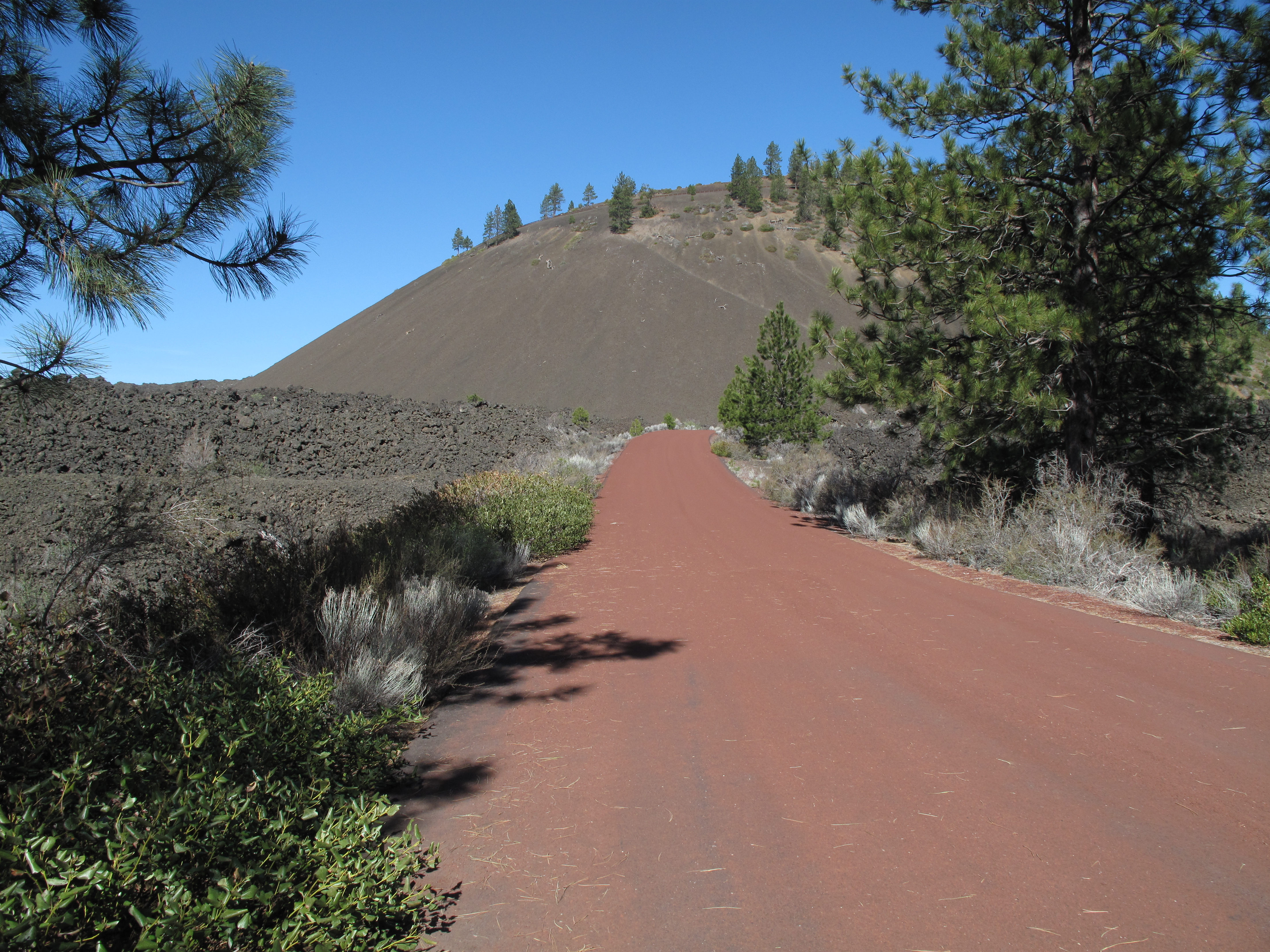
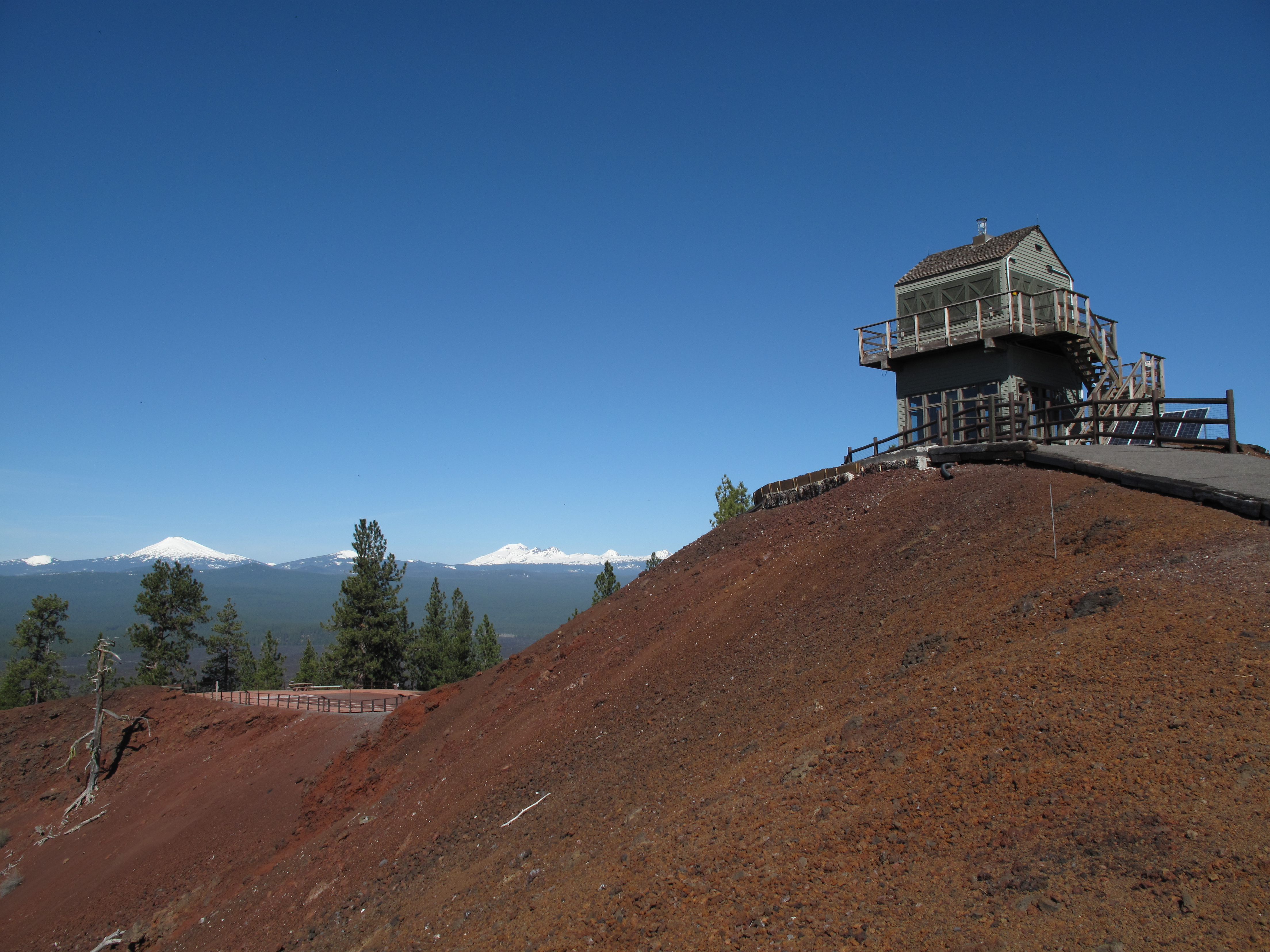
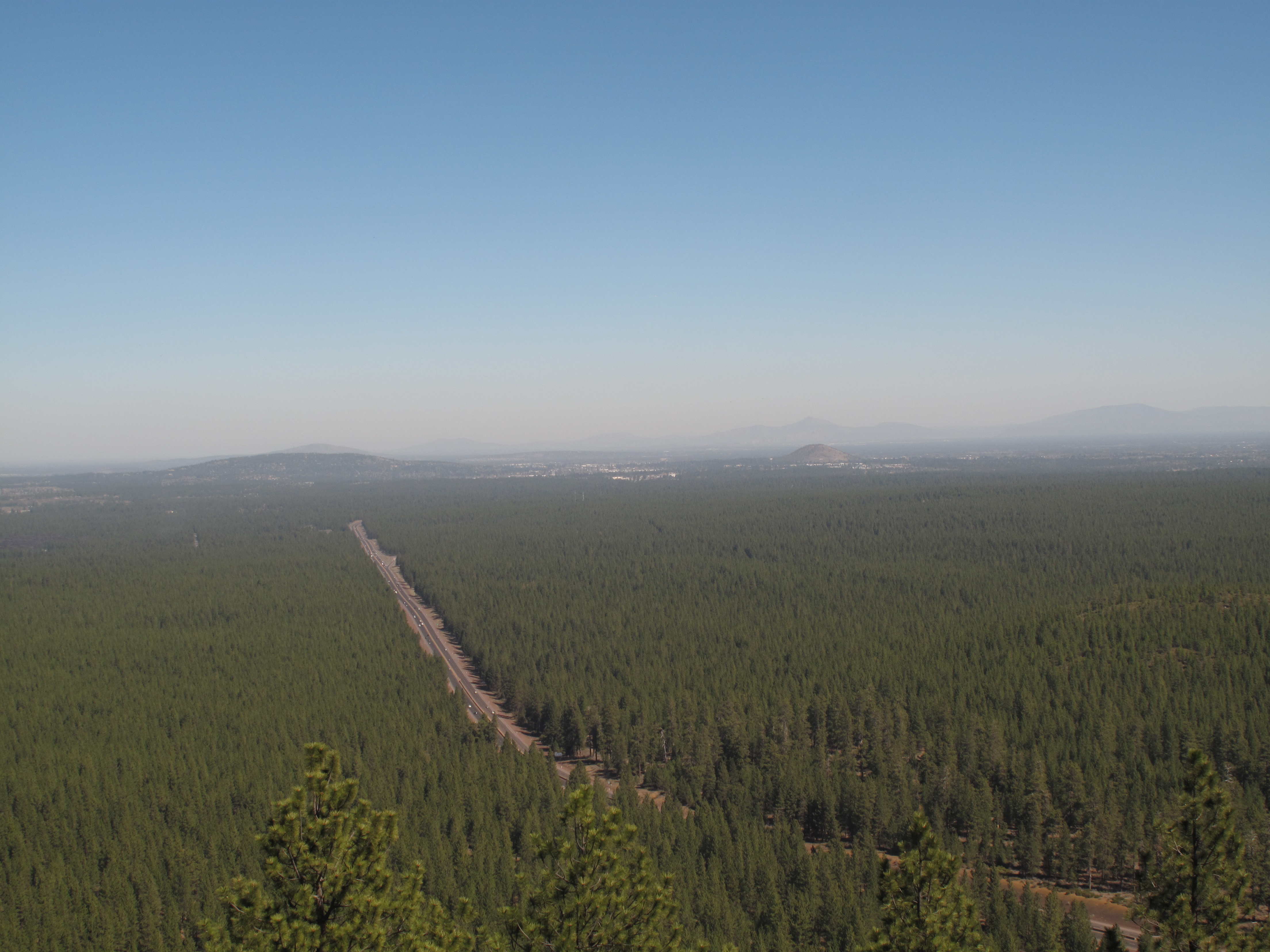
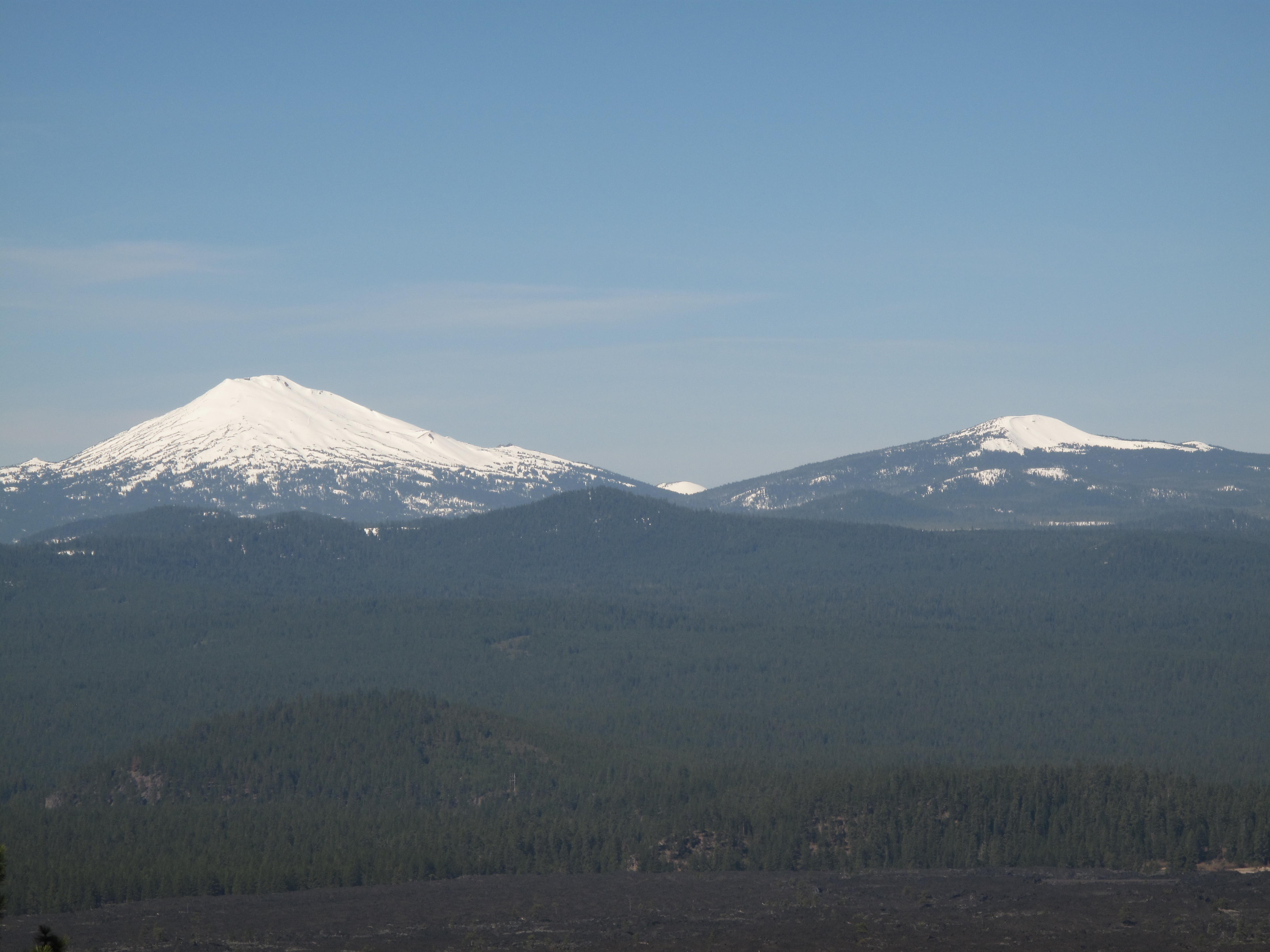
Access and parking was at the Lava Lands Visitor Center, directly off US 97. The only slight wrinkle for us was that we were coming from the south at Sun River, and there is no exit at the Lava Lands Visitor Center if travelling northbound on US 97. This necessitated driving to the next exit northbound, and making a U turn southbound. The Visitor Center and most facilities are closed for the season, and will reopen on May 1. The summit is reached via a 1.75 mile (one way) “trail” from the Visitor Center, which is actually a red paved road that spirals around the perfect volcanic cone that is Lava Butte. The hike took about ½ hour, and gained about 510 feet. The only detractor is the road noise from US 97. Otherwise the views and volcanic features on constant display are well worth the outing. We saw hikers, runners and bicyclists en route to the fire lookout on the summit. The day was somewhat hazy, but the views 360 degrees around were incredible. We also hike the short ¼ mile circuit around the cinder crater of Lava Butte to gain a different perspective and views.
I quickly set up for 2M FM using my trusty ICOM IC-V85 hand held radio, with an old AEA Hotrod telescoping vertical antenna. After Activations the previous 2 days in the area, I was again warmly received by members of the HiDARG club this time. I decided to limit my operations to 2M FM, despite having carried a full HF station to the summit. In about ¾ of an hour of operating time, I made 13 contacts, all on 2M.
There is ample information on the Lava Lands area and Lava Butte on line. See:
http://visitcentraloregon.com/central-oregon-stories/outdoor-activities-recreation-stories/lava-lands-visitor-center-a-central-oregon-geologic-gem/ and see: http://www.fs.usda.gov/recarea/deschutes/recreation/recarea/?recid=38394
Other resources are at: http://www.summitpost.org/lava-butte/916498 and at: http://www.peakbagger.com/peak.aspx?pid=31488
Thank you very much to all my contacts and the “Chasers”. In particular I’d like to single out many members of the High Desert Amateur Radio Group (HiDARG), who I worked on both 2M and 40M, and who followed me over the three days and three Activations I had in the area. Especially, I’d like to thank Max, KF7MAX, Secretary of the club, who sent out e-mail announcements and postings concerning my Activations. On this Activation I worked: KF7MAX; W7SCY; W7NHB; W7YPZ; W6RA; KE7ACY; KD6PLU; K7SQ; KE7YGB; KE7JEY; N7RGB; AF7QO and N7PWX.
End Report