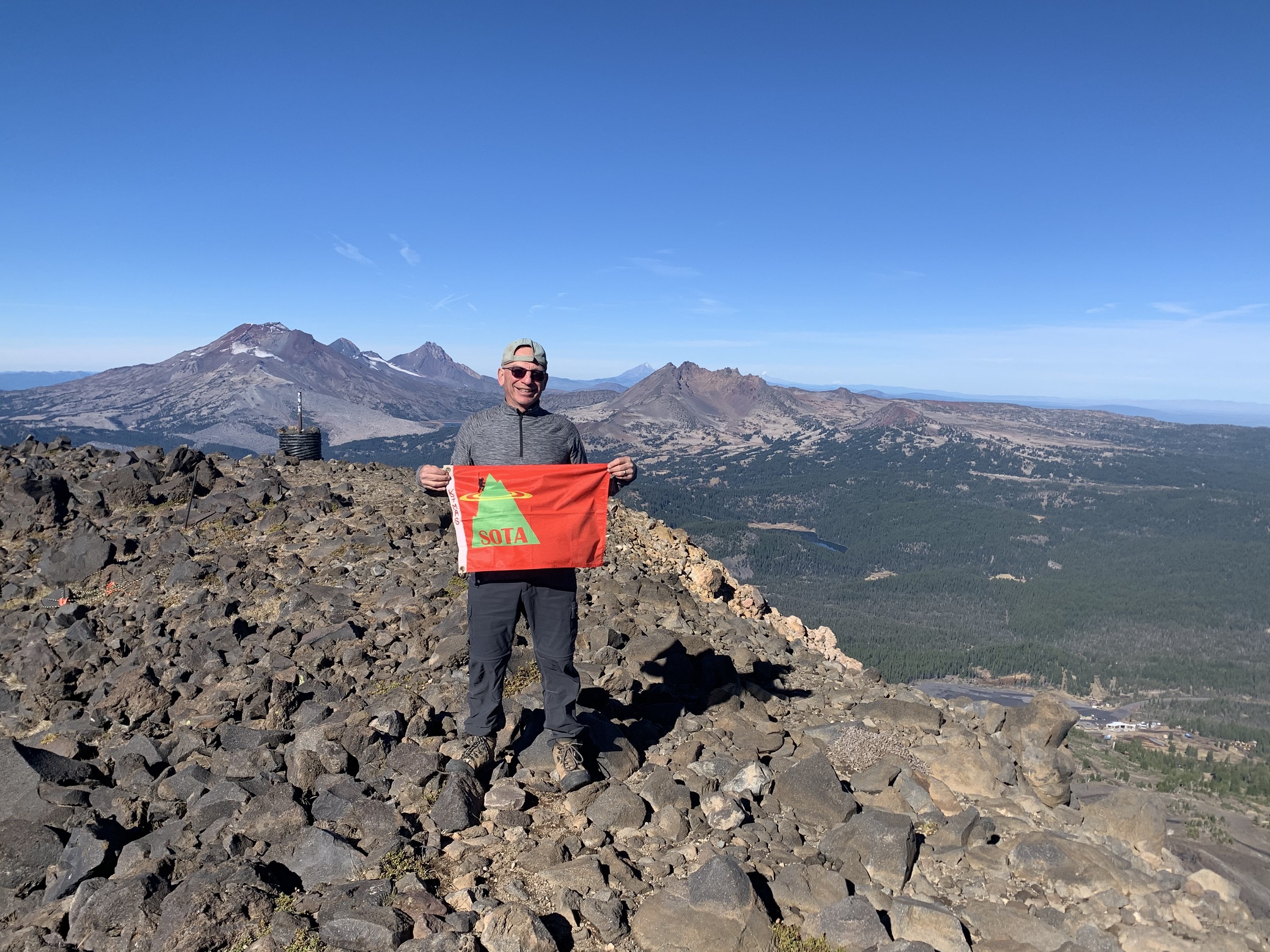
Between our October 21, 2020 arrival in Sunriver, Oregon, and our October 30 departure, we were fortunate enough to have a spell of mostly cold and dry weather. This allowed us to Activate 8 SOTA summits in 6 outings. We also had the opportunity of doing 2 joint Activations with Ron, W6PZA, of Bend, Oregon - which was a lot of fun! This report is one of a series, and deals with Mount Bachelor, W7O/CM-005. The mountain is a Strata-Volcano, standing 9,065 feet in elevation. It is in close proximity to the Three Sisters Wilderness, with its 3 namesake volcanos, all over 10,000 feet elevation. Also in the vicinity is Broken Top, a collapsed volcano of over 9,000 feet elevation. This nearby combination of peaks, together with a parade of many other strata volcanos from Washington State into Northern California, gives Mount Bachelor stunning vistas in all directions.
I had Activated Mount Bachelor 3 previous times, but all were in late winter or very early spring. The last time I was on the summit of Mount Bachelor when free of snow was in July of 1995. Thus, I was curious to revisit the snow fee volcano again. Wednesday, October 28th dawned clear and cool, with the temperature in the high 20's F. This was considerably warmer than the 10 degrees F of Monday morning, October 26th.
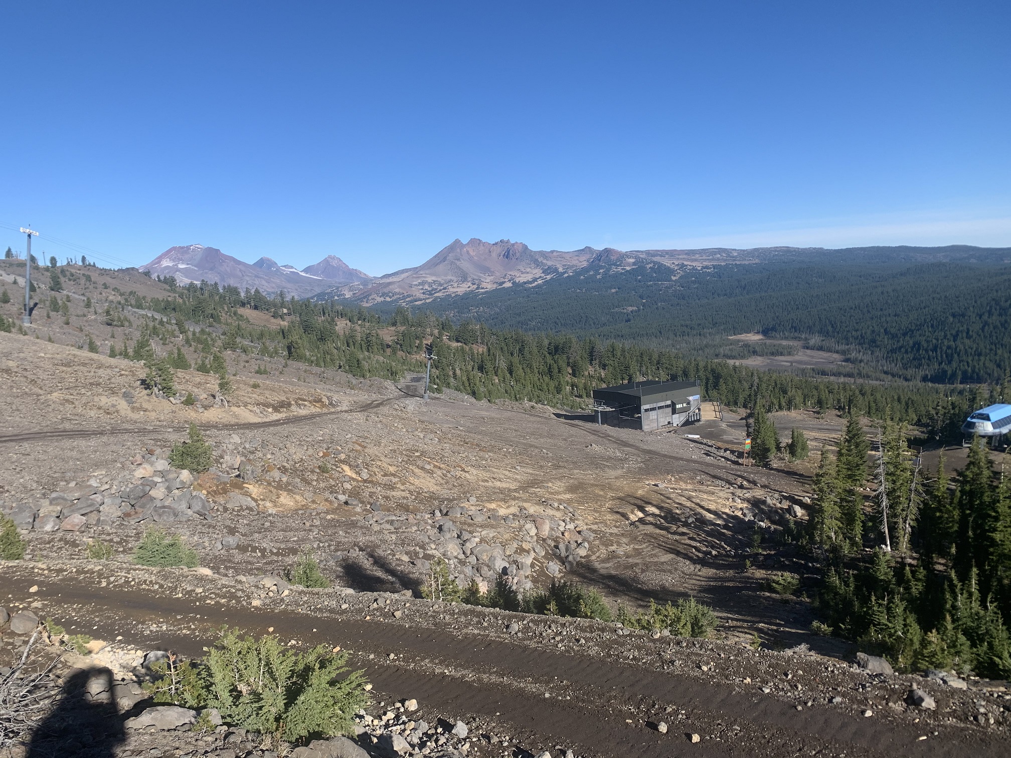
Access to Mount Bachelor is through the Mount Bachelor Ski Resort. There is much information available about Mount Bachelor Ski resort on-line. However, new this summer, is the re-routed trail which starts at the base of Pine Marten Chair, near the West Village lodge. The "old" trail started near the Sunrise Lodge, at the base of the Sunrise Chair. This change adds some distance and elevation to deal with, but the trail is in great shape on the lower mountain.
See: https://www.mtbachelor.com/plan-your-trip/summer-activities/hiking?season=summer
Unlike the previous 5 Activation of recent days we had done in the Bend area, this time I was by myself, without my XYL, Sharon and Dexter, the 11-year-old SOTA Dog. This allowed me to move considerably faster.
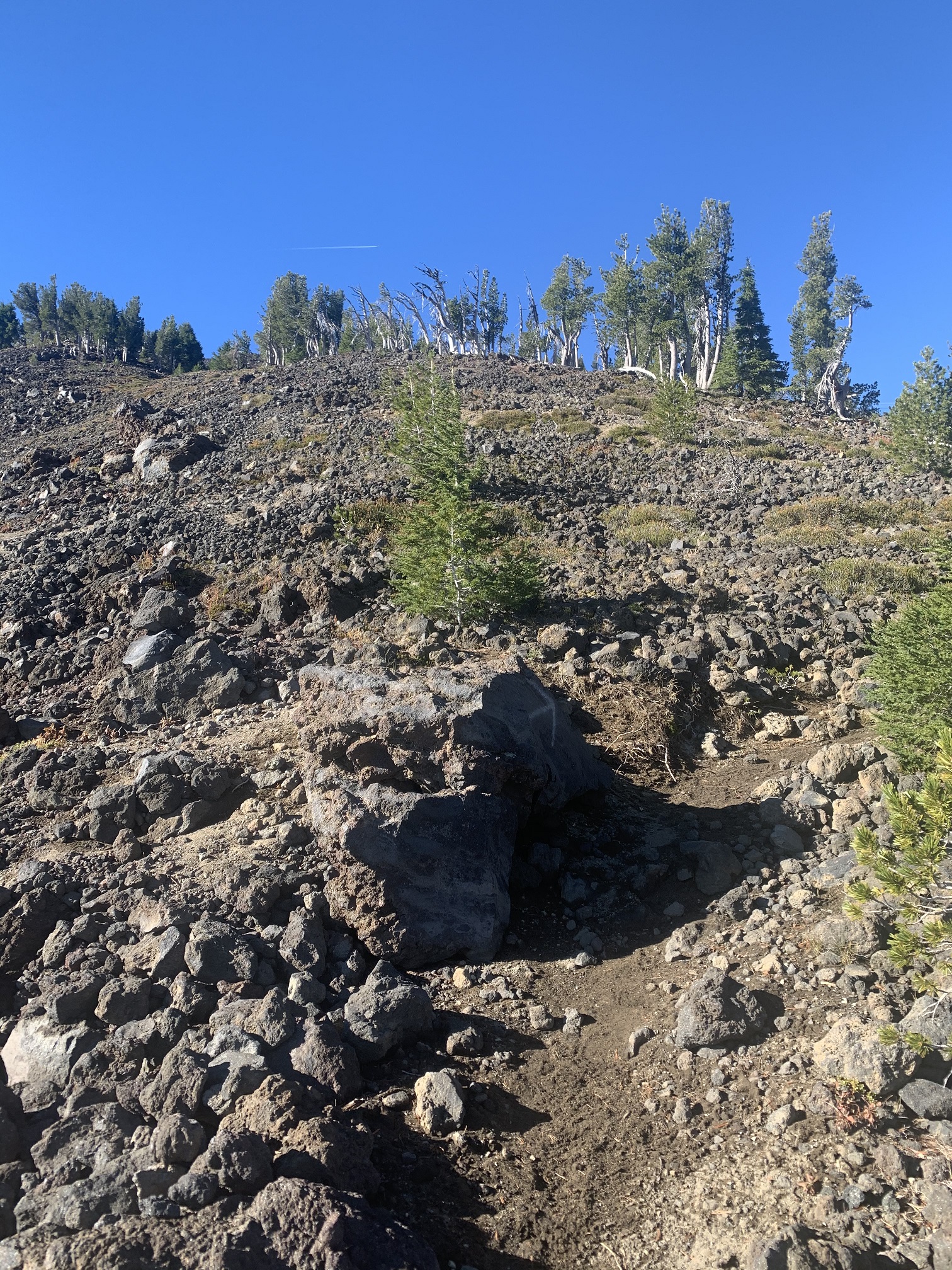
The overall trail is 6.5 miles RT, with 2,742 feet elevation gain. It took me 2:05 hours to hike up, and 1:20 hours (plus 3 Ibuprofen) to hike down. Lower on the mountain, the trail is a well graded stroll through the trees, occasionally crossing ski runs or service roads. Above the Summit Chair, which sits at approximately 7,240 feet, the trees thin out very rapidly, and the trail gets rockier, with many small switchbacks. I did not see anyone at all on the entire hike up, and had the summit to myself for close to an hour until a handful of hikers, in a couple groups, showed up. By that time, the temperature had risen to 55 degrees F, with little or no wind.
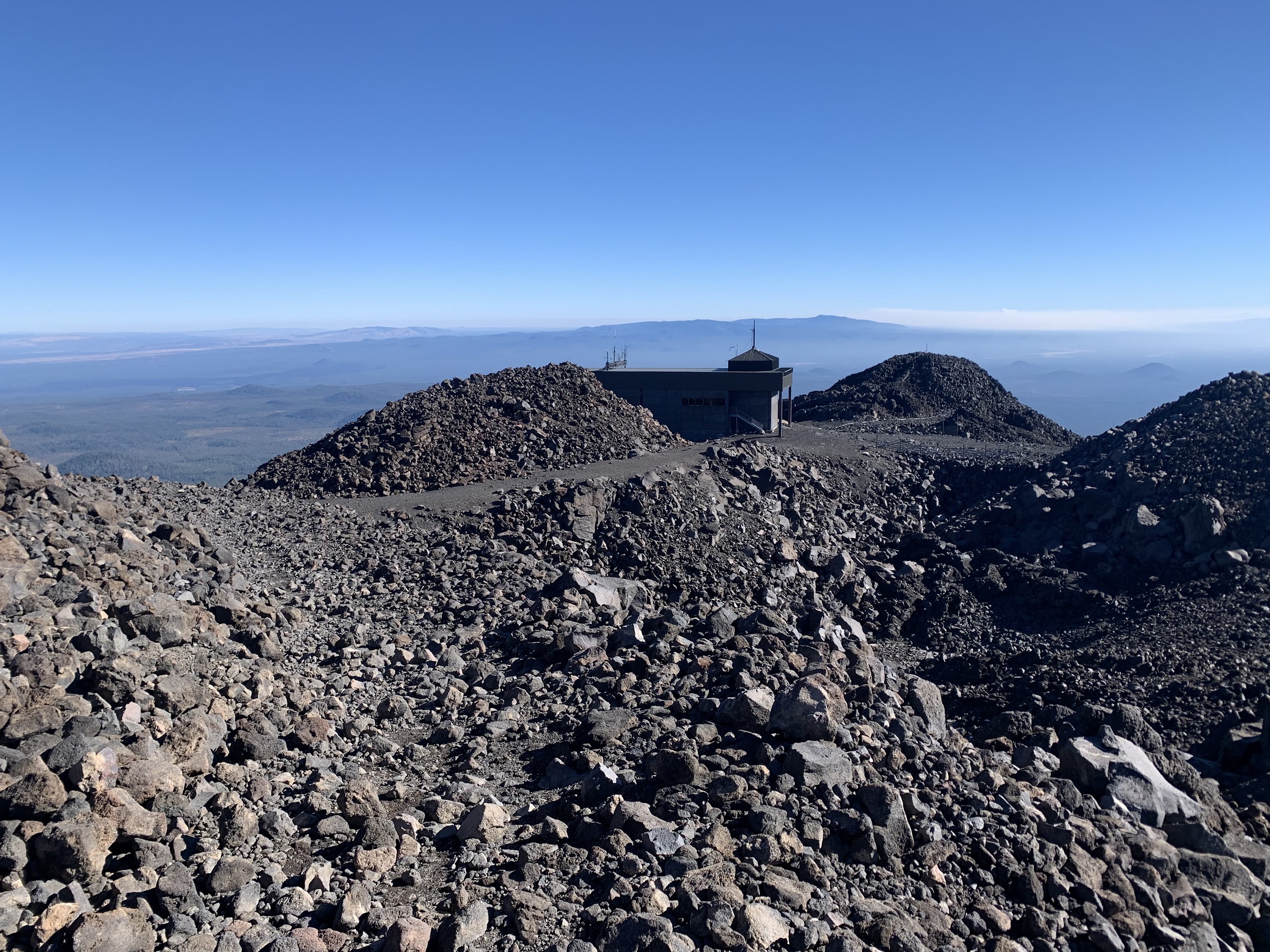
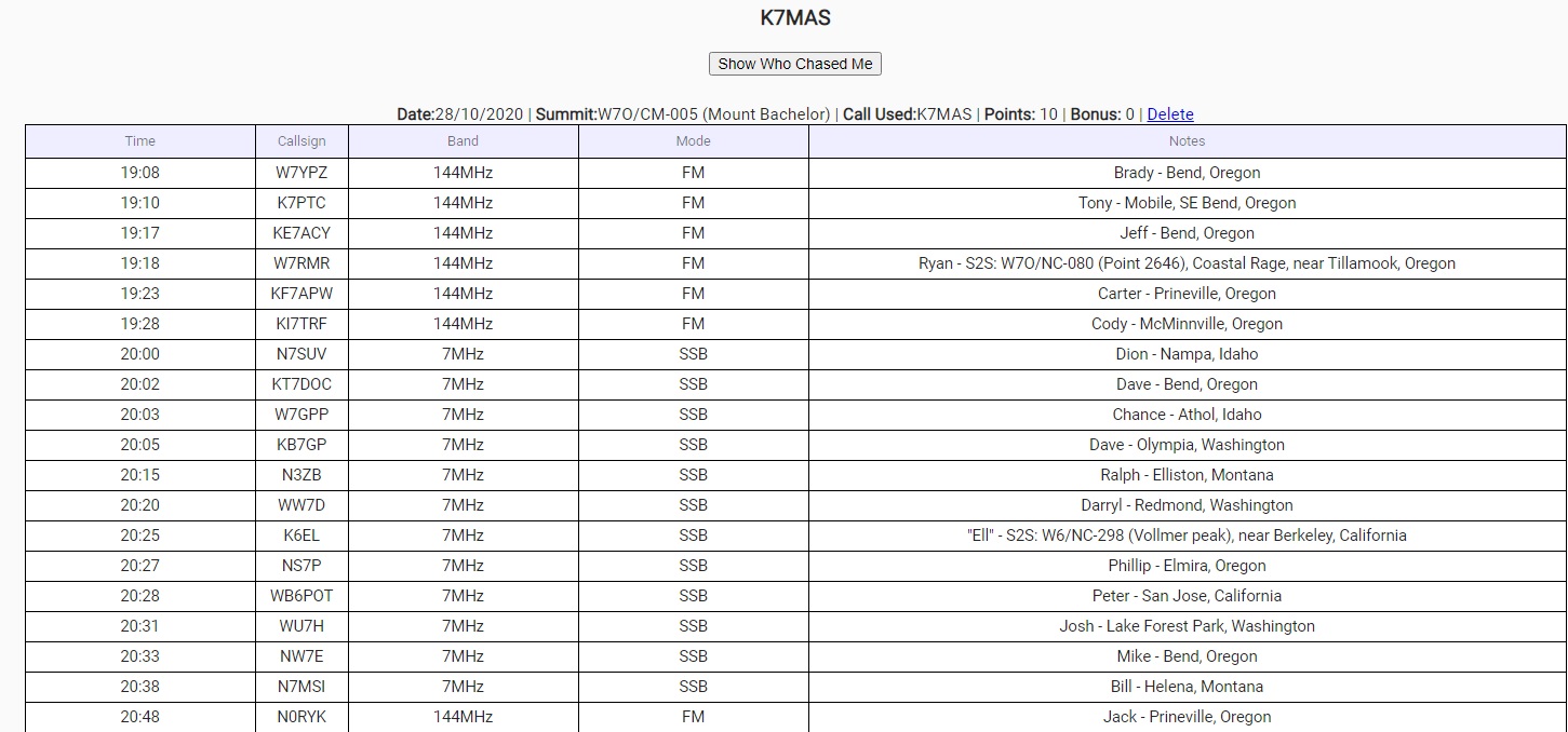
For the Activation I used my Elecraft KX3, a PacTenna end fed 1/2 wave 20M wire antenna, hung from a 22-foot carbon fiber fishing pole, as well as my 2M FM radio for that band. In 1:40 hours of operation, I managed 19 contacts, including 2X S2S contacts. The contacts were on 2M FM, with 7 contacts, and 40M ssb, with 12 contacts. I concentrated on 40M because I knew there were some chasers in W7W land waiting to work me, and I was happy to work a couple of them. In between, I hiked around the 3 small fumarole depressions in the summit area, and enjoyed the views in every direction. Thank you so much to all the Chasers! List attached as photo..