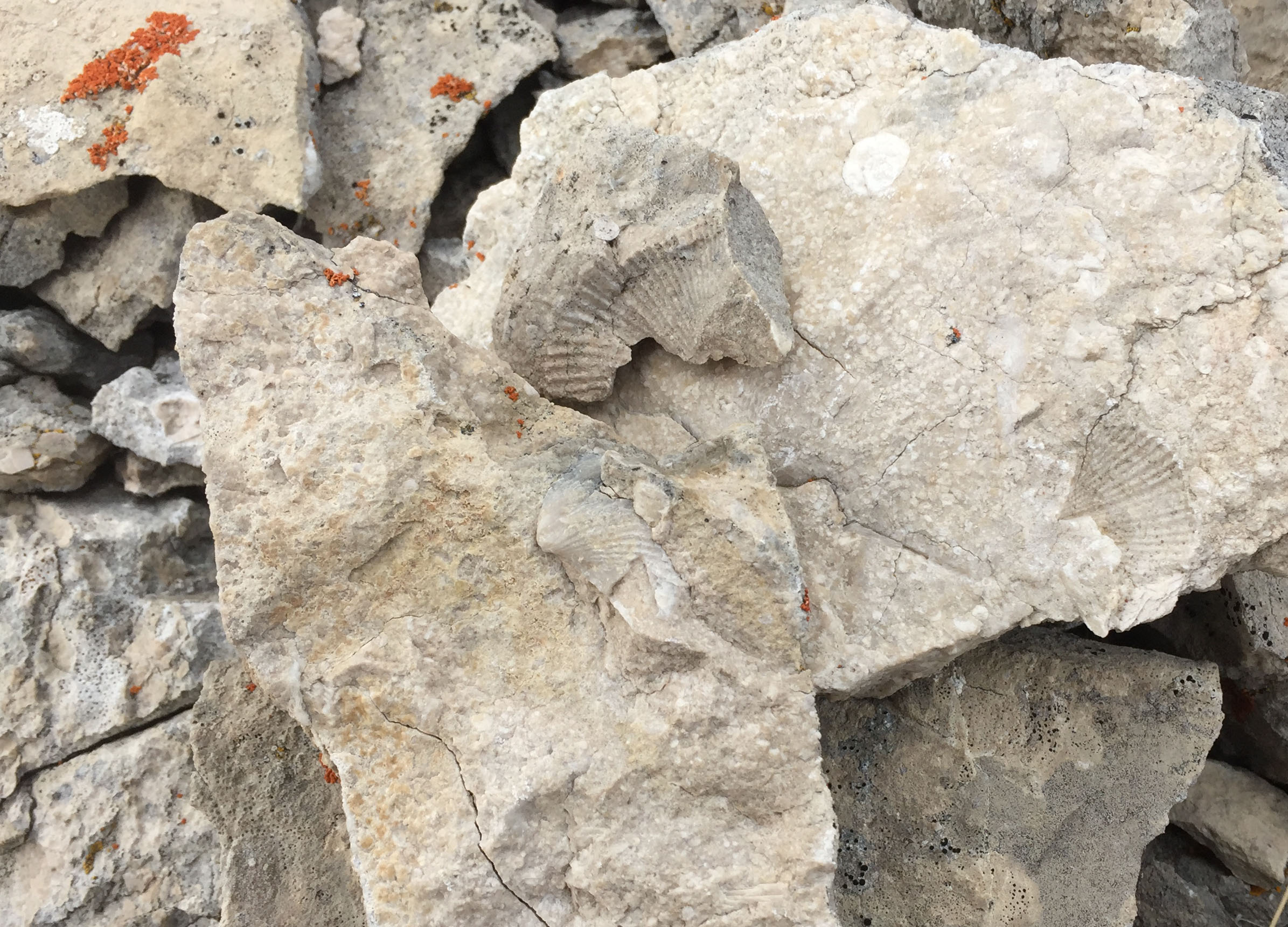
Scrambling much of the Rocky Mountain Front’s limestone summits keeps you looking for good footing as well as viewing the many ancient fossils of life when these high mountains were an ocean floor some 300 million years ago. The fossils are common and so are trails of big horn sheep and mountain goats. The views are outstanding of surrounding rugged SOTA summits and to the east, the vast plains of Montana.
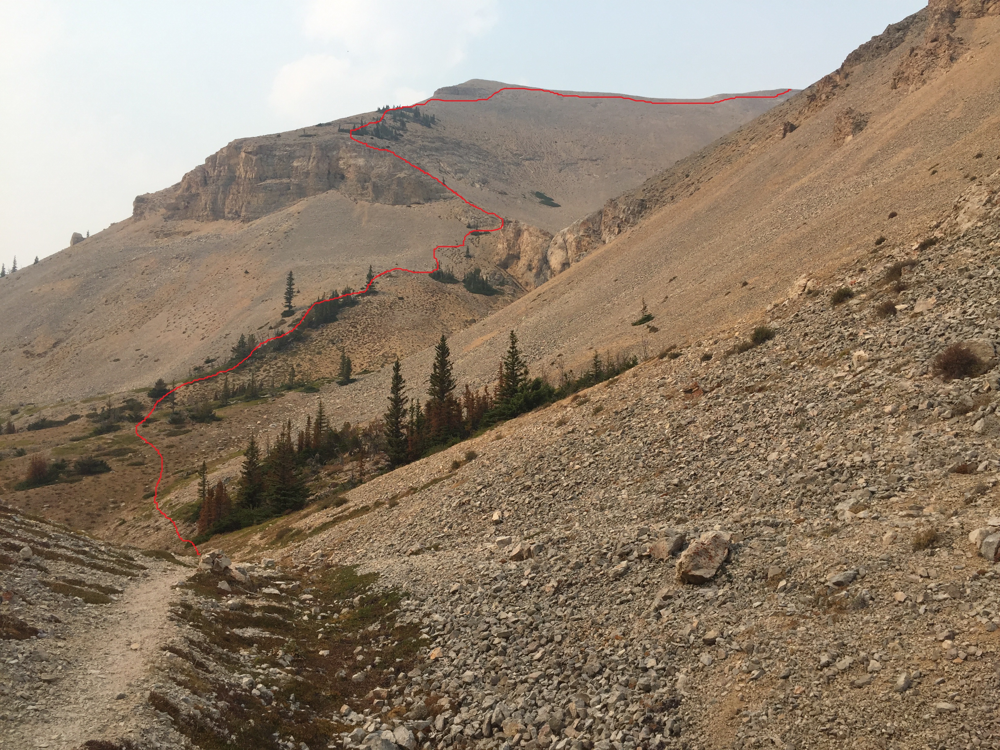
Getting to the summit is a fine trail for 3.5 miles and then a scramble up very loose scree for another 0.75 mile. Well-worn trails and dugout beds of primarily bighorn sheep are visible across much of the slopes. A logical summit approach is visible on the south side just up from the Petty Creek/Crown Creek divide. I chose to follow a climbing contour to the waterfall looking notch on the south side leading to the prominent basin below the summit. Once through this notch I headed west up mostly a sparsely forested limber pine krumholtz and bedrock ridge as the footing appeared firmer than the draw scree. Upon reaching the ridge it is an easy ‘walkup’ to the summit. The alternative is to follow the well-worn sheep trail up the draw, but it is an all scree slope with poor footing. It is the way down I took though as it is great ‘glissading’.
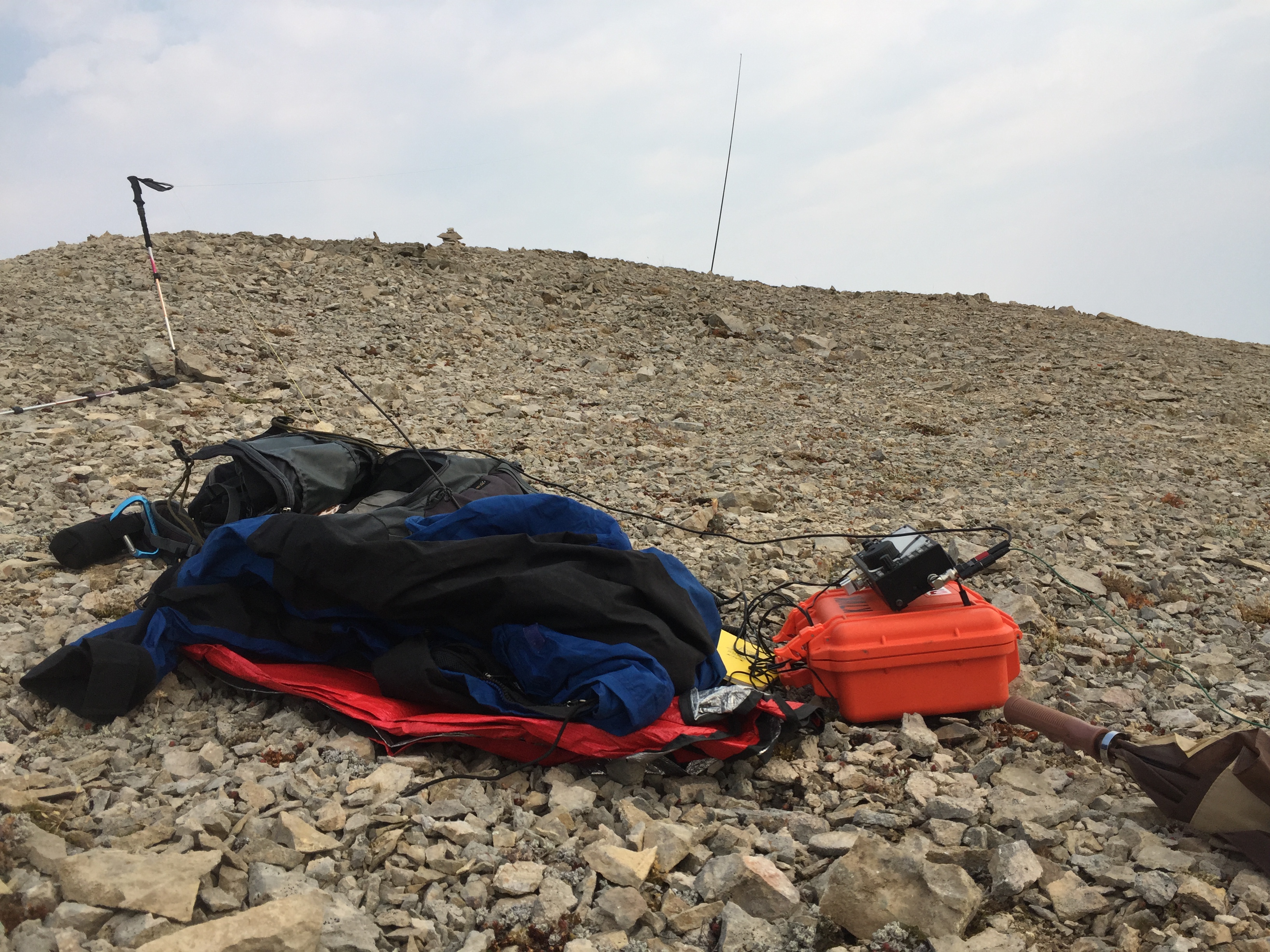
The ridge and summit are loose rock with many fossils. The ridge and summit are gradual southerly slope, but a sheer drop off to the west and north. There are very few larger rocks capable of anchoring a pole for an antenna. Here I lodged my pole in a northern cliff crack.
The views from the summit are spectacular with rugged SOTA summits to the north, west and south and the vast plains of Montana to the east. Late summer finds a constant chatter of Clark’s nutcrackers working the limber pine cone crop and picas whistling while gathering their winter ‘hay crop’. I hope you get a clear day without forest fire smoke.
Elevation gain: 2900’
Trail Miles: 7.0 round trip
Off trail scramble miles: approximately 1.5 round trip.
Water: Ford Creek and through early summer from snow melt near the pass. The scramble to the summit is dry.
Bear Pepper Spray: Highly recommended
Map: Bob Marshall, Great Bear & Scapegoat Wilderness Areas
Directions: from Augusta Montana on the south end of town, follow the Benchmark Road west for approximately 14.5 miles to a junction signed Ford Creek and Benchmark. Turn left and travel south-southwest toward Benchmark for another 5.5 miles to the trailhead. Upon entering the narrow canyon, look for the trail head sign for Crown Mountain. If you cross the main stream, a bridge across Ford Creek, you have gone 1 mile too far up the road. At the trail head, follow a gated road to the west, crossing a poor bridge for approximately 0.1 miles. The road just prior to a special use cabin has a trail to the right for Crown Mountain. Continue along this trail for approximately 3.5 miles. Upon reaching Crown Creek/Petty Creek Pass began looking to the northwest for a break in the cliff bands and a prominent notch. This is the route up the mountain. See photo.