Three Lakes Peak is just within the Flathead Indian Reservation along the Reservation Divide. The summit has great views of the Confederate Salish-Kootenai Tribes land, the Flathead River, three alpine lakes, the Mission Mountains and the Ninemile Valley. A Flathead Reservation Use Permit is required.
Two routes are described. The Alternate route is shorter, but much steeper and nearly double the elevation gain. The Reservation DivideTrail is good, but in some meadow crossings it is easy to lose the trail due to forb and grass overgrowth.
Permit: A Flathead Reservation Recreation Use Permit
Elevation gain: 1800’. Alternate route: 3400’
Trail Miles: 14.5 roundtrip. Alternate route: 8.5 roundtrip
Off-trail miles: 0.3
Water: None exists along the trail.
Bear Pepper Spray: Highly recommended in all Montana summits.
Map: US Forest Service, Ninemile Ranger District
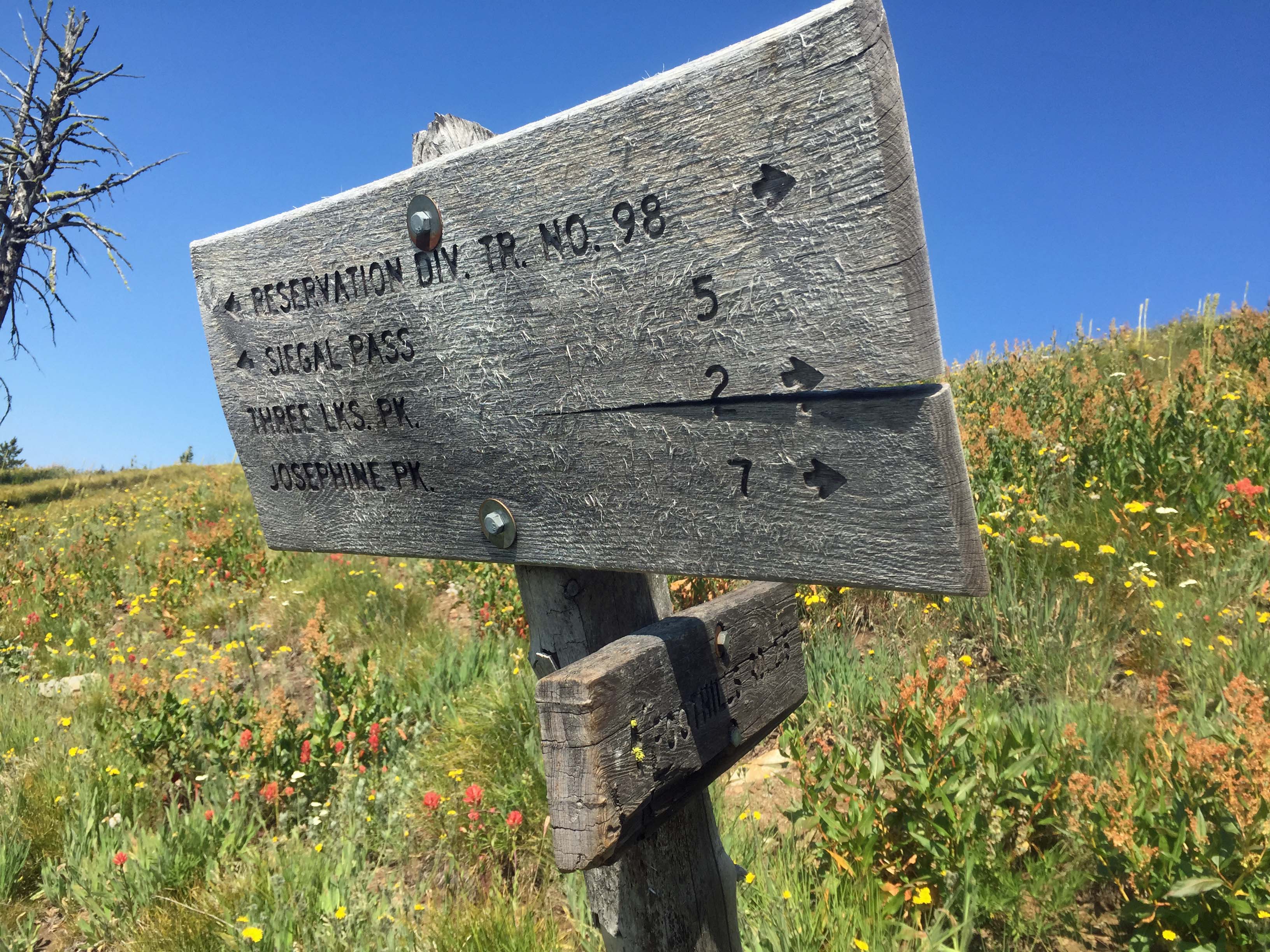
Directions: From I90 take exit #82 to the Ninemile Historic Remount Depot and Ranger Station. That is a good place to secure a map if you don’t have one. At the Ranger Station, travel up the Ninemile Road approximately 18.5 miles. This is the alternate route trailhead. Travel another 6 miles to Siegel Pass. At the Pass turn onto FS 5572 and travel that road 2.7 miles to the trailhead. The Trailhead is signed, Reservation Divide Trail #98. Hike this trail approximately 5 miles to a trail junction of FS 418. This trail leads to the Ninemile Road 2+ miles and 2400’ below, the alternative route. But continue heading east on FS98 for 2.2. Here one can leave the trail near a saddle and cross loose talus to the northeast to a saddle just below Three Lakes Peak or one can continue another 0.5 miles to the east slope of the summit and hit a faint non-system trail that goes to the saddle just below the summit. I took the talus slope going in and returned via the east slope. It’s easier than the talus, but a bit longer.