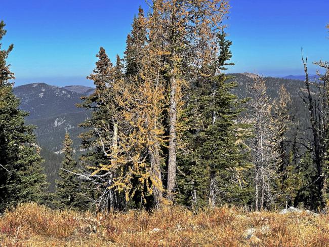
Skalkaho gets its name from the area in Salish meaning ‘many trails’. Unrelated to the name, the summit does have several trails converging near its summit. I chose the trail coming from the west off FS road #364. This trail has many views of other SOTA summits and to the west the much higher elevation Bitterroot Range.
The trail is well defined and approaches within ¼ mile of the summit, an easy off-trail scramble.
Four curious mule deer greeted me near the summit and hung around. Interested in CW, I thought?
There are trees on the summit suitable for hanging wire antennas or attaching antenna poles.
Trail Miles: 3 on-trail, 0.5 off-trail, round trip
Elevation Gain: 1300’
Water: None
Bear Spray: Recommend for all Montana summit hikes
Camping: Ample room is at the trailhead or several dispersed sites along the access road
Map: US Forest Service, Bitterroot National Forest
Directions: From Corvallis MT follow Willow Creek Road #373 for 2.25 miles west to junction with the signed Willow Creek Road. Turn right continuing on the Willow Creek road and travel up this road approximately 5.7 miles where it becomes FS#364. Follow #364 another 3.7 miles where it turns hard right and crosses Willow Creek at the junction of road #969. Follow #364 to its near end in a saddle junction with roads #73898 and #13141. #364 continues up to old mining areas, but don’t go there as you’ll miss the trailhead. The trailhead is not signed. At this junction, look for the trail going ENE up the ridge through heavy forest. Shortly up this trail the area becomes quite open with scattered trees and grassland slopes for much of the remaining hike.


