
Summary - Given the two hour drive, a really steep, brush covered cross county hike to the summit, and the need to bring HF along, summiting 4220 is best part of a multi-hill day. A map and compass or GPS is a really good idea, as are trekking poles and long pants. There is no trail to the summit and on the short bu very steep climb up (roughly 300' elevation gain) you will encounter a lot of deadfall along with stands of manzanita and poison oak. 2M contacts are difficult unless other SOTA ops are working on nearby mountains, APRS works well, and ATT messaging sometimes. The summit itself is open to the north and east and probably has nice views when it is not shrouded by cloud.
Long Version - 4220 (SOTA name: D Layer Mountain) is one of a cluster of summits west of Stabler, WA. I did 4220 and 4340 (SOTA name: Mt Continuity, LC-062) together and if you don't mind a long day or are good at quick activations, you can add Lookout (LC-066) to the mix and rack up twelve points in one outing.
To get to the summit, I parked at a wide spot in the road at 45.81572, -122.08966 and headed up the fall line, generally WNW, staying to the right of the gully that used to be the trail you'll find on Forest Service maps. The climb is short but very steep with lots of deadfall, loose topsoil, and brush to work through. It is not quite hands-and-knees territory, though it gets pretty close in places. Along the way, you may encounter the remains of a path switchbacking up the hill but mostly you will be going cross country. After getting to the final ridge, head roughly north to attain the summit, which is open to the east and north. Trekking poles and good shoes are a must, especially on the way down, as is setting a waypoint for your vehicle location.
Getting to the trailhead is straightforward. The drive from SE Portland is a little less than hours, split evenly between paved and unpaved road time. I recommend a 4WD vehicle with a bit of clearance as the roads get progressively rockier, more washed out, and narrower as you go further back. Long portions of the forest roads combine breath taking drops on one side and a lack of turnouts. These GPX routes cover three mountains in this area:
GPX tracks to lookout, 4340, and 4220
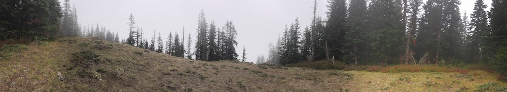
The summit itself is densely forested to the west and south and open to the east and north. I imagine the view is pretty good when the mountain is not covered in dense clouds, as it was today. Here's what it looked like from my operating position:
As with 4340, the only 2M contacts I made were with other SOTA ops on nearby summits. I might have done better with a beam pointed at Portland but who knows given forest between me and there. There were plenty of places to hang wires for antennas and HF contacts were plentiful.
So... 4220 is another long drive from Portland over often rough forest roads, involves a cross country hike through brush, poison oak, and deadfall, and isn't great for local QSOs. I wouldn't recommend it as a destination summit but done with one or more of its neighbors, it is a worth hiking and on a nice day, probably has awesome views .