
Summary -- Badger Butte is broad, treed summit, with a fairly easy climb from the road. Getting to it by way of Bennett Pass Road requires 4WD, low tire pressure, and high clearance and some patience. 2M contacts are possible and both APRS and ATT digital service work for spots. Can be done with 6001.
TL;DR -- I hiked Badger Butte, along with Lookout (CN-008) and 6001 (CN-078), with Tim N7KOM and Roscoe. To reach Badger, we parked at Windy Camp and hiked the road up to the southeastern ridge of the summit (45.286, -121.551). The hike is roughly 2.2 miles from camp to summit. You can park much closer if you want to hike a shorter distance. The hike from the summit trailhead is a 400 foot climb mostly through open forest and meadow, and about half a mile long. You can safely ignore any trail you might find on a map because there isn't one.
Once on top, you'll find a broad summit with lots of trees and not much of a view. We made contacts on 2M with a half-wave whip and were able to spot using APRS and ATT cell service. As usual, HF contacts were plentiful. Pro tip: don't be tempted to follow the "shortcut" down the west ridge. It is very steep, crossed with cliff bands, and an difficult descent. Sorry about that decision, Tim and Roscoe.
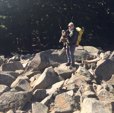
Roscoe letting me know that Tim gets to choose the way down next time:
You get to Badger on Bennett Pass Road, through Bennett Pass Snowpark or by way of Lookout Mountain. Bennett Pass Road is an off road adventurer's dream: in poor condition, rutted, mostly single lane without turnouts, and exposed sections. 4WD, low tire pressure, and high clearance are a must. We encountered more traffic on the road than we expected, given the time of year.
If you are going to negotiate Bennett Pass Road, consider doing 6001 (CN-078), too.