Summary - Birkenfeld Mountain from the east side is a steep, mostly pathless, ridge bushwhack to a brushy forested summit. The approach via CG2020, is a logging road with some very steep sections that can also be used to reach Greenleaf Peak. Drive time to the trailhead was about 90 minutes. ATT cell service was good, as was APRS and I was able (though I wouldn't count on it) to activate the peak using a 2M HT. This is a short and tough cross country hike with some exposure; 4WD, good footwear, trekking poles, a map and compass or GPS recommended. USFS and gaiagps maps are accurate with respect to the roads in this area.
TL;DR - This was my second visit to Birkenfeld, which I intended to do with Greenleaf Peak back in July. That attempt was foiled by truck trouble so I returned this morning for a second try. The drive up is on CG2020, a logging road that begins on the northwest border of Stevenson, Washington and meanders through forest and under power lines for six sometimes-steep miles before reaching a five way junction. From here, you can head up to Birkenfeld or to Greenleaf Peak. The road is rough and has a few steep sections but isn't littered with big potholes. If you choose Birkenfeld you will head up hill from the junction, make a right onto a road marked 044, and park in a pullout about one-tenth of a mile further on. If you go too far you will encounter a big locked gate and a lot of scary no trespassing signs.
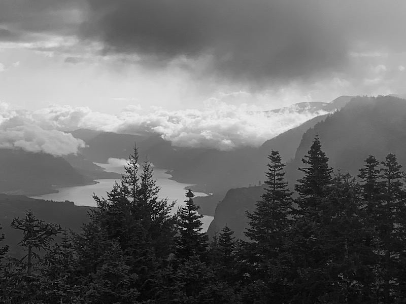
The Birkenfeld Mountain entry on Summitpost suggests there is a boot path up the ridge from here and while I came across a couple of short path-like sections near the summit, don't waste a lot of time looking for it. Your best bet is to scramble up the embankment and stick to the ridge, path or no. To get to the main summit you will pass over the lower, eastern summit -- which has a great view of Greenleaf Peak and the gorge -- drop into a saddle and climb again to the true summit. all along the ridge. While you will need to veer off to the south side in several places, stay on the ridge unless forced off; the forest and ground cover are even denser below it. The grade is often in the forty percent range and the north side of the ridge is very steep and exposed in several places. And after all climbing, your last challenge will be the band of thick ground cover guarding the summit.
The summit itself is brushy, tree-covered and without views, which makes for a dreary operating position, especially with temperatures in the forties and wet clouds enveloping the mountain. Needless to say, I didn't stay long. I was able to spot myself using ATT cell service and make four contacts on two meters though I am not sure that would have happened if other SOTA ops weren't out at the same time. I would generally assume HF is required for an activation.
Here's the view of Greenleaf and the Gorge from the east summit: