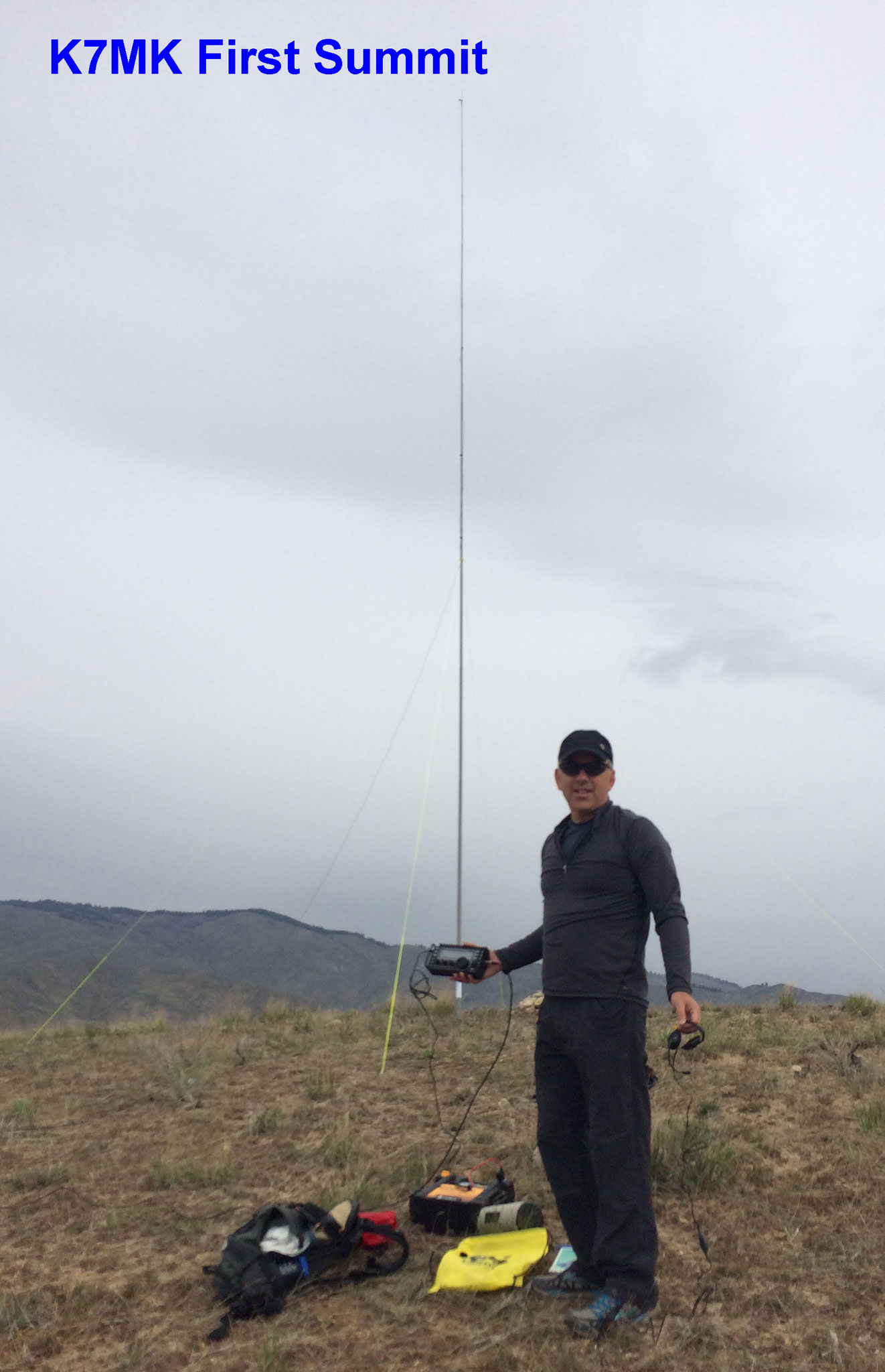
K7MK and I headed out to activate this summit as our first ever activation. K7MK has been assembling a SOTA capable station for the last 6 months or so. We have done a dry run or two in his back yard and even hauled it up to a non-SOTA summit back in February on a rare warm winter weekend afternoon. But, this was our first real activation.
We chose W7I/SR-167 for a couple of reasons. First is it close to Boise. Second we could actually get to it. Most of the higher summits around Boise are still not accessible for a couple of reasons. One is that they are still snowed in. Though snow is rapidly melting. Second is that the access roads to trailheads are mostly still closed until the end of April. So unless we want to walk 5, 10, 15 miles to a summit we still need to wait a few weeks for a full SOTA season to begin.
It was a great April day for our first activation. About 50 degrees, mostly overcast, and with light to no wind. This summit will be brutally hot in the summer. There is no shade and the routes are all on the south face of the hill. When we had moments where the clouds and wind conspired to bring on a slight chill I reminded everyone that we would look back on this day as a great SOTA day. (Oh yea -- K7MK's XYL and Golden Retriever came along on the hike as well.)
The trailhead for this summit is pretty well described in K7ATN's blog. http://www.pnwsota.org/node/220 . It seems like there are more pullouts now on the right side of the road than when he wrote his blog. The one to choose is at GPS: 43 degrees 33 minutes 23.91 seconds North 116 degrees 02 minutes 33.46 seconds West. Or, if you reach the turnoff for Highland Valley Road on the left side of the road you have gone too far. Double back two parking areas. Also, since K7ATN's blog a range fire went through parts of the hike and most of the sagebrush are now blackened skeletons.
From the parking area you drop down to a creek and cross on a faintly marked trail. From there you climb up to a saddle where the various approaches to the summit are in front of you. There are no trails so you are going cross country from here. But, it is pretty hard to get lost. Just keep going up until you get there. From what we could tell. all possible routes will have some section that is really steep. Just pick one and go. On the way up we took the third ridge to the right. It took us about 50 minutes from the car to make the summit. On the way down we took the ridgeline dropping off to the west from the summit that brings your down in the draw North of the saddle. This is probably the route as described by K7ATN. It took us about 35 minutes to get back to the car. This included a nice chat with a couple just heading out for the summit. They had climbed it "many times" and they confirmed all routes have some sort of steep section. They recommended taking the first one on the right from the saddle, which you see right in front of you when you are on the saddle facing the summit. This gets the steep section out of the way right at the start. They also mentioned there is a long route up that is less steep by going around the summit to the south, off to the right as you face the summit from the saddle. There is a streambed with a trail alongside it that goes around to the east side of the summit and then comes up from there. You can see this route on maps. It would be a substantially longer hike and, in the end, might not be any faster.
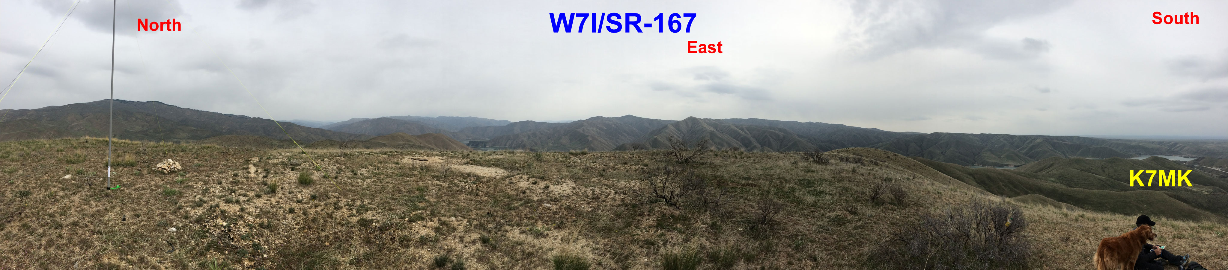
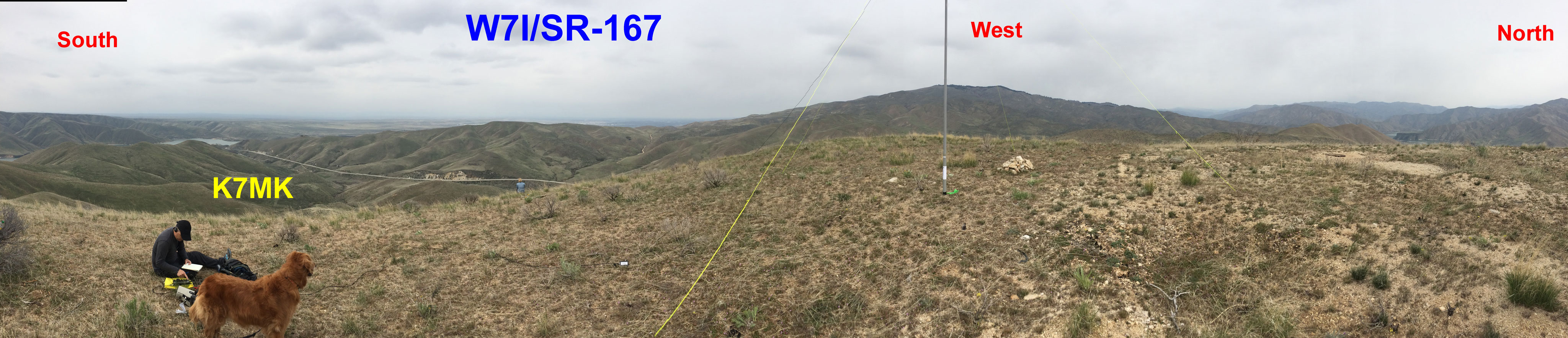
As K7ATN said there are great views from the top. Right after we got there a Golden Eagle sailed by at eye level! There really is not any vegetation on the summit proper. The one sagebrush as in K7ATN's photo is still there but does not look very healthy. I would not count on it to hold any antenna.
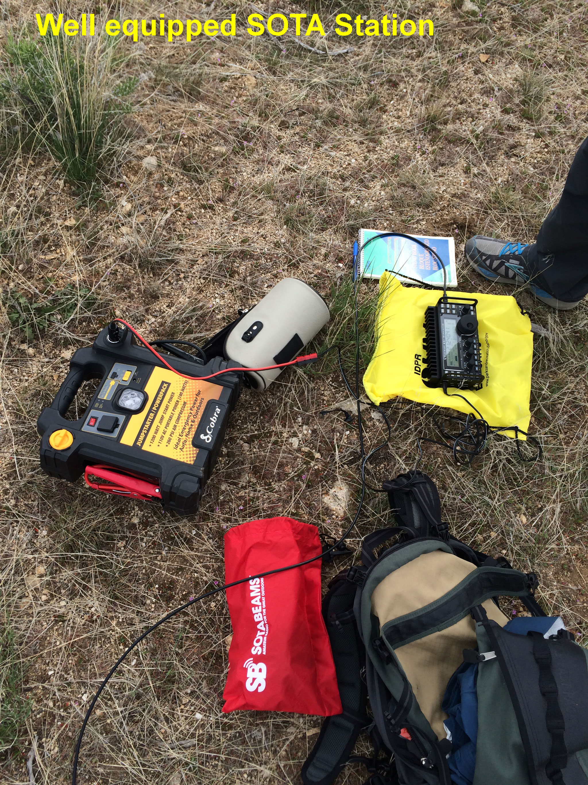
K7MK did all the operating. We used his SOTApole with an end fed antenna in a semi vertical configuration and his Elecraft KX3. To power the KX3 we ended up using a 12V Automobile Jumpstarter Powerpack that I hauled up to the summit. Since it had been my job to track down a light weight 12V battery, a task I did not accomplish, I volunteered to haul this thing up to the summit. It didn't seem so heavy at the car but as we got closer to the summit it put on weight. Jim made 14 QSOs, SSB only as we don't have our CW keyer system put together yet. Most of the QSOs were on 20M with one on 17M and a few on 15M. The 17M and 15M QSOs were the first ever from this summit. Also since we had great 4G access on the summit I fed Jim the frequencies of other active summits and he did make two Summit-to-Summit QSOs. One in California and one in New Mexico.
Videos of K7MK operating can be seen at: https://vimeo.com/124117234 and https://vimeo.com/124117235
Not a bad first activation! We have our next summits scoped out. Just need to wait for the roads to open and more snow to melt.