K7MK and I headed out late in the morning on July 24 to accomplish a double -- Boise Peak - W7I/BC-079 and this summit 6624 - W7I/BC-077. We were thwarted on our access to Boise Peak by an impassible section of road. See a separate activation report on Boise Peak for that story. This wasted well over an hour of time as we drove up the road to Boise Peak and then came back down again. If there was one silver lining is this cloud is that during the round trip we noticed that K7MK's APRS system was not working. We highly suspected that BC-077 would be without cell phone coverage so we needed APRS2SOTA for spotting. Some moderately quick jury rigging by K7ZO got his APRS system working and off we went to this peak.
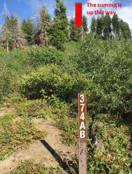
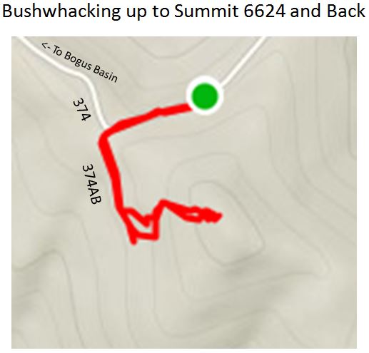
Access to BC-077 is very straightforward from Boise. Take the road of up to the Bogus Basin ski area, head around to "The Back side", and get on the dirt road at the Cross Country ski building. Continue on this road, which is marked at Forest Service road 297, until you reach the turnoff to the Shafer Butte/Mores Mountain Picnic Area. Keep going straight on what is now marked as Forest Service road 374. Stay on the pretty good dirt road for a little less than 5 miles more and it will bring you around on the north side of the summit. Look for where Forest Service road 374AB cuts off to the south. The summit is southeast of this junction. Find a wide spot on the road somewhere around here to park.
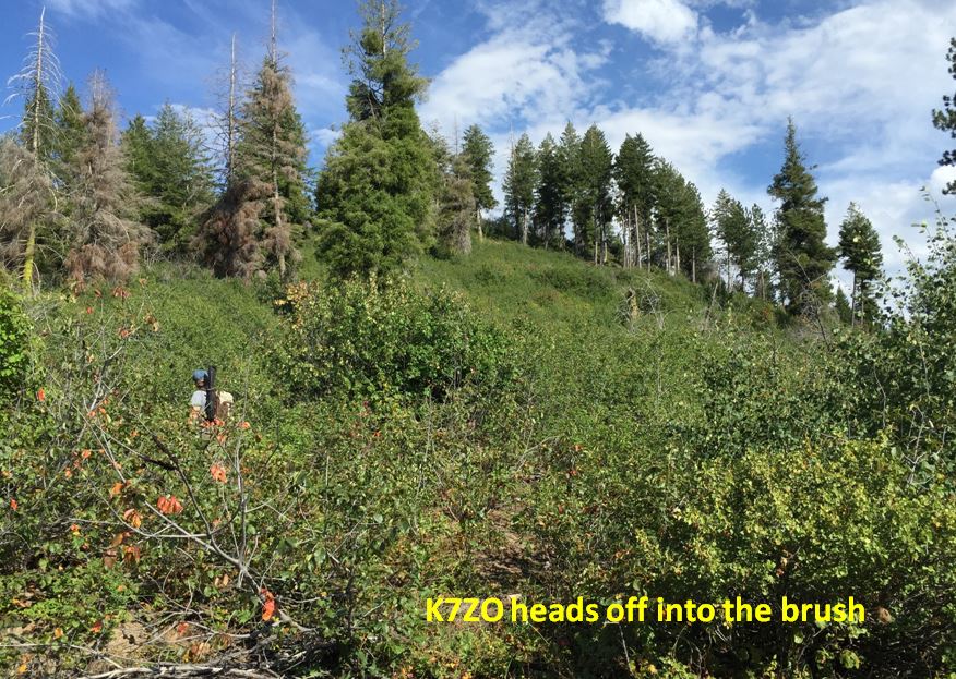
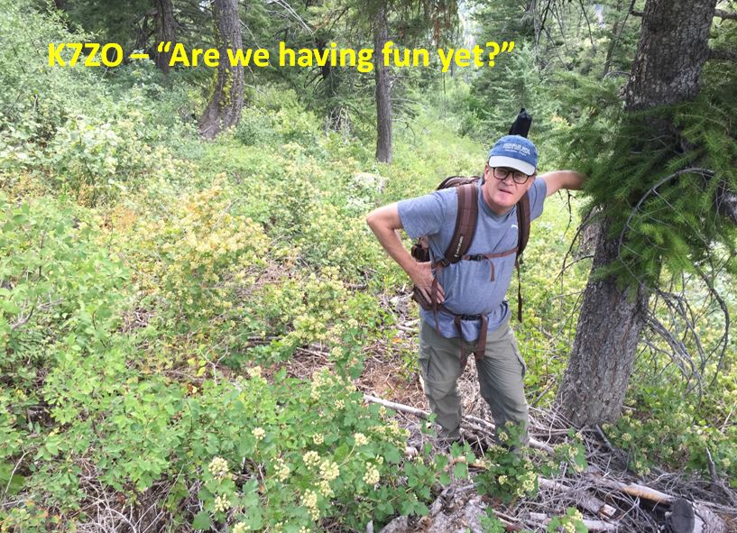
There is no trail to this summit so you get to pick your route through the brush. We hiked a hundred yards or so down 374AB and then headed on up. It was pretty much bushwhacking the whole way up except where we walked through areas that firewood cutters had cleared or where elk had created vague game trails. Finding your way to the summit is really easy. Just keep heading up hill and you will get there. Luckily the total climb is only a little over 200 feet and when you reach the summit there are a few rock outcroppings indicating you have arrived. By this time it was about 4:45PM and we knew the day was getting long.
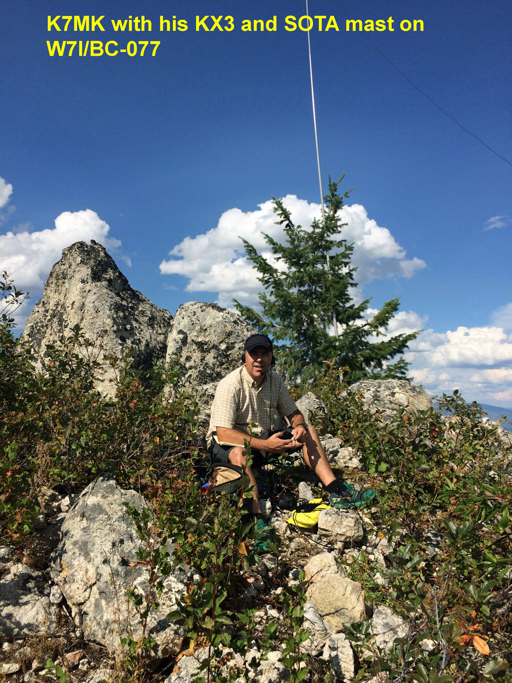
K7ZO had hauled his SOTAbeam dipole up with him and really wanted to give it a try. However the amount of brush in the activation area meant it would have been a study in frustration as all the wires and strings would get tangled around every twig and branch. So we went with K7MK's KX3 Helper End Fed antenna attached to his SOTAbeam travel mast. We did use K7ZO's TS-480 running at 50 watts for a little more power than our usual 10-12 watts from K7MK's KX3.
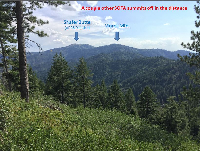
As expected we had no cell phone service at the summit so we used APRS to spot ourselves. The nearest digipeater site was visible by line of sight 4 miles away on Shafer Butte so we had no trouble. A APRS2SOTA spot went out and we called CQ on 20M for what seemed like forever until finally N4EX showed up and K7ZO worked him. Our plan was for both of us to work all callers but he disappeared before I could hand the mic to K7MK. We did each manage to work the next 5 to make it a valid activation for both of us. But, a good lesson learned was "Don't start activations too late on weekday nights". We missed many of the regulars including Gary and Martha.
After working out 20M we tried 40M and 17M with no success. After 30 minutes on the summit we packed up and headed back down. At least we didn't get skunked for the day and felt good we had a valid activation. However our mutual conclusion is this summit, though easy to get to, is pretty unremarkable and is not likely to be on our list to return to in future years.
Scott/K7ZO for K7MK and I -- the Idaho Kool Aid Kids
The current standings for our 2015 Idaho Kool Aid Kids Challenge are as follows:
Call Total
QSOs
W7RV 12
N4EX 8
W0MNA 7
W0ERI 7
N6KZ 5
K4MF 5
WA2USA 4
NS7P 4
NE4TN 4
N7AMA 4
AA7DK 4