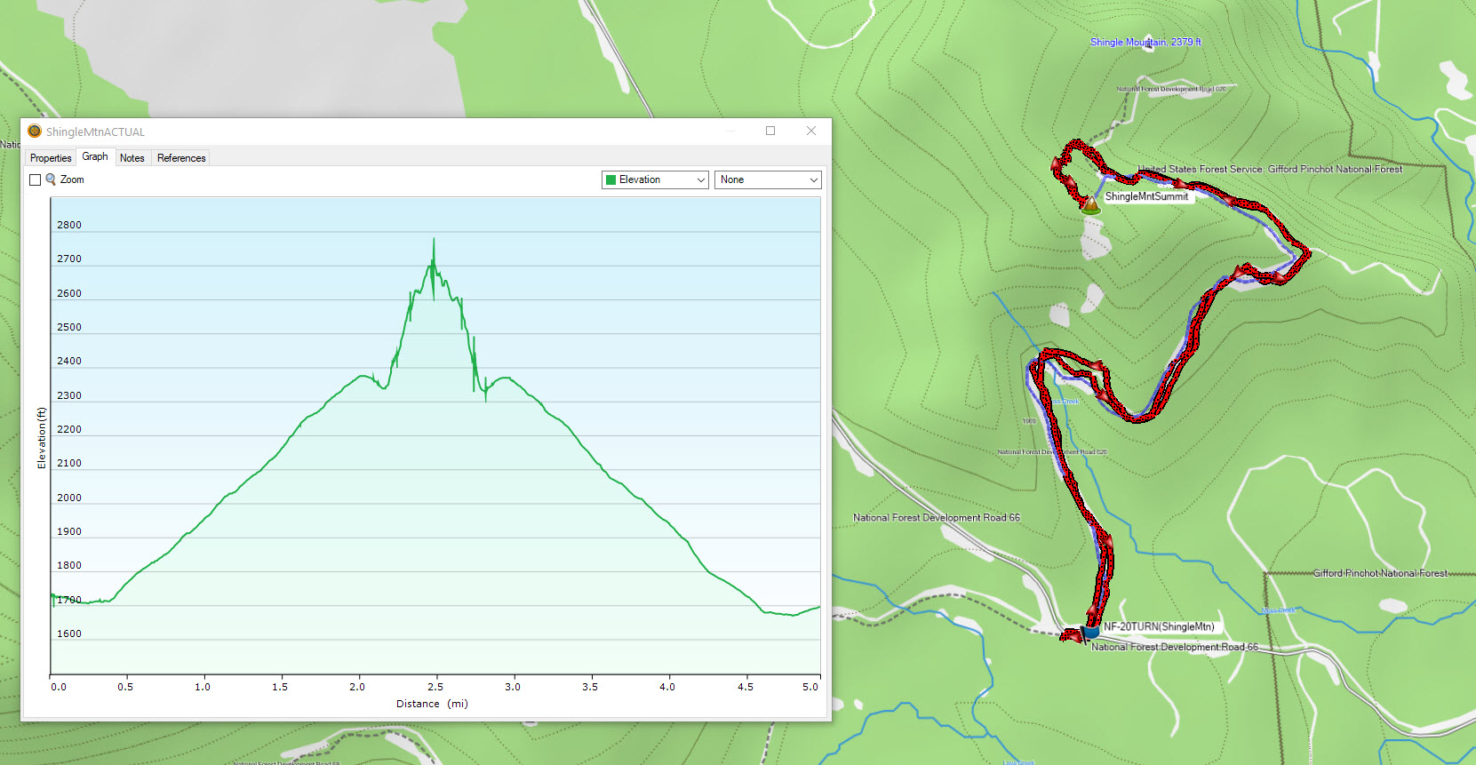
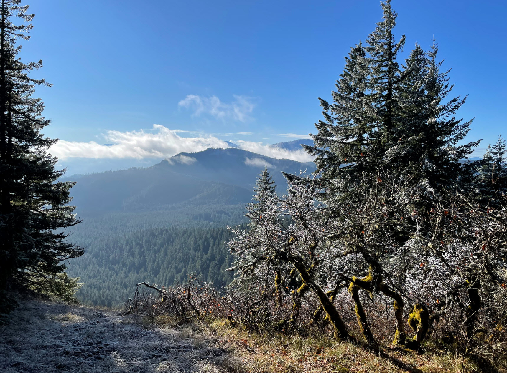
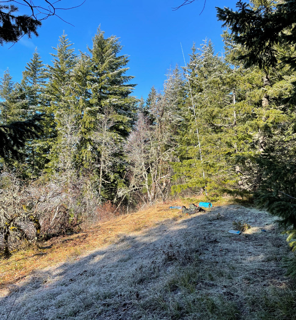
Shingle Mountain summit is a 5-mile out and back hike located Northeast of Dog Mountain and Augspurger Mountain north of the Columbia River accessed from a national forest road just before reaching the Moss Creek Campground. I marked both “Easy Trail” and “Treacherous Trial” above because like many SOTA summits, you get both on this one. You are rewarded at the top with a very pleasant activation area with a clearing at the summit and a view south.
To get to the trailhead from Portland cross over to Hwy 14 at Bridge of the Gods (toll) and go east on Hwy 14. Go past the Dog Mountain Trailhead and then turn left on Cook Underwood road. This merges into Willard Road then Oklahoma road. I put in “Moss Creek Campground” in Google Maps and used the routing from that. But before you get to the campground, turn left onto NF-066 near 45.78861, -121.63399. Go West on NF-066 to near 45.79539, -121.66763 which is where the unsigned NF-020 road is located. There is a small parking area just a few hundred feet past this point with room for 4-6 cars.
NF-020 is drivable. There are not many potholes, but it is encroached with fir and deciduous tree branches from the sides and top that will no doubt scratch your paint. I chose to hike NF-020, but if you drive up, there is a flat spot to park about ¼ from the summit exit point off of NF-020.
So that is the “Easy Trail” part.
The final bit to the summit is a difficult, but doable bushwhack. The forest has been thinned here, but there is a lot of blowdown requiring stepping over branches and navigating downed trees. I did the trek in winter, with no snow and there was a nice layer of leaves giving solid footing. I chose to exit NF-020 near 45.81037, -121.66800 where there was a drainage that looked like it had less blowdown and was less steep than other places. It is less than ½ mile and only ~350 feet of vertical, but it felt like more due to the challenging conditions.
I followed the draw upwards, then followed the ridgeline east to the summit clearing. Note that the SOTA summit is NOT the summit shown on Topo Maps! I was able to get S2S contacts to Larch Mountain and Three Corner rock with 5W FM on an HT. On HF SSB phone I got 5x9 reports on 40M south to AZ & CA, and on 20M was getting to Virginia. I had decent cell service from the top (ATT) and was getting SMS out and SOTA Goat alerts no problem. Since this location is within the Gifford Pinchot National Forest, you need a NW Forest Pass for parking, also used this activation for US-4529 for POTA.