UPDATE Jan 2023 - Beacon Rock Trail is closed. You might find status here:
https://www.parks.wa.gov/AlertCenter.aspx?AID=3530&fbclid=IwAR16QwFmuw_…
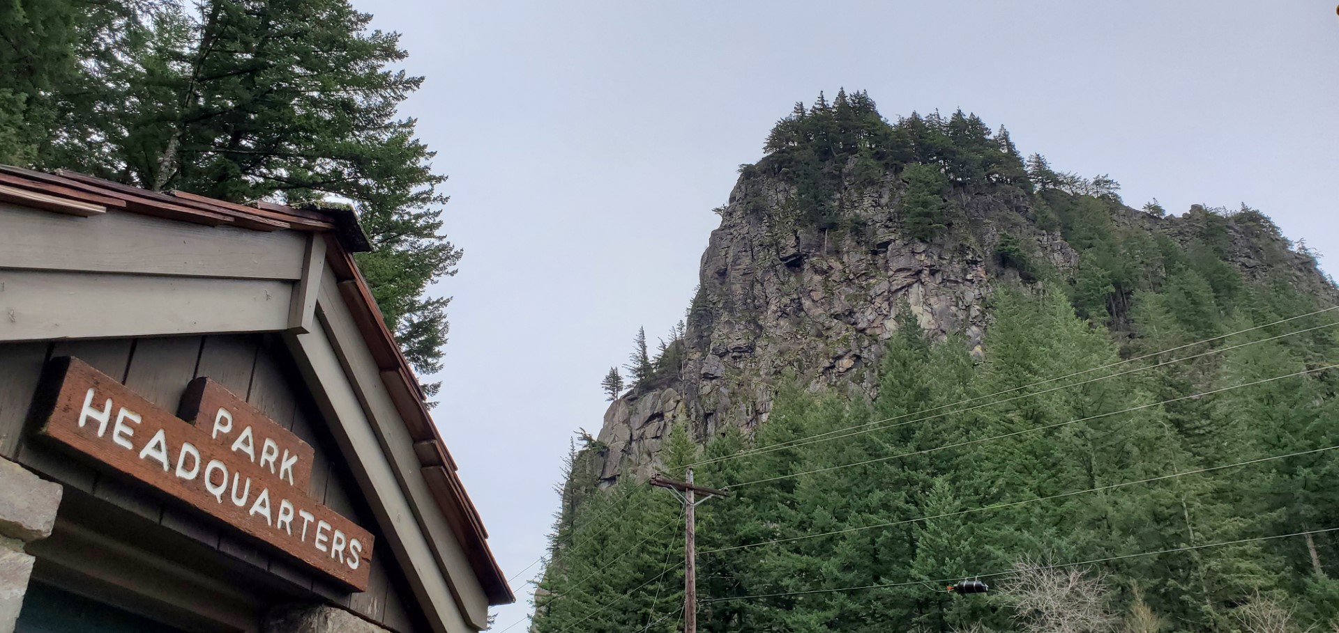
It was a nippy but dry day when KJ7UIZ and I headed out to activate several summits along the Washington side of the Columbia Gorge. We arrived at Beacon Rock State Park. It has two parking areas along Hwy 14, one across the road from the park service office, and one just to the east that flanks the rock climbing walls and has a restroom. Bring your hand warmers, as the water is COOOOOLD!!!
Parking pass (single day) is available at the eastern lot or purchase the yearly Discover Pass. The trailhead is roughly right in-between the two parking lots.
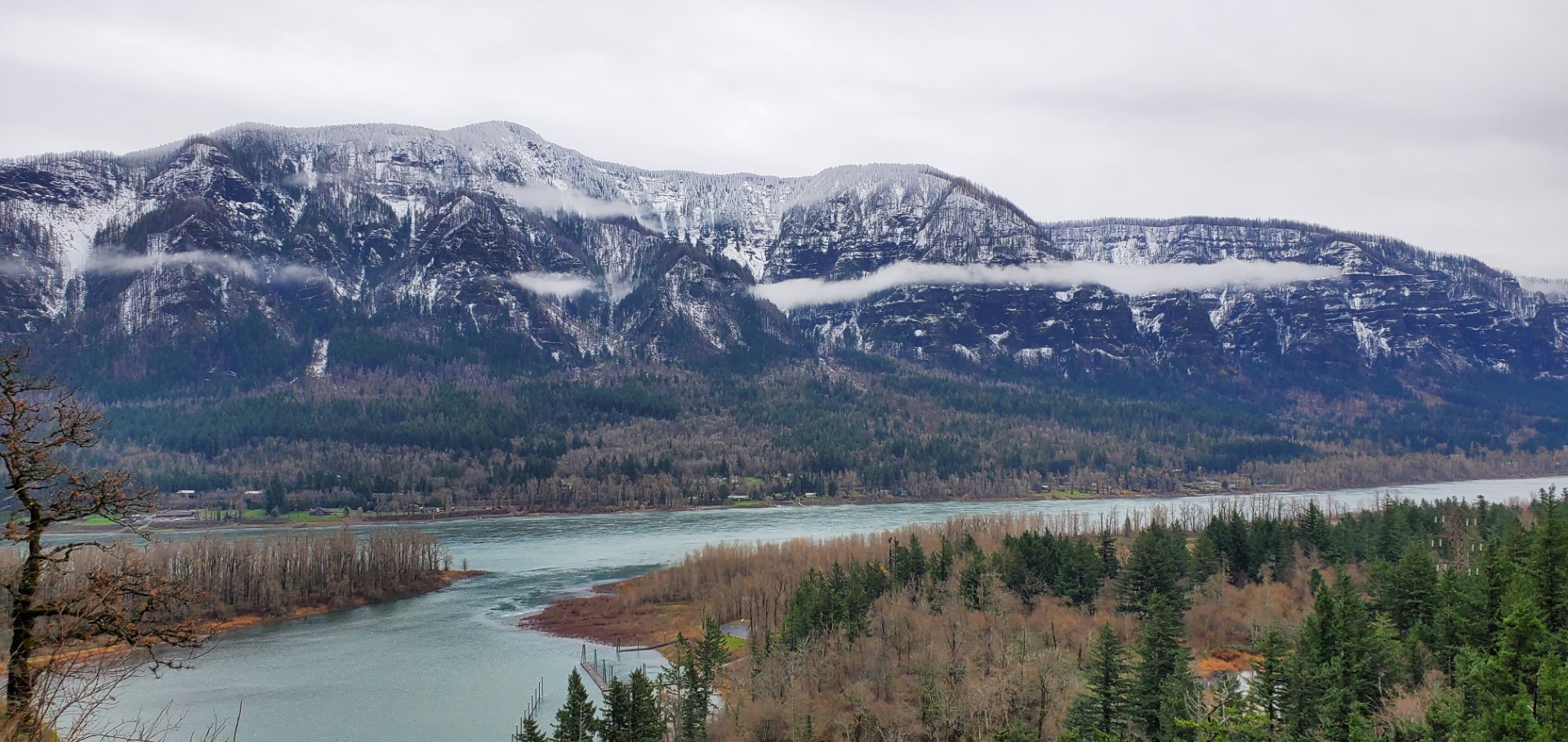
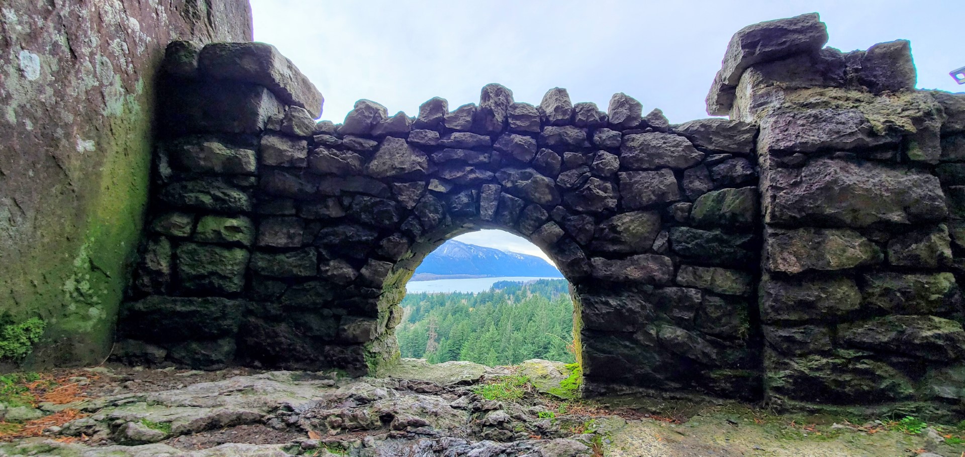
This has a very gentle trail with about 24-27 switchbacks, depending on whom you're arguing with, to the summit. It took us around 45 min to get to the summit, and some of the path is wet/slippery for the wrong kinds of shoes, or boots. There are places where some might consider the trail exposed, but there's a guard rail all the way up and even at the summit. Views are mostly on the way up including a really cool small archway.
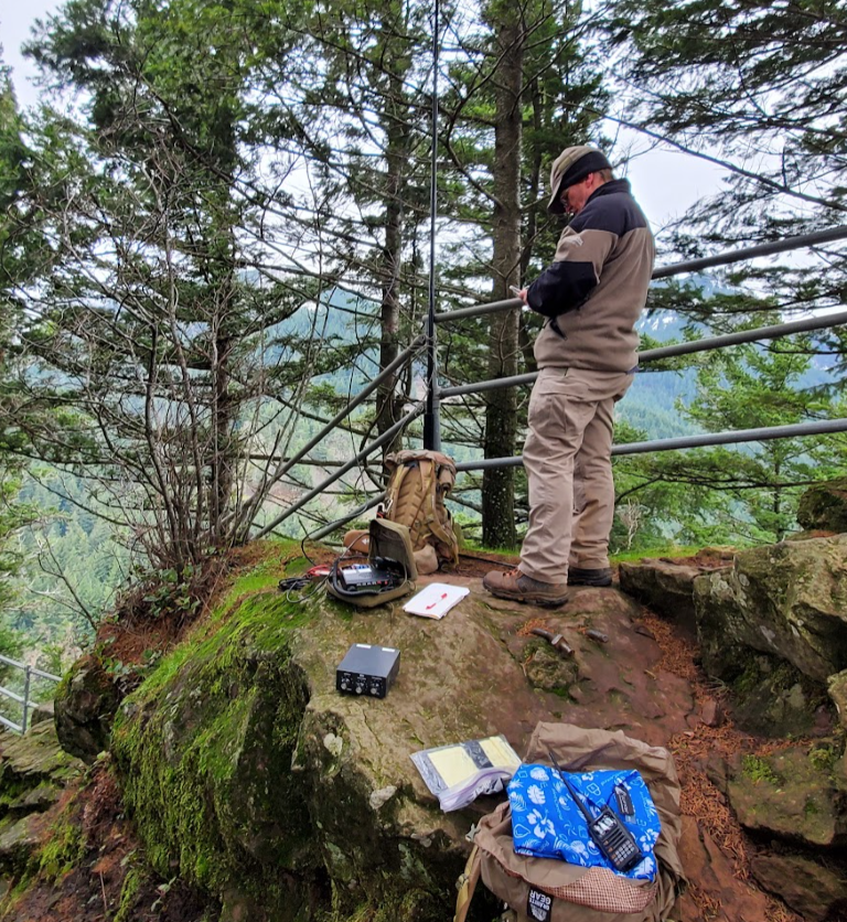
The top was quite windy, but we found a very decent spot just a few steps down from the summit. We used a j-pole on a fiberglass mast and obtained sufficient QSOs within a few minutes. The 20m end-fed had more difficulties finding a good attachment point due to length, and since it was nippy, we moved on to Larch Mountain (W7O/WV-062, Oregon one).
This summit paired nicely with either Prune Hill (W7W/LC-164) on the way there from Portland and during non-snowy times, Larch Mountain (W7O/WV-062) after crossing the Bridge of the Gods.
SOTAdata log: https://www.sotadata.org.uk/en/log/activator/show/588047