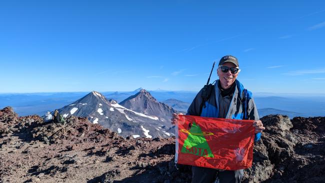
Bill K7WXW is an early riser, and I was stoked to find someone keen to get up South Sister for a sunrise activation. We set out from the trailhead in the dark at 2:12am PST. Bill had an issue with his headlamp battery. Luckily, I had a spare headlamp to loan him. With that sorted, we hit the trail.
The initial approach of south sister requires climbing from Devils Lake to the volcanic moraine terrain of the Three Sisters Wilderness. The 1.8miles and ~1400’ of hiking we knocked out in under an hour. We bobbed along the moraine until the real hiking started at about 3.5mi in and 7000’ elevation.
In the dark the trail steepened and slowly transitioned from the packed sand of the moraine to a sand and scree combo. Yum. With steeper terrain the trail devolves into a braided “choose your own adventure” style. In the dark it was difficult to tell the best path. I tried to take us up whatever path looked easiest in the moment. Hard to tell in the dark and the only option is really “up”.
At 4am we made it to a saddle that overlooks a tarn. Of course, we couldn’t see the tarn, but it was strange to hear water flowing at 8,900’. We stopped here for a final breakfast before the steep push to the crater rim. Good view of the Milky Way and I saw some shooting stars.
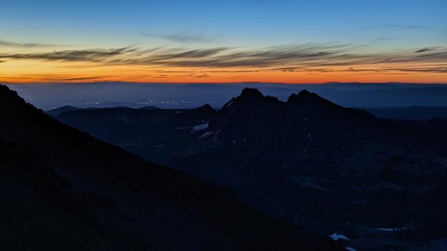
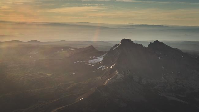
We started up again and the trail became that two-steps-forward-one-step-back footing of loose rhyolitic scoria and sand. This trail made us work for the summit. As we made our way up the sun gave us some alpenglow views.
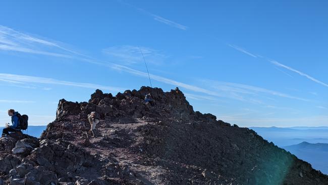
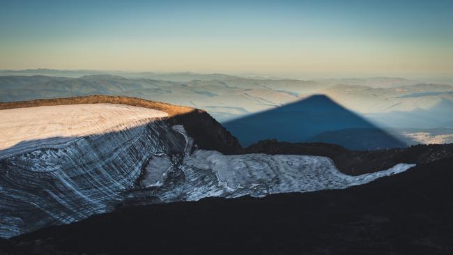
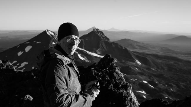
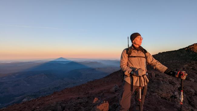
We hit the crater rim (10,200’) moments after sunrise and stopped to take in the view. This is the highest Bill had been up in a while. The shadow of the mountain was really showing itself off. After some photos we made our way along the bowl of the crater and scrambled up to the true summit (10,300’). There was some sort of chipmunk hanging out up there. Must be living off the crumbs of clifbars dropped by hikers.
I had been on South Sister twice before for sunrise and both times the wind howled, and temps were very cold. This day Bill and I were gifted with a still mountain. Hardly a breeze the whole time we were up there. This made for excellent conditions to enjoy the view AND play radio.
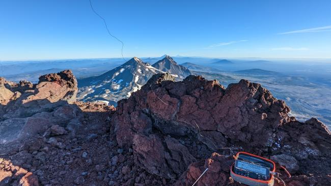
The previous day had been the central Oregon S2S party and a smattering of SOTA folks were still in the area including K7FOP & K7ATN on Pine Benchmark (W7O/CE-068). Bill and I got plenty of 2m contacts to activate. Bill set up his HF station on the true summit and I moved farther down to the North to set up. We were both using End Fed Random Wires with our KX2s and this combo worked great for a joint activation. At 5 watts, with enough distance between us, and us working different bands we managed zero interference with each other. Perhaps a testament to the filters on the KX2.
I started on 20m and logged 15 QSOs including an S2S with KC1MXB on W1/AM-285 (2500mi), and two Japan stations. Bill switched from 40 to 30m and I jumped over to 40m for 11 more QSOs (6 on cw, 5 on ssb) including S2S with K6ARK on W6/CT-157 (800mi) and an SSB S2S with N3BZ on W7A/AP-006 (950mi). Bill moved to 20m and I jumped on 30m. I got 5 more QSOs before things dried up. Apparently a solar flare hit and blacked out radio across North America shortly after we wrapped up.
I got back on 2m FM before packing up and managed 110mi QSO with NR7Y and K7AHR back near my QTH of Beaverton, OR. I also got an 80mi QSO with NS7P, who I’d previously had a 40m SSB QSO with! Fun to get different bands and modes like that!
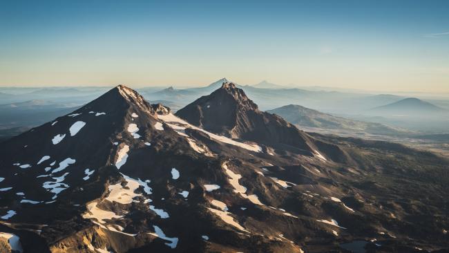
Bill and I packed up and started making our way down the mountain—this time in the light! The trail down the mountain is just as difficult to hike down. The pebbles and boulders of scoria easily slide on the sand and rock below and footing can rush out beneath you. Despite this, we enjoyed the views of the mountain features we missed on the way up. A conga line of hikers were on their way up and we almost ran out of breath saying hello and words of encouragement to everyone we passed.
The total elevation gain of this hike close to 5000’ on a round trip of 12 miles. The descent was hot, dusty, and a bit of a slog to get back to the car. I highly recommend doing this mountain in the early morning as the lower elevations heat up quickly. We were back at the car just before noon.
Bill says this is the hardest thing he’s ever done. He also told me that he once hiked for something like 18 days straight in Nepal in the same t-shirt and yoga pants. That sounds way worse to me, but in either case Bill should probably be regarded as some sort of authority on discomfort.
All in all we lucked out with great weather that let us play radio from high up for nearly 2 hours. I racked up 44 QSOs across 2m/20m/30m/40m. I look forward to seeing Bill’s log when he is home and uploads it. Thanks for all the QSOs!


