Access: Since SR26 is closed from the north due to a washout, you must come in on SR26 from the south. Take SR25 south out of Randle then SR99 west towards Windy Ridge. At approx 11 mi in, take SR26 north for about 1 mi to the Norway Pass TH parking area. Restrooms are available.
Note: The Independance Ridge trail is closed due to a washout.
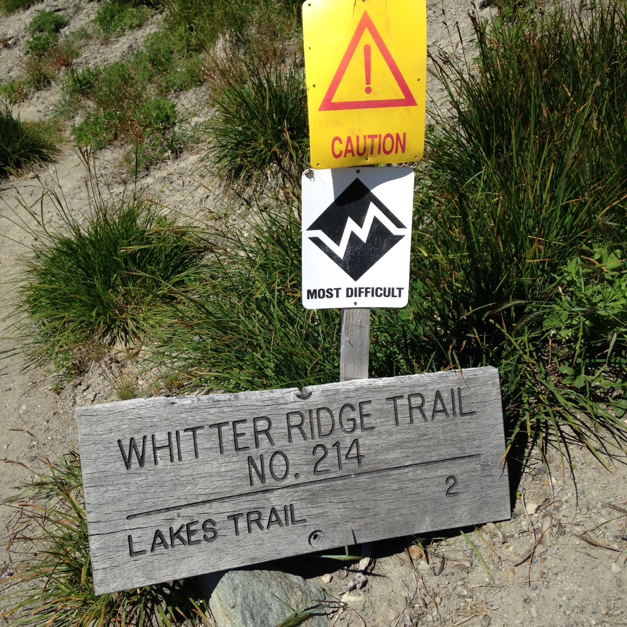
Hike: Hike 2-1/4 miles on the good trail to Norway Pass, a very popular scenic area of Spirit Lake and Mt St Helens. Continue on the Boundary Trail for another 3 miles to the trail intersection with Mt Margaret and the Mt Whittier trail. The Boundary Trail is a south-facing so it can get hot in the summer.
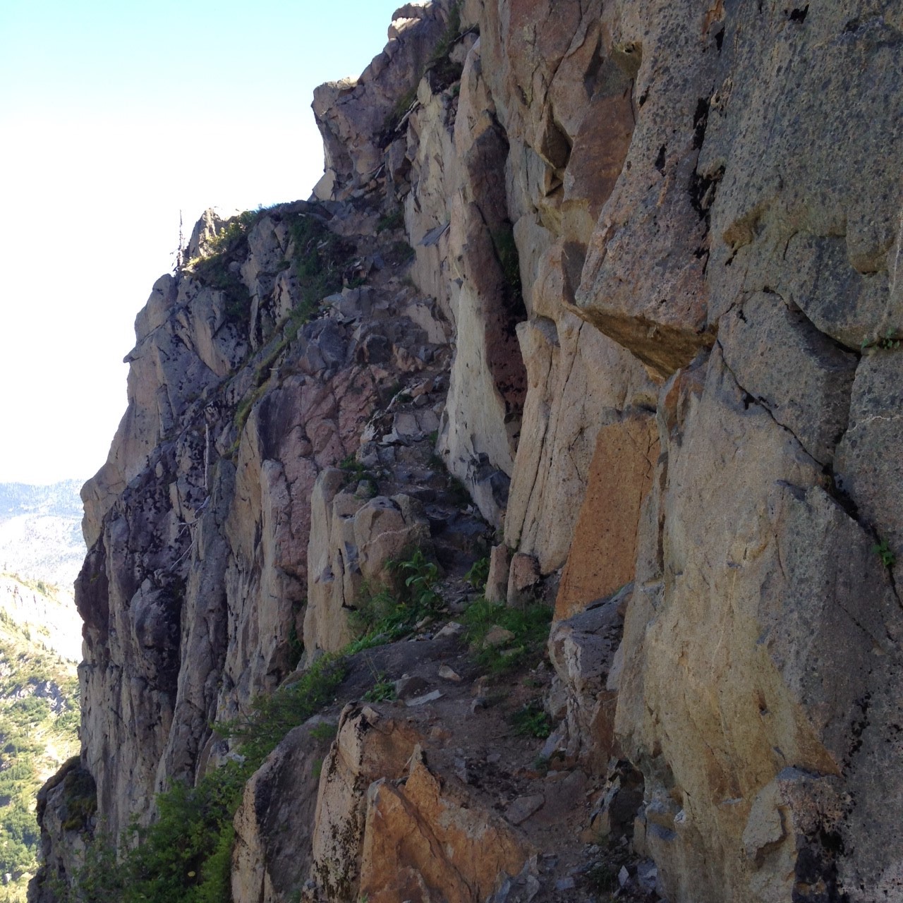
Warning: Note the FS signage for the Mt Whittier trail. First time I've ever seen "hazardous" and difficult markers for a trail! This trail is part of the Whittier Ridge hike...many very exposed areas and some class 3+ bouldering. Lots of ledge hiking with significant (300+ feet of vertical fall...) exposure. You must be comfortable with this type of climbing.
After the first 1/2 mi it is all bouldering and ledge crawling for the next 1/2 mi to the summit. Not much room up top. I activated just below the rock pinnacle.
Great views to the south of St Helens and Mt Margaret and east to Mt Adams from the rocky outcropings at the top. I had no cell coverage but was getting APRS pings. I think you could SOTA-spot via APRS.
Would I go back to this summit? No. The risk/reward isn't worth it for me. Too much climbing exposure!