Let's just get this out of the way. Schreiner Peak is a beast. On the web you
can read many accounts of how difficult reaching this peak is. They're true.
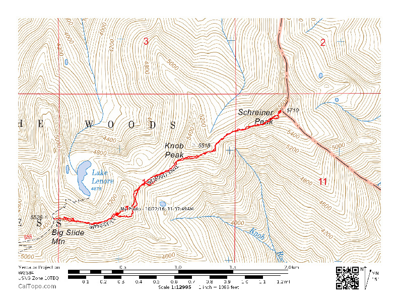
Getting to the trailhead for Schreiner Peak is straight forward. I suggest you
follow Etienne's (K7ATN) excellent directions to reach the Pansy Mountain
trailhead. Specifically, you need to get to the Pansy Lake Trail #551.
Hike up the Pansy Lake Trail. You will pass trail #550 on the left. After Pansy
Lake ascend steeply to a saddle where trail #558 heads east. Its 1.5 miles to
this junction.
Go east 1.1 miles on trail #558 towards Bull of the Woods (W7O/WV-009). At a
slight saddle, there is an unmarked trail that heads back west towards Bull
of the Woods. Instead, continue on another 0.2 miles to the intersection with
trail #555. Take #555 steeply downhill for 0.6 miles following numerous
switchbacks.
At the next fork continue east on trail #555 encountering a brief level section.
Continue 1.0 miles on #555 gradually ascending Big Slide Mountain to a saddle
between the two peaks of Big Slide Mountain. From here the trail goes down to
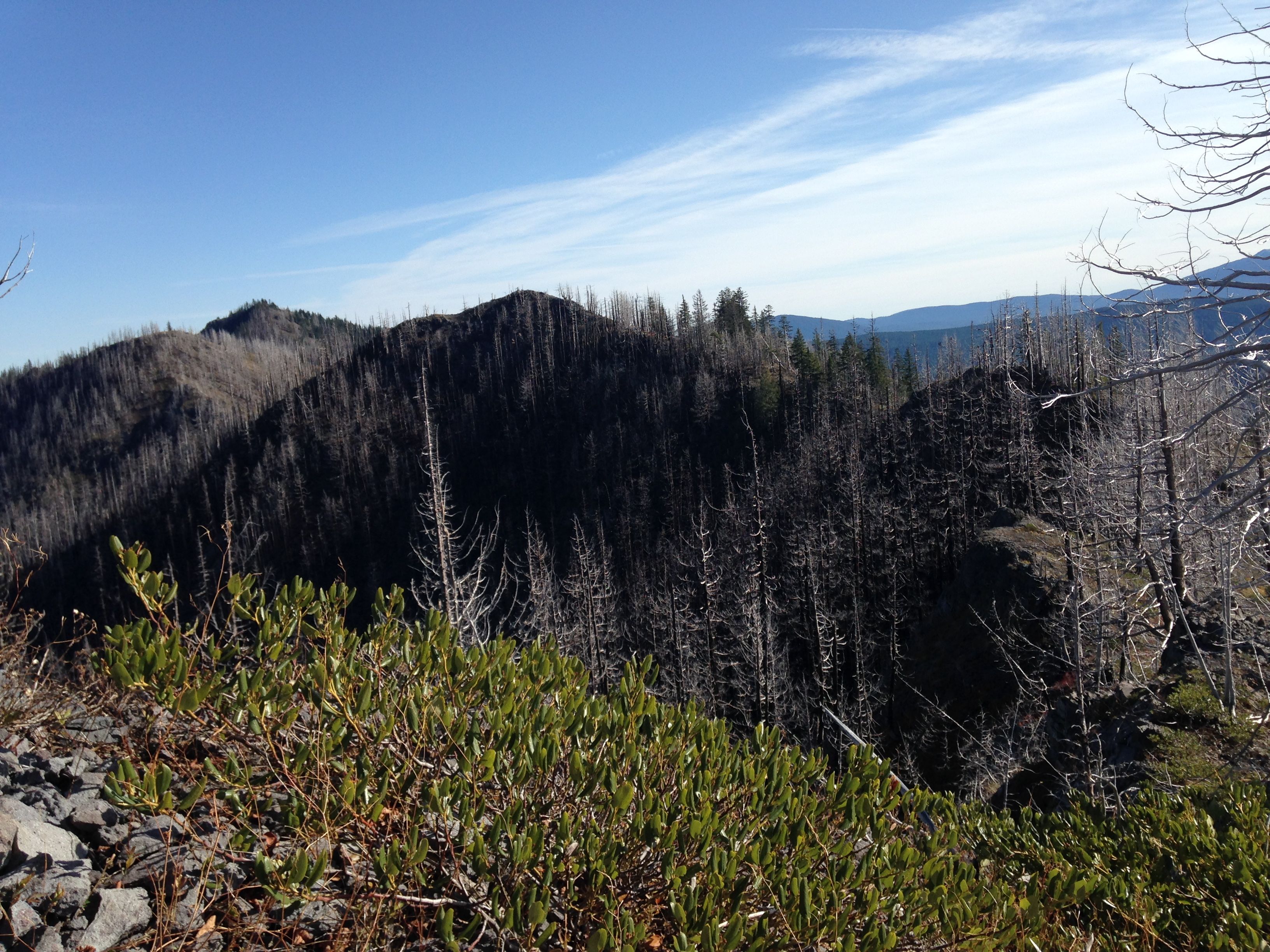
Lake Lenore. Lake Lenore looked like a beautiful lake before this area burned.
On this trip, the lake looked brown from runoff, surrounded by black, burned
trees. So sad.
Here, you leave the trail for a 1.5 mile cross country trek towards Schreiner
Peak. There is a slight trail heading west from this point, but it ends quickly.
From here to Schreiner, the going is rough. You should have a good map, a GPS
and/or compass and plenty of time. Not counting the lesser peak of Big Slide,
there are two peaks to skirt on your way to Schreiner Peak.
From the saddle I went nearly directly over the lesser peak of Big Slide and
then followed the ridgeline towards the unnamed peak. In this burned out area,
its best to stay on or near the ridgeline where possible. This avoids many of
the downed trees and very steep slopes.
I skirted the unnamed 5440 foot peak by ascending to about 5280ft on the south
side then holding that elevation till descending sharply to the next saddle.
This is a very steep area with slopes I would estimate at 45 to 60 degrees.
There are endless large downed trees and limbs from the burned forest. Staying
near the ridgeline also helps by keeping you off the steeply sloped terrain.
Moving past the unnamed peak continue on towards Knob Peak. I ascended Knob
Peak to about the 5260ft level and then held that elevation to the saddle
following. There is a bit of an open area around the shoulder of Knob Peak
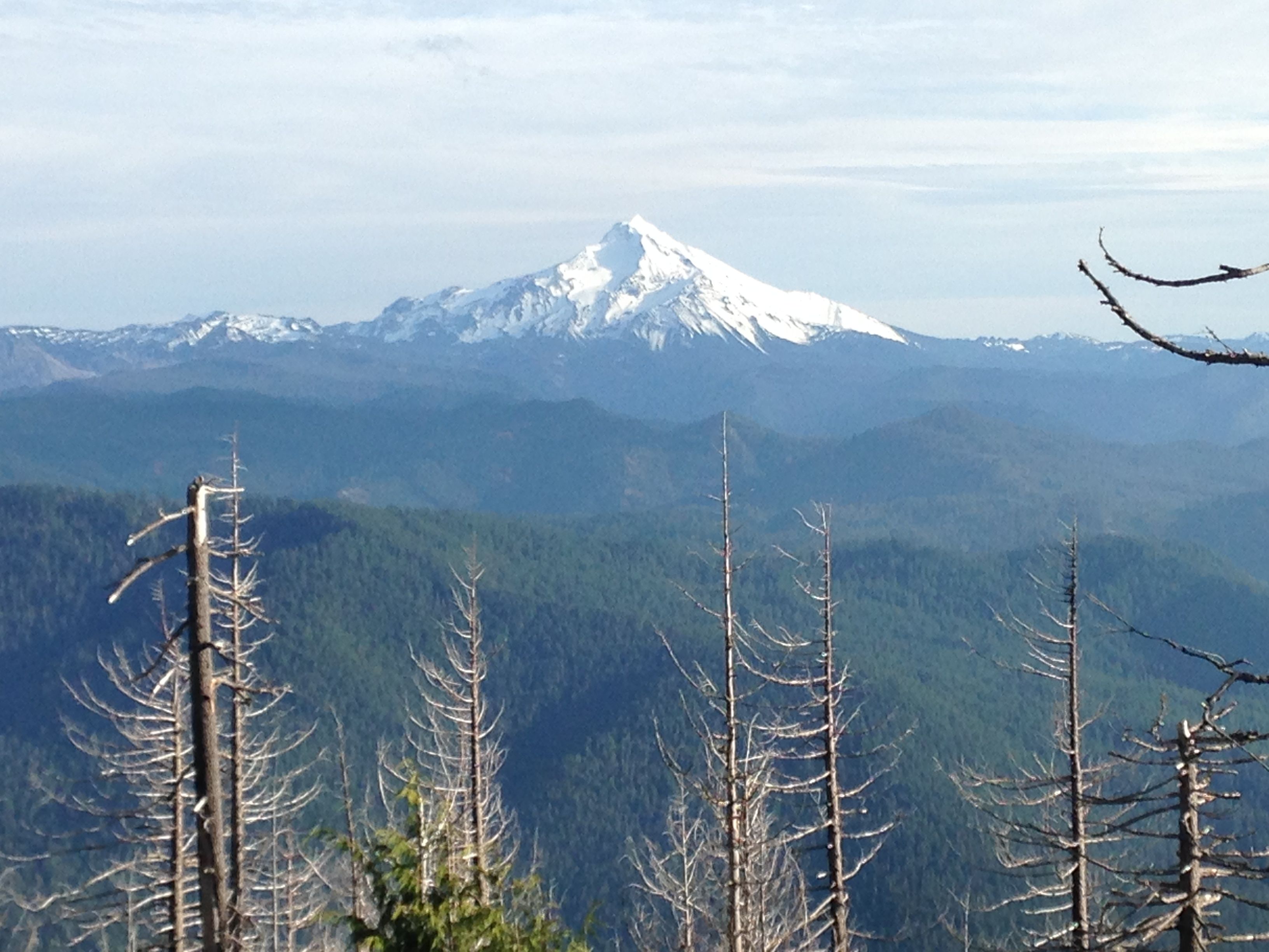
where you get a clear glimpse of Schreiner Peak.
After passing through the saddle between Knob and Schreiner Peak, ascend
directly up Schreiner Peak. This is the easiest walking of the cross country
jaunt. Ascend the western shoulder till reaching the summit.
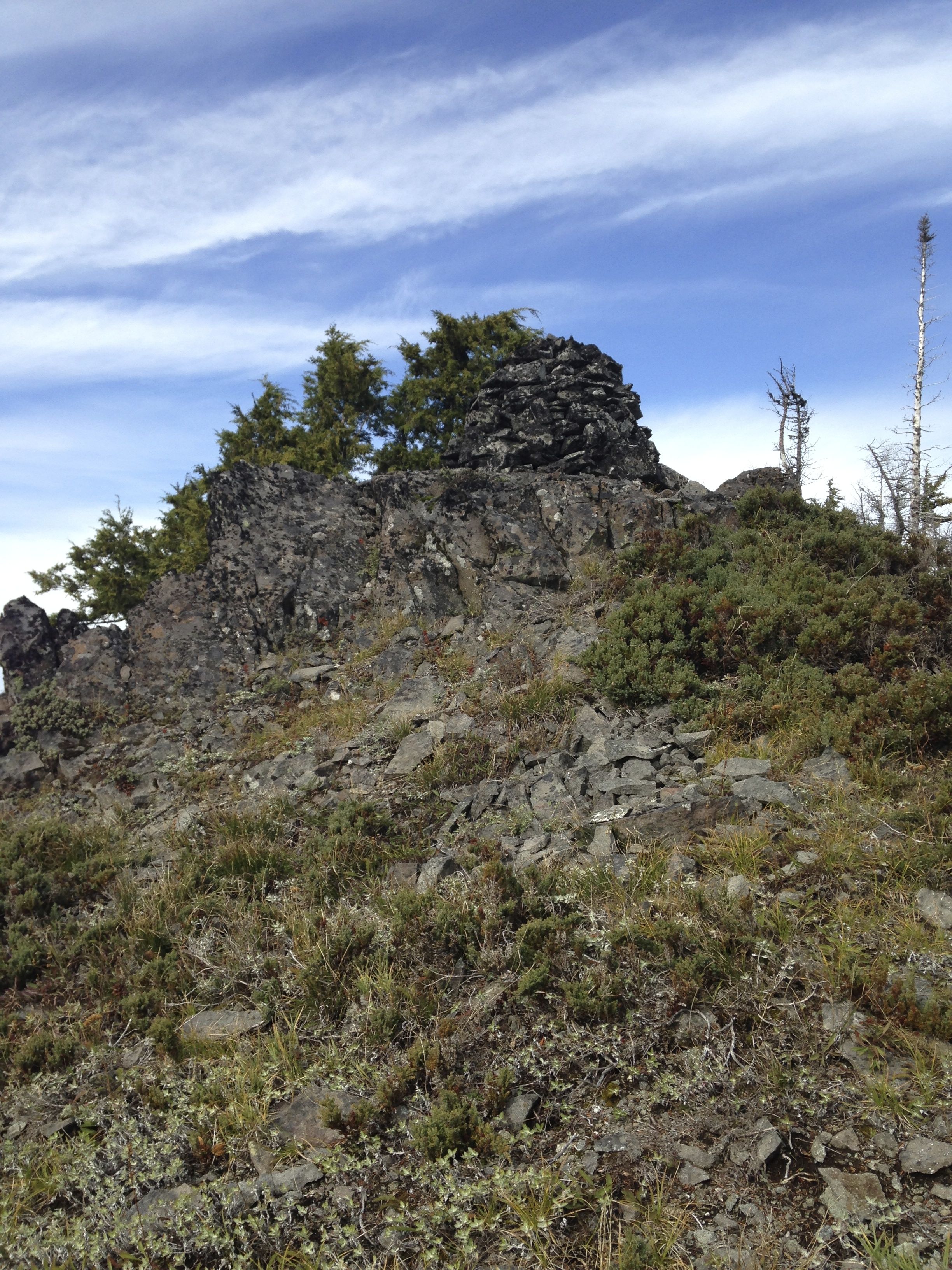
The peak of Schreiner is fairly open. There is a large cairn here with a glass
jar inside with a summit log. There are a few trees that could work for a dipole
but I used the cairn to hold my SOTA pole. I dropped it down into the cairn and
lodged it in place with a couple of rocks. I was dead beat from the climb and
left my outer shell sitting on the summit rocks.
The activation went well although the wind began to pick up. Taking the antenna
back down, the wind became so strong I had to bend the pole over, stringing
the EFHW wire behind me where my equipment was still just sitting on the rocks.
Once the last section of the antenna came down, I noticed the wire was not there.
I looked everywhere and it was missing. Then I noticed my Arcteryx rain jacket was
gone also. Just gone. A 20 meter string and a $300 kite. They apparently flew off
the cliff off the northwest side of the peak. I was quite upset. Couldn't see
the coat anywhere.
I knew better than to just drop my stuff down on the ground. I remember telling my
son Andrew about not putting equipment down on snow one winter climb. He thought
better till his helmet went on a sledding trip. I should have listened to my own
advice. When you get tired, really tired, you tend to cut corners. This was an
expensive corner.
I headed back attempting to backtrack except where I had taken a few poor dead
ends. It seemed to take forever to get back to the trail. I had hoped to activate
another peak that day but there was no way. I worked my way back down to the
trailhead arriving after walking about an hour and a half with headlamp.
This trip was twelve hours, car-to-car, including activation time. It took just
over five hours from leaving the trail to when I got back to it. The cross country
part was 3.52 miles round trip over which I averaged only 0.7 mph. Its roughly 4.5
miles from the trailhead to the point where I left the trail. So it was a 12 hour,
12 mile day. All for four points. In Oregon, we earn our points.
This was certainly an epic trip. It was expensive in a number of ways. If any
one sees a bright orange Arcteryx Beta LT raincoat up there, let me know. My
adventure tank is full for some time to come.