Cruising through Chemult Oregon at 6:40am, the dashboard said the outside temperature
was 29 degrees. This was far cooler than we anticipated for our attempt on Mt. Thielsen.
A few years ago, my son Andrew and I tried this summit but were driven off by mosquitoes
and our lack of DEET. I actually inhaled two of the beasts and slapped my glasses off my
face several times before we literally ran back to the safety of our car. The Diamond Lake
area is legendary for mosquitoes.
This morning was different. It was a brisk 36 degrees at the Mt. Thielsen trailhead. Seeing
no mosquitoes, we suspected they couldn't fly in down coats. However, we put ours on immediately.
We didn't see a mosquito all day. The sky was painted a beautiful blue, and there was little
wind. A blessed day to play in the mountains.
The Mt. Thielsen trailhead is located directly off of Oregon Highway 138 just north of its
junction with Oregon highway 230, about 22 miles west of US Hwy 97.
The trailhead for Mt. Thielsen is well marked and there are many Internet sources that can
help you get to the summit. We took the standard West Ridge approach. The trail is well graded
and wide. We walked up the Mt. Thielsen trail about 3.2 miles to where it crosses the PCT.
Along the way we were accosted by a group of Clark's Nutcrackers. These are very raucous birds
that remind you of a Stellar Jay. It has a narrow long beak that is perfectly suited to getting
the seeds in the cone of the white bark pine common to the area. The pines are vitally dependent
on the Nutcrackers for scattering seeds.
After the Mt. Thielsen trail crosses the PCT, you begin ascending a steep ridge towards the
summit. The trail splinters into many different routes but there is a pretty good serpentine
trail that is easy to follow for a while. Before too long however it also splinters into many
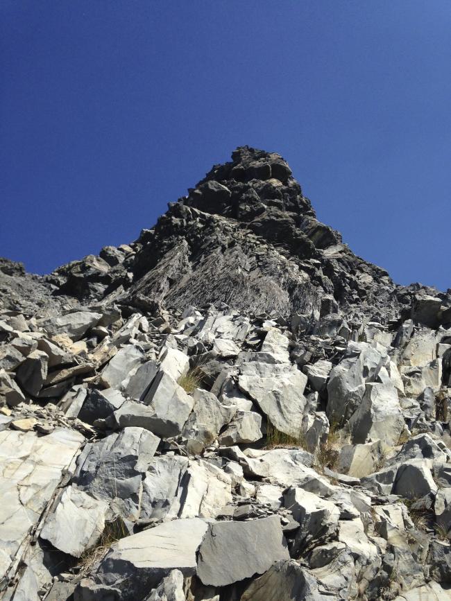
different possible routes among scree and talus. The toughest part is where the trail crosses
the southern shoulder of Thielsen. From this point to "Chicken Ledge", the terrain gets
increasingly steeper with loose rocks of every size, shape and of questionable stability.
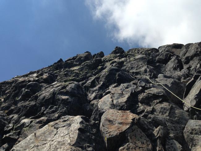
"Chicken Ledge" is about 80 feet below the top of the summit pinnacle. The pinnacle is fortunately
the best rock on the mountain. The climb from chicken ledge to the top would rate about a 5.3,
an easy climb. The only catch is the exposure. But if you are paying attention to your climbing
you won't notice till you reach the top. There are quite a few You Tube videos showing folks
climbing the summit pinnacle unroped but I wouldn't do it. You're unlikely to slip, but if you do,
its almost surely fatal.
My son Andrew led and protected the climb to the summit pinnacle. On the top he used some quick-draw
and cams to fix the SOTA pole in between the blocky rock rubble on the summit. There were a notable
lack of smaller rocks to wedge the pole into a stable position.
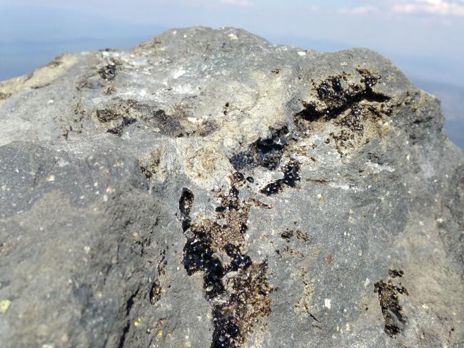
Mt. Thielsen is known as the lightning rod of the Cascades. Several of the rocks at the very top
of the pinnacle are streaked with obsidian caused by the lightening strikes. I have to say it was
a bit unnerving to erect a 10 meter pole with a conductor on such a peak. Thankfully, it was clear
for miles and winds were light.
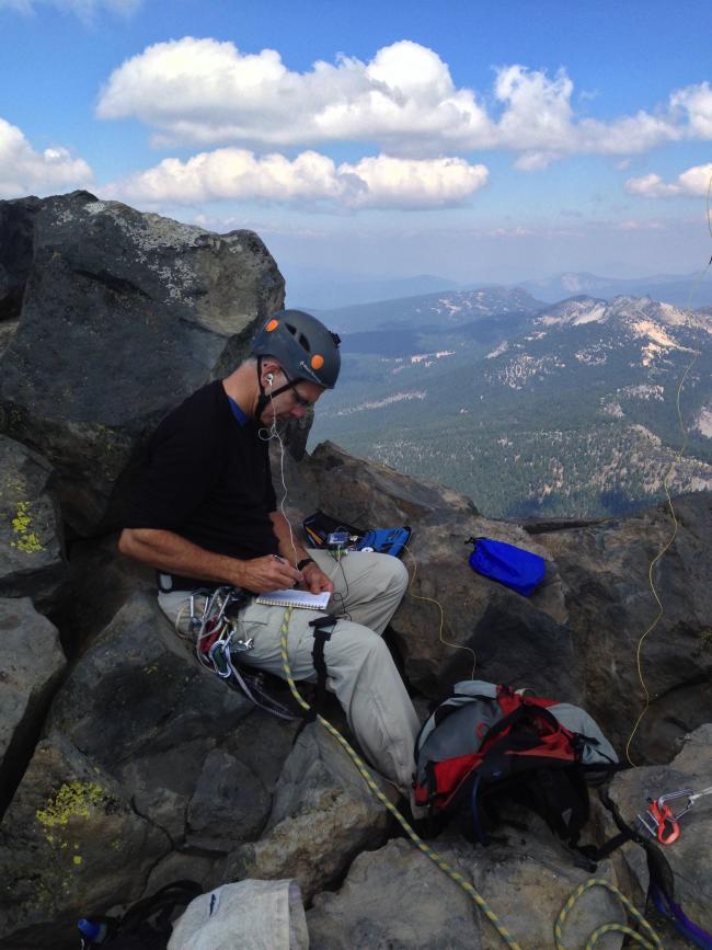
The summit area is quite small and cramped. Fortunately, we were the only ones there. On a weekend,
Chicken Ledge is probably a better operating position as I believe it is probably in the AZ. On the
summit there is no level place to sit. The exposure is substantial but the view is amazing. You
feel like you are floating in mid-air.
I operated 20 meters as usual with the ATS-3B. As on Broken Top, the ATU null indicating minimum
reflected power was very deep and well defined. I wonder if it has something to do with the EFHW
seeming being suspended in free space.
We were amazingly almost on time with the activation and got totally clobbered with chasers. I worked
through the pileup and had a ball. It was fun to look up occasionally and check out the view. I felt
so fortunate to be playing radio from such a cool place. What a great experience!
We had a nice lunch after I signed off and then rappelled off the summit pinnacle. The trek back down
the talus field was as unpleasant as it was going up. If you come to Mt. Thielsen, I recommend trekking
poles. By the time we got back to the rig, the round trip time was 9 hours and 30 minutes. About 10
miles were traveled.
If you come to Mt. Thielsen, I strongly recommend a roped ascent on the summit pinnacle. Chicken Ledge
can be reached if you have strong legs and feel stable in near-vertical environments. I struggled with
vertigo most of the way up. I'm working on what the cause of this is and hope to get a better handle
on it. It's really a pain.
ViewVoting details
Mt Thielsen activation, 8.31.2016
Summit:
W7O/CE-002
Voice Cellular Coverage:
Don't know
Data Cellular Coverage:
Decent, workable
Cellular Provider:
Verizon
APRS Coverage:
Don't know 


