Foley Peak is a short hike including a "choose your own adventure" bushwhack where there used to be a trail but there is no longer, up to the site of what used to be a fire lookout but is no longer. There might be ghosts.
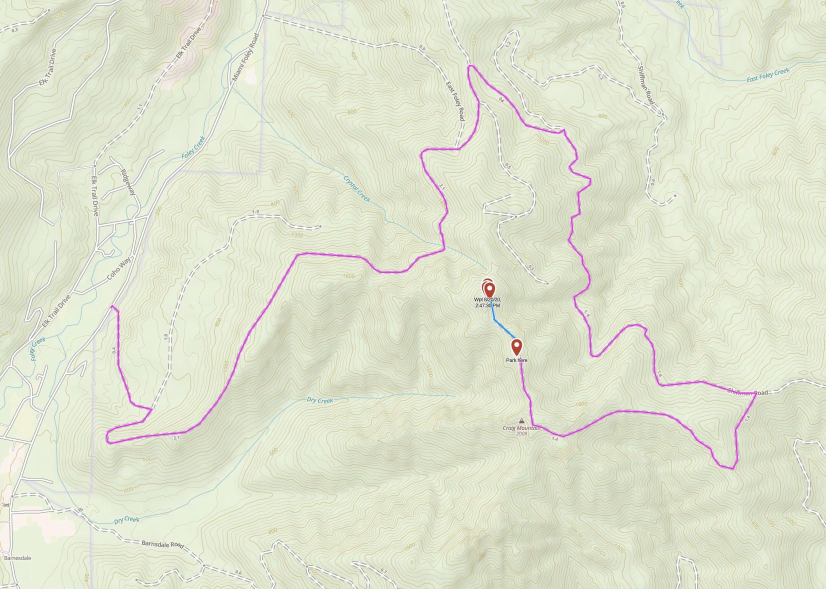
Start either on HWY 101 near Garibaldi and take Miami Foley Rd Northbound, or near Wheeler on HWY 53 onto Miami Foley Rd Southbound. Turn west onto Crystal Creek Rd at ( 45.65115, -123.84824 ). It appears that in the past it might also be possible to go up Frank Crane Rd / Miami River Forest Rd, but when I went that road was closed at Miami Foley.
The route along Crystal Creek turns into Shiffman, then finally a road that may or may not be named Foley Peak Rd.
Starting at the turn onto Crystal Creek:
- Right turn at .4 miles 45.64630, -123.84558
- Right on the fork at 2.5 miles 45.65852, -123.82513
- Right on the fork at 2.8 miles 45.66245, -123.82417
- Right on the T at 3.3 miles onto Shiffman Rd 45.66245, -123.82417
- Right at 4.9 miles off Shiffman 45.64704, -123.80489
- Park at 6.1 miles in an meadow opening 45.64868, -123.82101
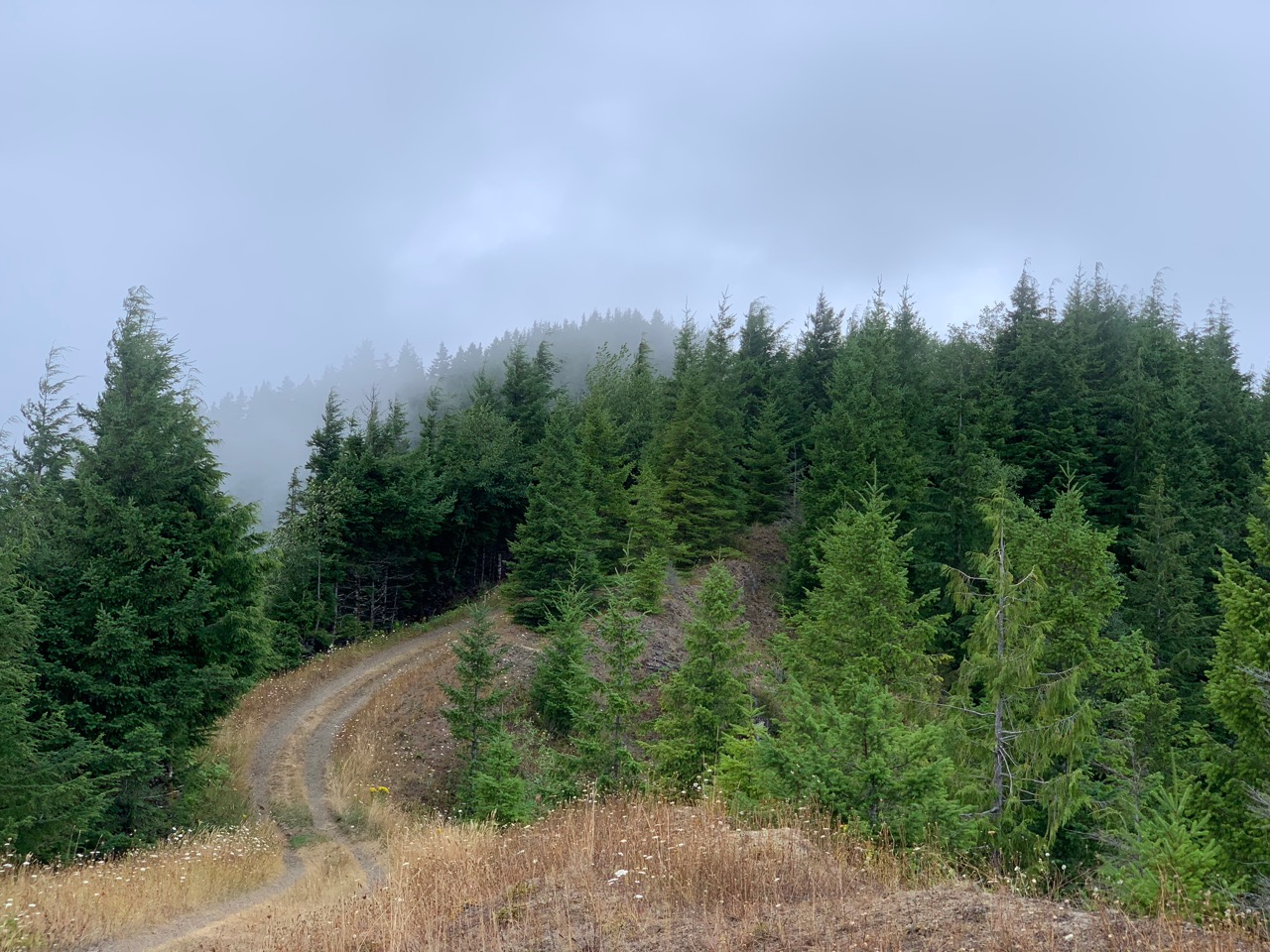
These roads are your standard forest gravel road fare; better traversed in an AWD vehicle but passable in a 2WD passenger car if the ground is fully dry. There are a couple of steeper spots but nowhere that I felt I would have lost traction in a passenger sedan, and there's no particularly rough washouts or rocky areas.
After the parking location the road starts to be grown over too much to proceed in a doubletracked vehicle, although the road itself and the hiking trail that it turns into are still fairly obvious for almost a 1/4 mile. Just shy of the 1/4 mile mark the trail starts to really disappear, and you can pick your own favorite spot to turn left and start bushwhacking up the final approach. My choice was at about 45.65136, -123.82284. At this point you only have around 100 feet travel and elevation. The lowest portion of the forest along the disappearing trail is a bit thick, but thins out quickly once you start gaining.
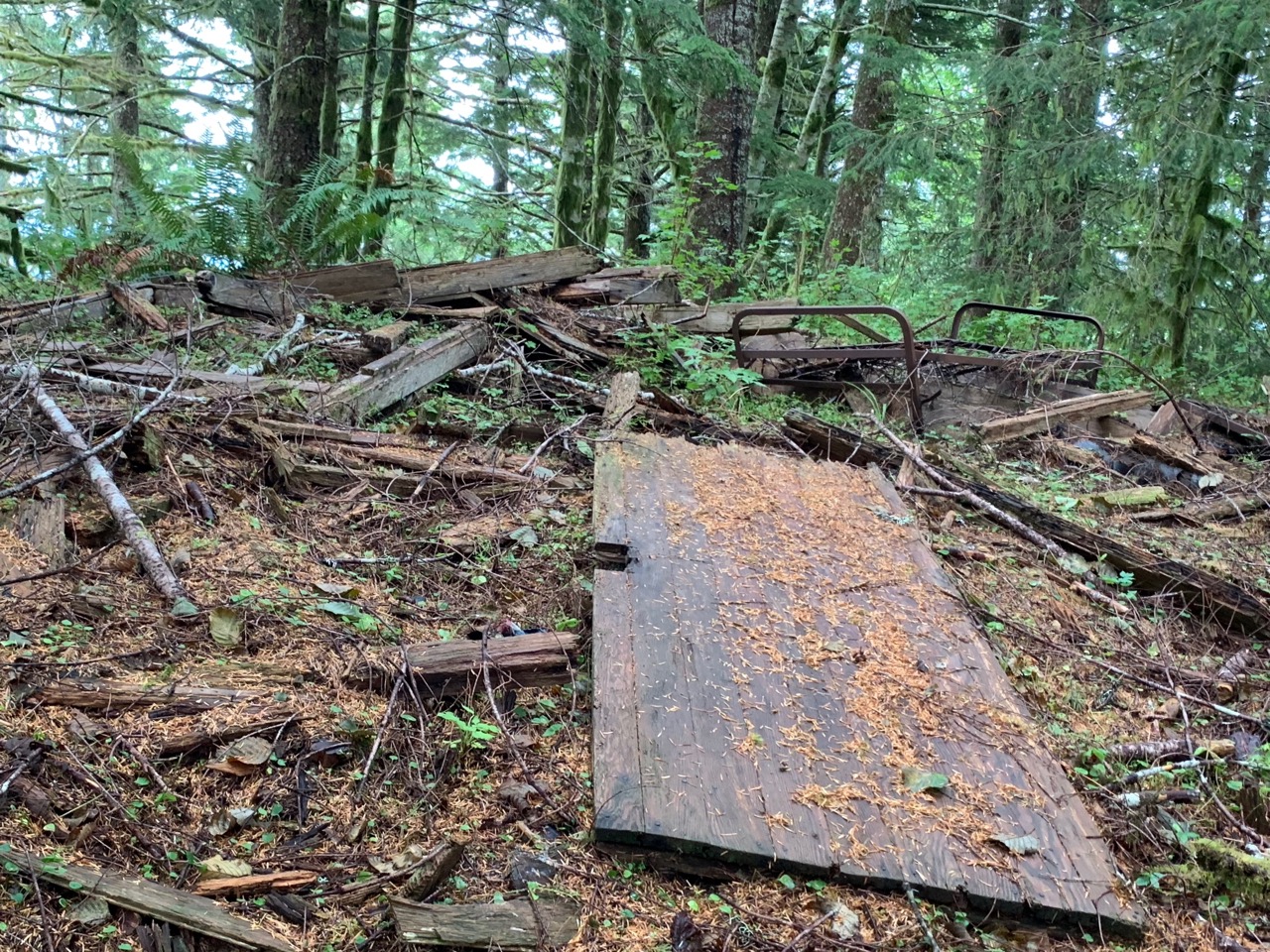
The summit used to house a fire lookout, originally established in the 1930s and then improved in 1943. What remains is one of the more complete and slightly spooky ruins I've found, including a bedframe, door, and a good portion of the floor framing. There are also two benchmarks and a geocache to be found, if that's your thing. With the crow's nest gone and the forest regrown around the site, there are no views to be had, and this location is close enough to the ocean that fog and forest-borne moisture is possible on an otherwise pleasant day.
GPX Route available in public downloads.