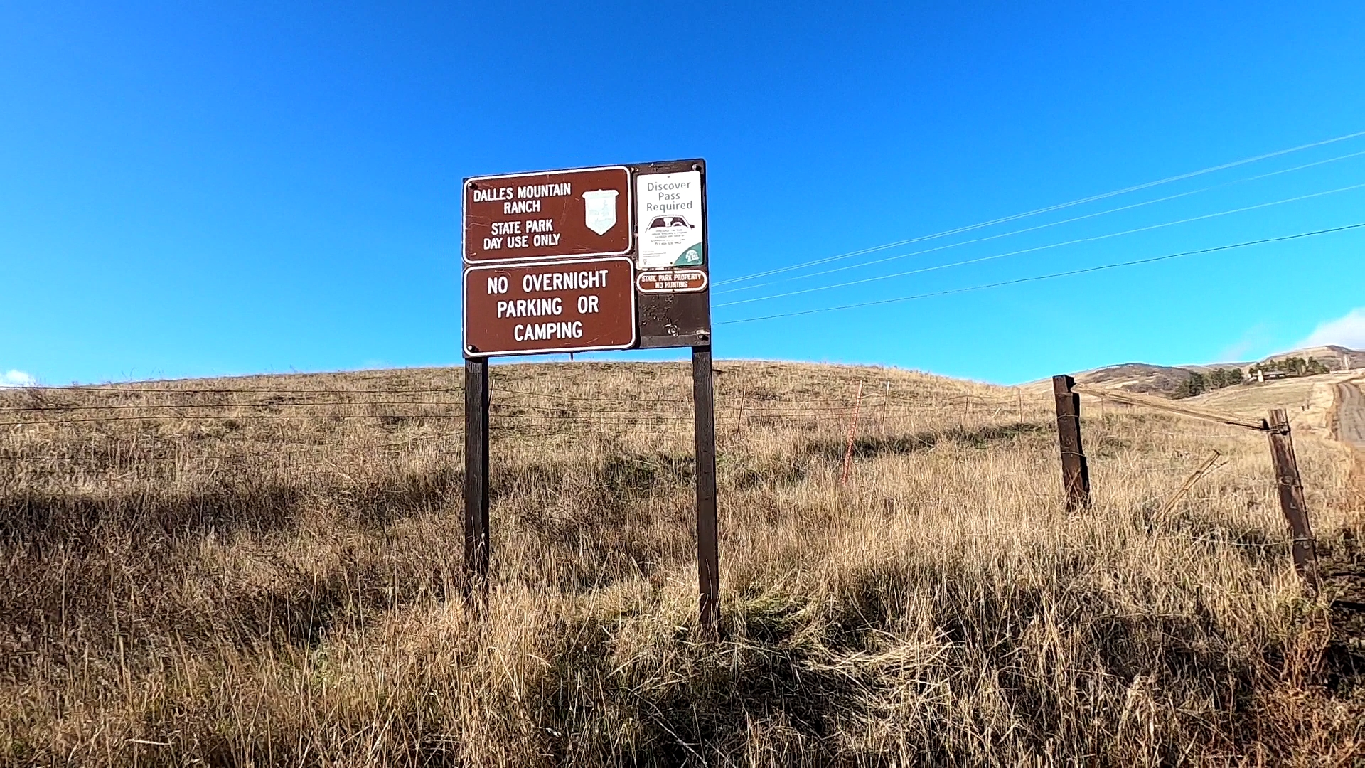
To get to Stacker Butte, Washington, from Interstate 84, take exit 87 at the Dalles and go north across the Columbia River for approximately 3.5 miles to Highway 14. Note; After taking exit 87 and turning north, there is a McDonalds on the left. This is the last opportunity for "facilities". If you don't use them, Stacker butte is very exposed all the way up, and you will be too! Also, this bridge crossing the Columbia is NOT a toll bridge. When you get to Highway 14, turn right (east) and go about 0.9 miles to Dalles Mtn Rd and turn left. Pavement ends here and turns into a good gravel road. Proceed approximately 3.4 miles and make a uphill left just before a few barns. If you have taken the correct turn, you will pass a house on the left in about half a mile. Note; this last section of road is not always well maintained and parts of it can be very rutted with lots of rocks, some can be sharp so be slow and careful. I wouldn't recommend this last section of road for a passenger car with no ground clearance. CUVs, SUVs, Trucks, are fine (January 2021 found the road to be Priusable the entire way). After making the previously mentioned left, go about 1.5 miles to a parking area at a locked gate and a sign board (45.695,-121.0925). A Washington Discover Pass is required to park here. Note, this gate is always closed and locked. If for some reason it is not, DO NOT drive past it, as it WILL get locked and you will be stuck. Dogs are not allowed and a DISCOVER PASS is required.
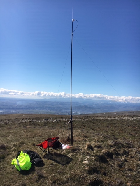
Now the fun starts. It's about a 2.5 mile walk up the gravel road to the Activation Zone and nearly every step is UP. It took me about 1.5 hours to plod up the road, and about 1 hour to come back down. This is in a natural area so you must stay on the road and not go cross country. The road will go right through the activation zone and there is plenty of room to set up. This is a barren summit so bring everything you need to erect an antenna. I found an old steel post I could bungee my jackite pole to otherwise I would have guyed it, but there are no trees etc. There is a VOR site at the activation zone and several broadcast / microwave buildings on the top - there was some intermod interference near the VOR site. Great views of the Columbia River, Mt Hood, Mt. St. Helens, Mt. Adams and Mt, Rainier on a cloudless day. The day I was up there it was clear but unfortunately a line of clouds obscured the mountains all day so no good pics to share. This is a pretty popular place for people to walk. I encountered about a dozen other hikers up on the summit during the afternoon I was there. This summit is usually breezy - windy enough to snap a fiberglass telescopic pole actually. It can be significantly colder than down below, and the weather can change dramatically and quickly so don't go up in shorts and flip flops with no better clothes. Unfortunately I did not measure the elevation gain from the parking area to the summit but I would guess at somewhere around 900 feet maybe. Picture of my activation below. Sat there and ate lunch, worked a bunch of other summits, including Mt St Helens with my FT60 Hand Held and the vertical dipole at the top of the mast, and made a bunch of HF CW contacts with my PFR3B and a 35 foot wire. Have fun!
73 Joe-WB7VTY
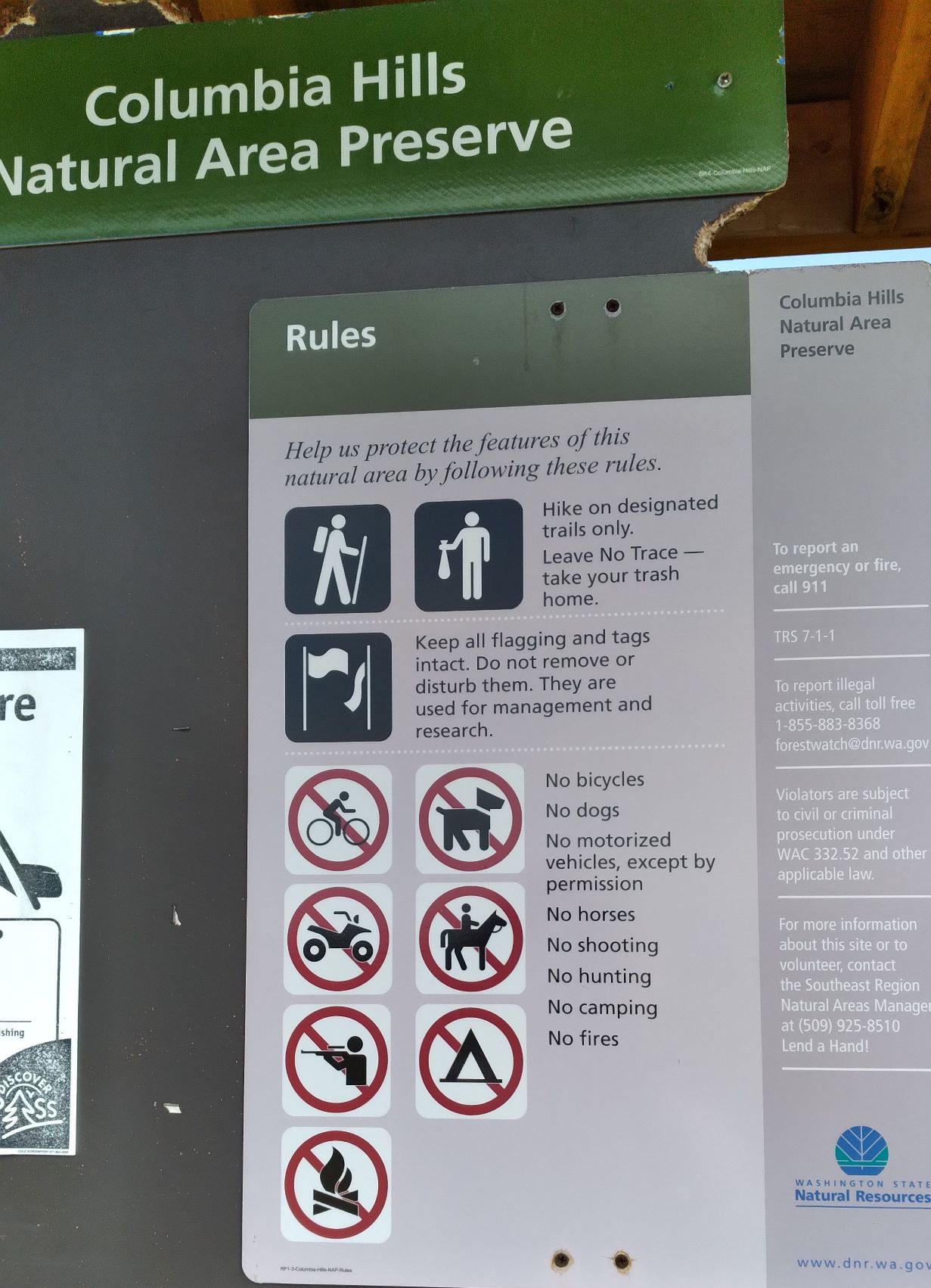
PS - Also note Columbia Hills Natural Area Preserve restrictions on the sign (below). In particular, no bikes and no dogs allowed.