Turn east off of Fields-Denio Road at 42.1606, -118.6033 onto Whitehorse Ranch Lane.
Turn off of that onto an unmarked road at 42.3111, -118.2625
Go past the right turn to Willow Creek Hot Springs to turn left at 42.2769, -118.2624
Park at 42.2463, -118.2392
From here it is cross country 3.6 miles round trip with 1400 feet of elevation gain.
These roads are drive-able in a passenger car with reasonable clearance in dry weather. In fact Whitehorse ranch road may be the widest, smoothest dust maker I’ve been on. Keep the speed in check though. We came upon a road worker that was dumping large piles of gravel in the lane and then coming back later to spread it with a grader.
There is no trail. The first mile is on gently rising ground with a few sage brush pockets to avoid. The ascent then gets steadily steeper. There are some rimrocks to avoid, but many routes to the top. We walked around to the far side (north side) which was nice as it was in the shade and despite the early hour and late season it was starting to heat up. We went down the near (south side) and that worked too, although we did get rimmed out at one point and had to traverse around.
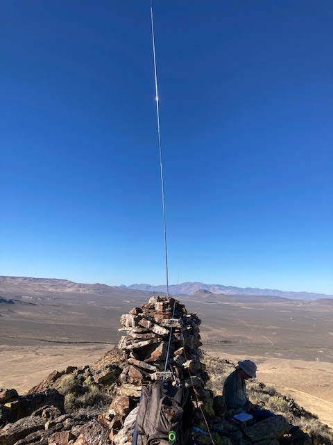
There are no trees on top so bring your own antenna support. We pitched ours on top of a large cairn that appeared to be the summit. The gps disagreed, but did assure we were in the activation zone.
Return to Willow Hot Springs and rinse the dust off. We camped there two nights.