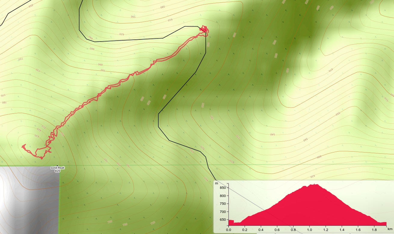
1.2 miles round trip. ~900ft elevation gain. Moderate bushwhack.
Gold Peak is a one point steep bushwhack in the Tillamook State Forest. To get to the trailhead one needs first to get to the Trask River Road out of the town of Tillamook. From Portland there are two cutoffs. One is longer and paved, the other good gravel. Travel times are similar, but the gravel route is shorter.
Once on the Trask River road proceed past the County Park to the end of the pavement. Continue on good gravel to 45.4098, -123.6120 where you will turn right on Gold Peak Road (unmarked, of course, this is the Tillamook forest after all). At 45.4112, -123.6166 a right turn is required to stay on Gold Peak road. Follow this to the “trailhead” at 45.4289, -123.6468. The last half mile or so of the road is double track, but most vehicles could manage. There were two downed trees on the double track. I was able to drive under one and over the other. The “over” tree was at the trailhead so a vehicle not able to manage that could park before that point.
There is actually a bit of a trail to the top but it comes and goes as blow down obscures it or requires various routes to bypass. In essence though the trick is to stay on or near the very narrow ridge line. The other hint is to set your GPS for the saddle between the two parts of the peak, 45.4262, -123.6529. Then proceed to the peak from there. I climbed (and that is nearly the right word) to the SW false summit only to find my gps saying I was in the activation zone and Sota Goat saying I was not. Anyway, it was clear the tippy top was as advertised in the sota data base, and I proceeded there. If you find yourself using your hands, know that this is not required from the saddle. On the way down I traversed around the false summit to get back onto the ridge down. Be sure you go down the correct ridge to get back to your vehicle.
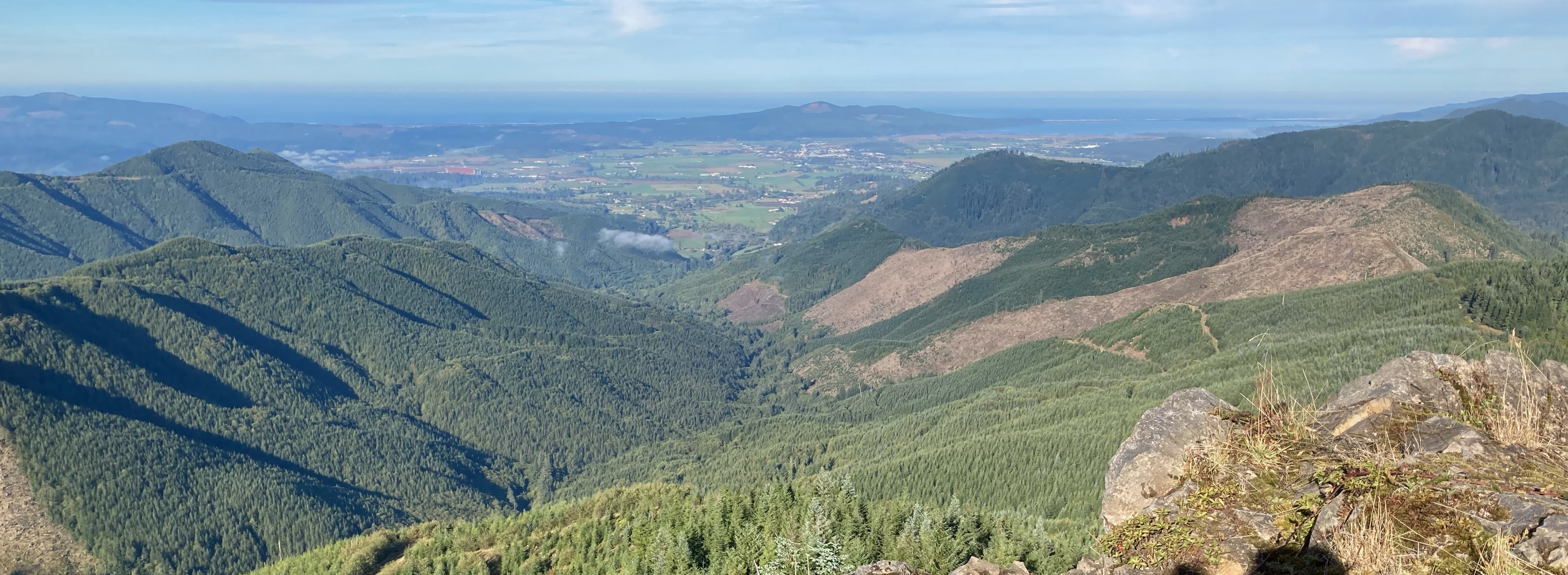
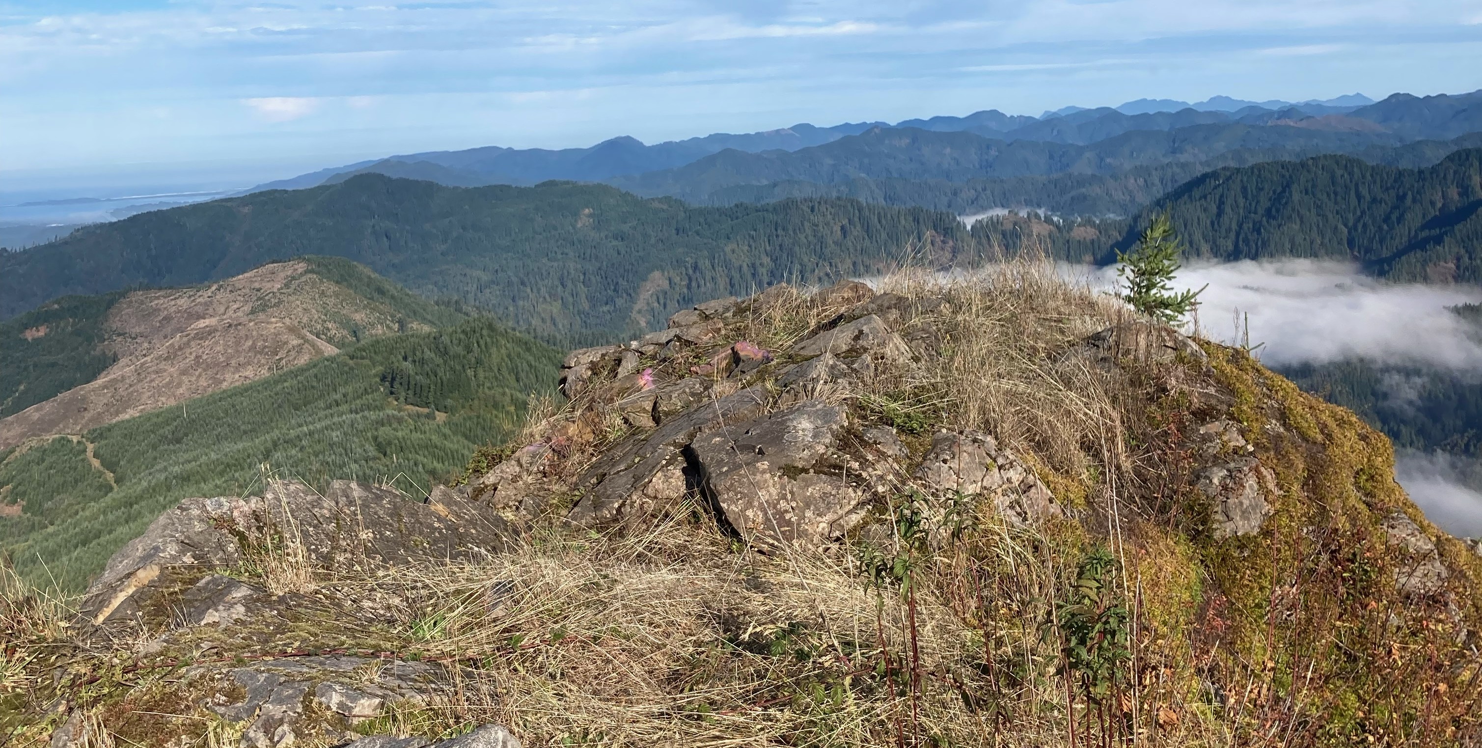
The top is hard rock so no stakes or piling of rocks to secure an antenna. A bit down from the top was a stump I used to secure my antenna pole. There are trees in the activation zone, but I wanted to be on the very top to work the several stations activating from Washington on 2M.