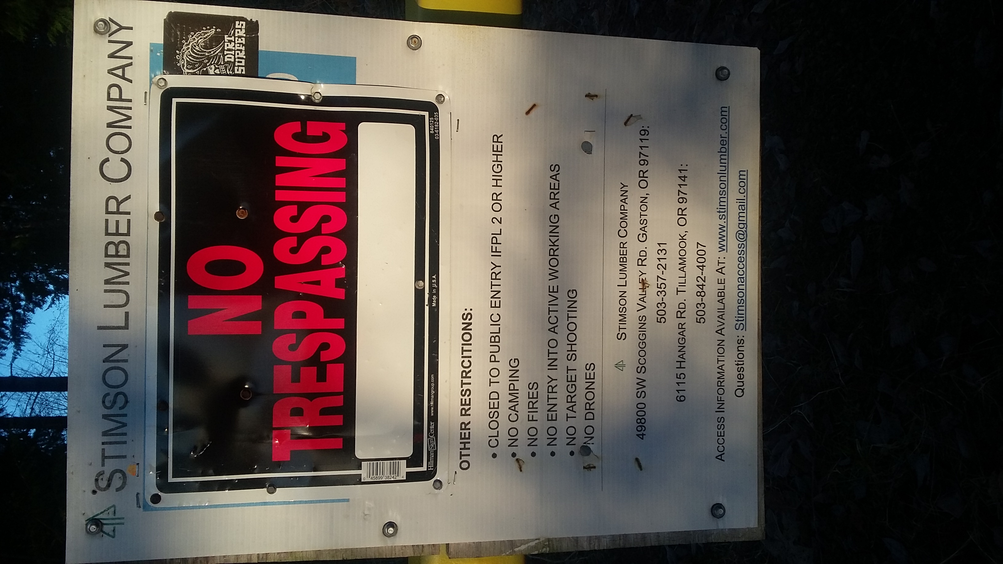
NOTE in January 2021 there was a NO TRESPASSING sign posted on the Stimson Gate Placard. See photo below.
There are FOUR Wildcat Mountains in Oregon, so be sure you want the North Coast version south of Highway 26. The road to the trailhead is short and easy in any passenger vehicle, there's a good spot to park, and summit is in the Tillamook Forest, although the shortest access crosses private timberland. The hike is about 1.5 miles one way, and 400 vertical feet gain. This description is a 'no bushwack' version.
Start near Highway 26 milepost 47, across from Manning, Oregon by turning south onto Hayward Road. Pavement for a while turns to good gravel. After 3.5 miles when the road makes a sharp turn to the left, there will be two roads to the right - one is a driveway and the other is gated as the start of Wildcat Mountain Road near 45.660 -123.226.
You'll go about 3/4 mile on Wildcat Mountain Road. As soon as you come around the first corner you'll have a good view of the summit of Wildcat and the quarry that you should not use as a route to the top. Around a slight bend to the right, we found obvious flagging tape and an 'abandoned' road on the left side (perhaps near 45.658 -123.236). This is about a quarter mile long and is easy to follow. You'll pass by an abandoned gate and come out at a five-way intersection. The second road from the right heads steeply up the summit ridge. From this intersection it's another 0.5 miles or so to the summit.
You'll arrive at the top of this steep road at a landing above the quarry - this is just within the Activation Zone and is a fine place to stop. However, for those that like to get the actual summit, it's less than 1/10 of a mile farther - continue up, following the flagging tape up the ridge on an abandoned road through Oregon Grape. There are many trees and it's a bit challenging to put up antennas and there are no views or sunshine, but you'll be at the top.
See also these trip reports:
http://www.pnwsota.org/blog/kk7ds/2012-may-12/wildcat-mountain
http://www.pnwsota.org/blog/k9wbz/2019-april-23/w7onc-044-access-update