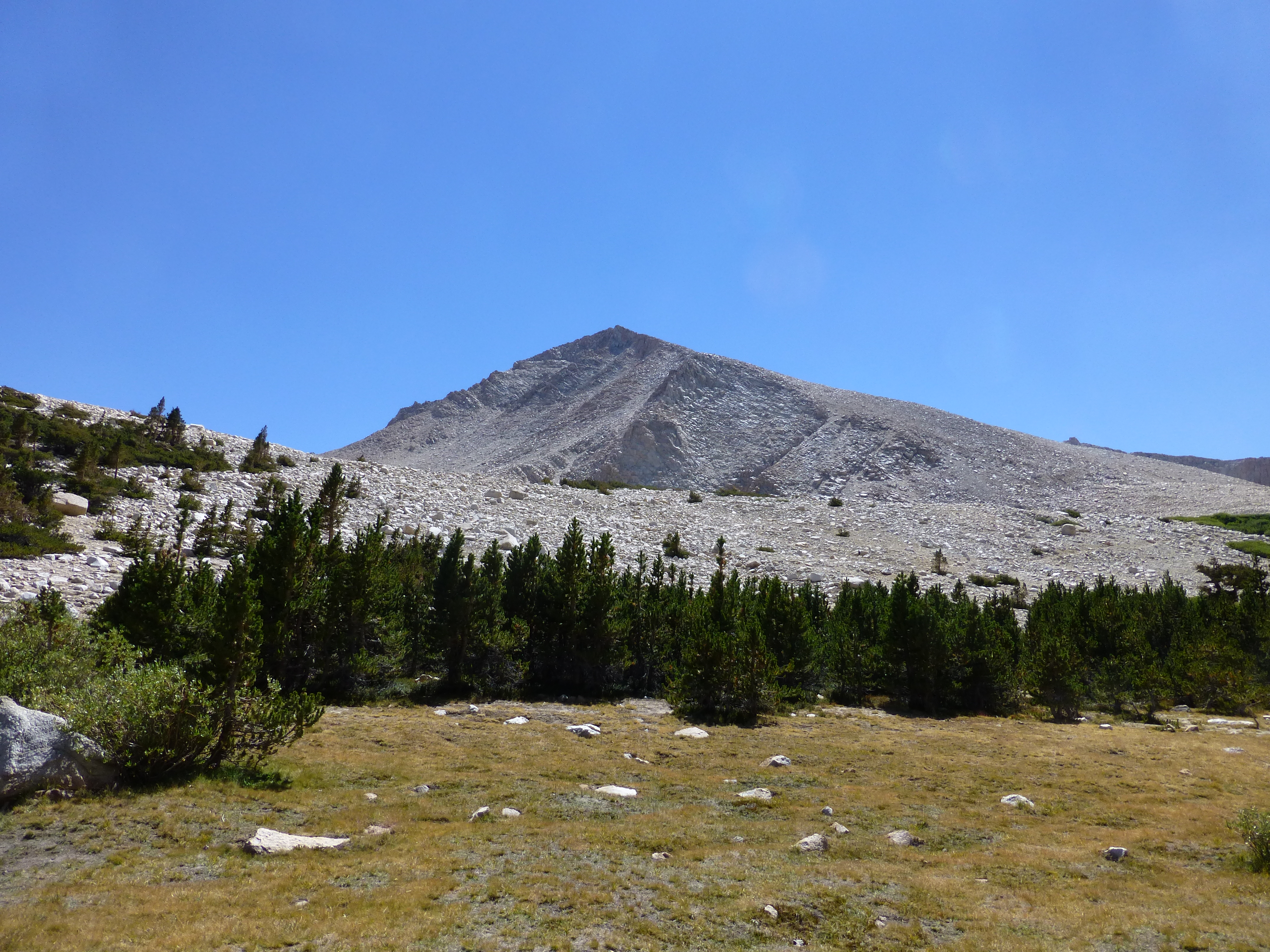
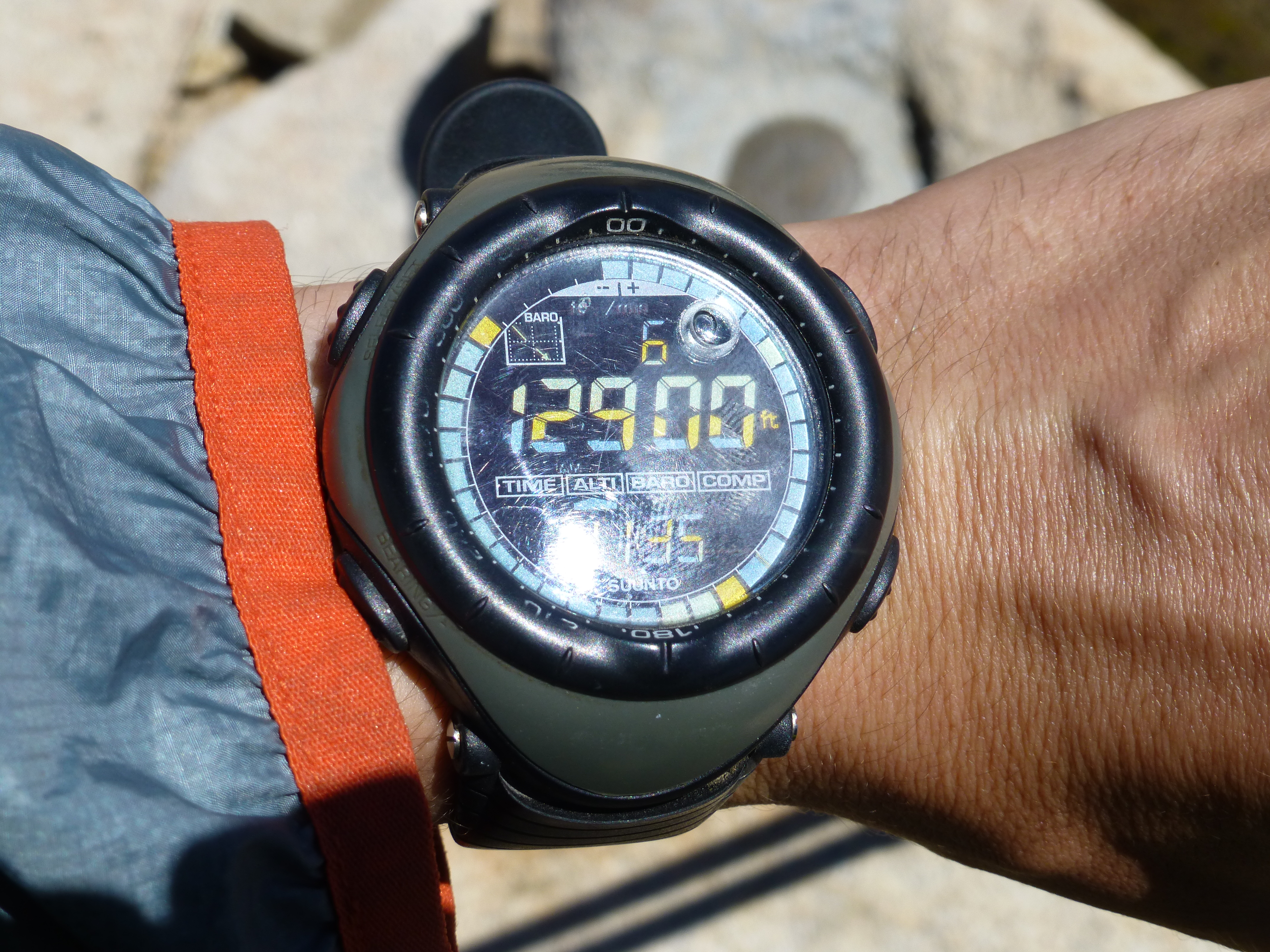
First Activation of Cirque Peak, 12,900 feet, High Sierra's of California, Inyo County. Sunshine, blue sky & endless granite...but with a little price to pay.
The Hike (Scramble) is 5.25 miles south - southeast of Mount Whitney, California, and 10.5 miles southwest of the town of Lone Pine, California. This was a father / son outing with my 28 year old son, who lives in the Los Angeles suburb of Sherman Oaks (sea level), and I, a 62 year old who resides in Bellevue, Washington, at the high altitude of 728 feet.
From the town of Lone Pine on Highway US-395, drive 5 miles west on Whitney Portal Road. Go left on Horseshoe Meadow Road and continue 20 miles up a remarkable set of switchbacks to the Horseshoe Meadow trailhead. The peak may be approached by hiking up New Army Pass (as for Mount Langley, which we did) or up Cottonwood Pass to Chicken Spring Lake. The trailhead is at 10,050 feet! In researching this outing, I came to realize that there are only 5 points in Washington state that are higher than the trailhead…and all of them are the summits of strata volcanos.
Trip Diary:
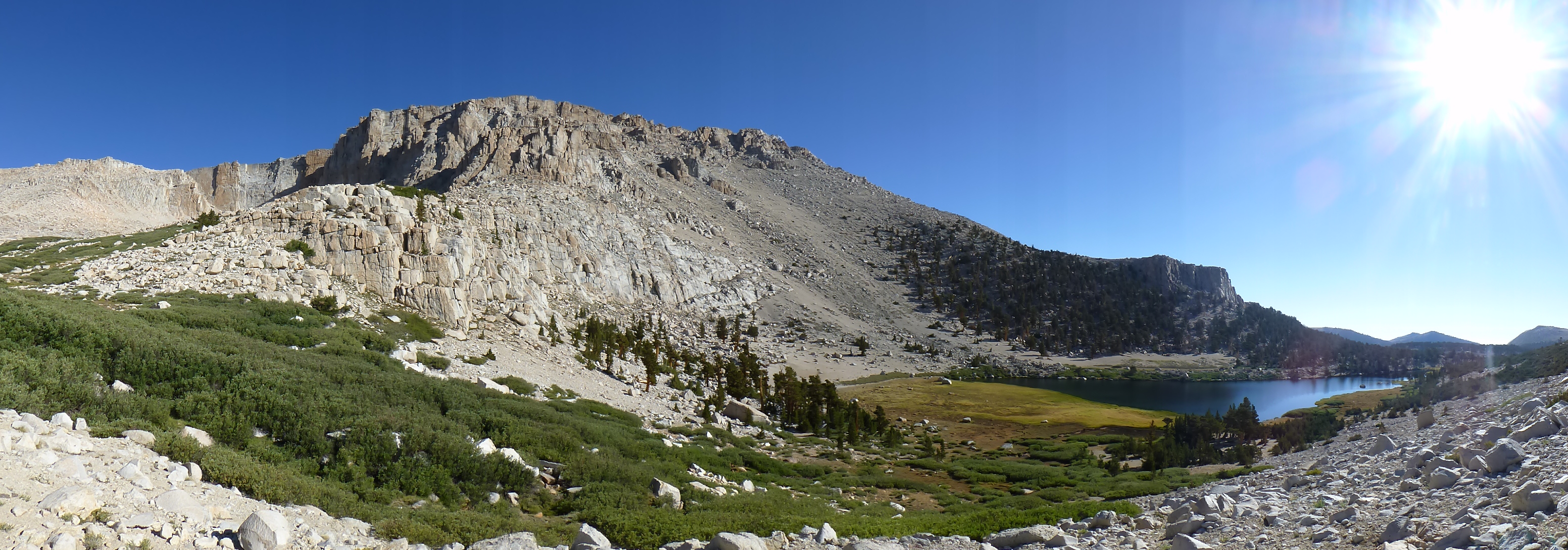
Day 1, hike from Horshoe Meadows TH at 10,050 feet to Base camp at Long Lake, 11,150 feet and 6.75 miles.
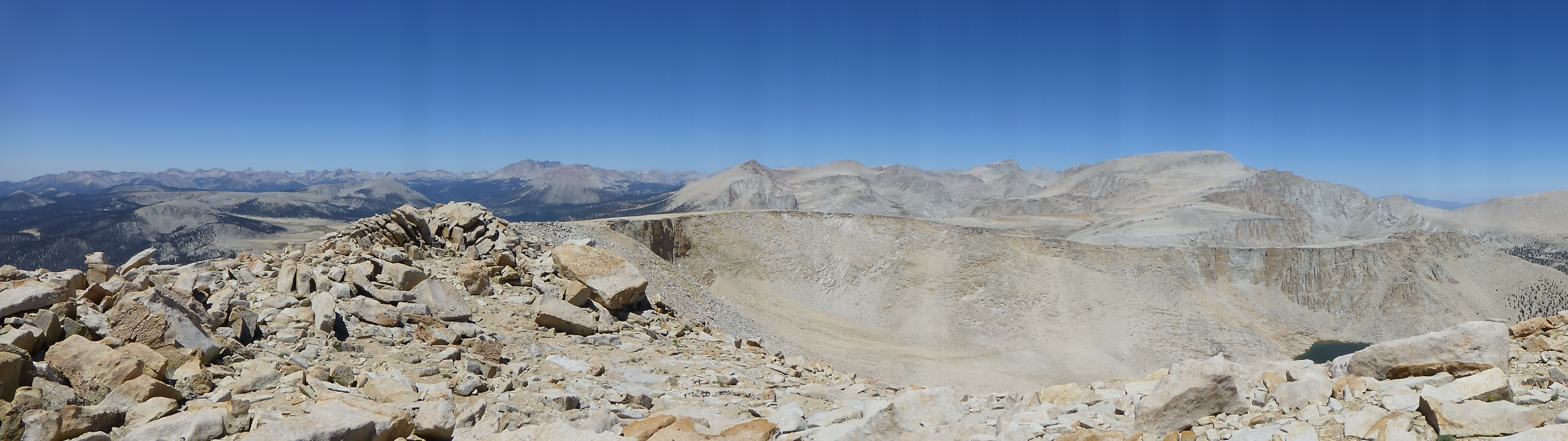
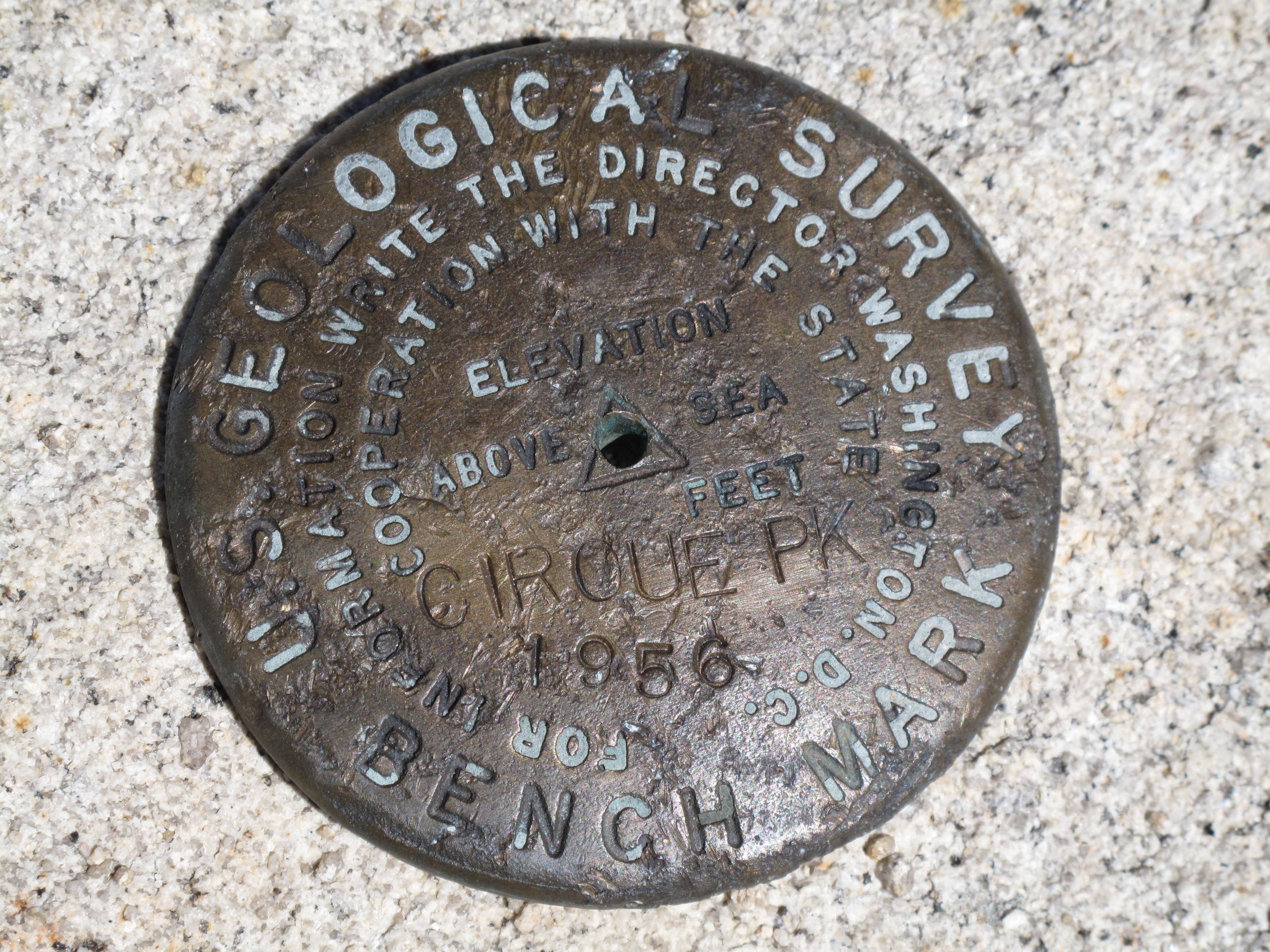
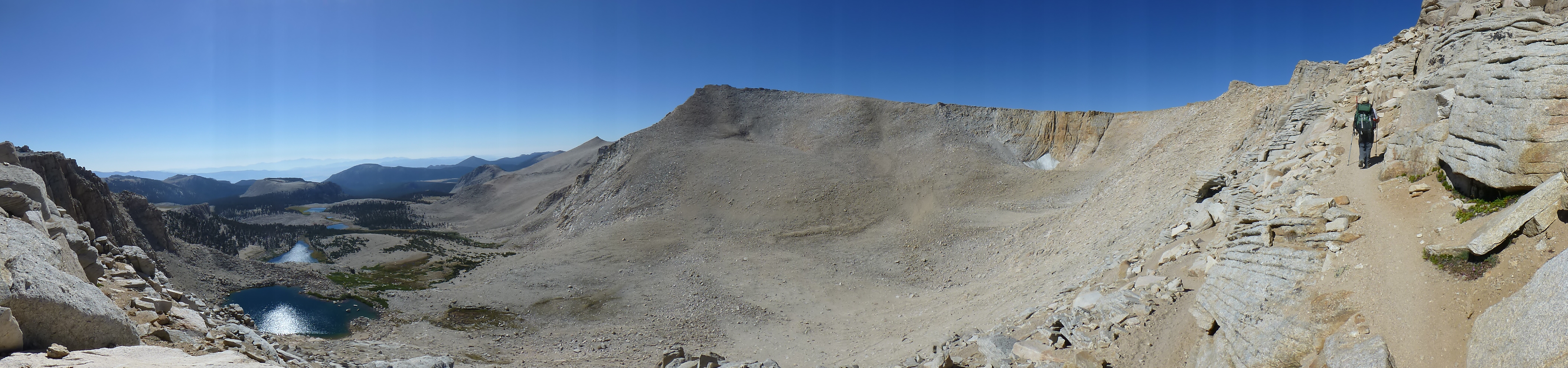
Day 2, hike / scramble to Cirque Peak, 12,900 feet via "New Army Pass". This is an easy ascent, except for dealing with the altitude. A little bit of headache and heavy breathing to suck in every bit of rarified oxygen. 1,750 feet elevation gain, 6 miles round trip.
Day 3, hike / scrabmle up Mount Langley, 14,042 feet. Full report on Langley under separate report form. 11.5 miles round trip, and 3,700 feet elevation gain.
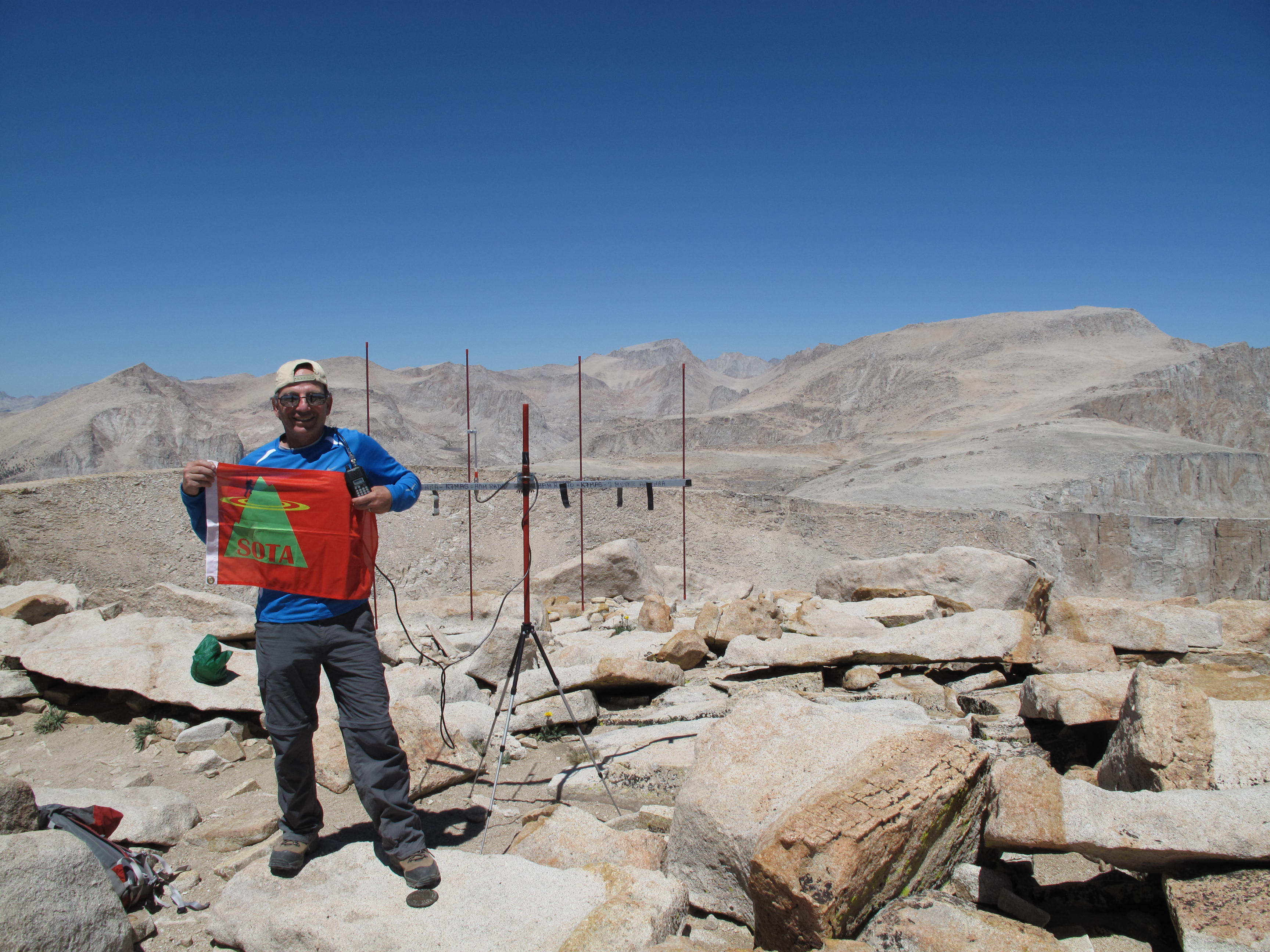
SOTA Data: On Cirque Peak, 100% 2 Meter Simplex, using my 4 Element Yagi, vertically polarized, and 7 watt Icom IC-V85 hand held 2 meter radio. I have calculated the Effective Radiated Power (ERP) with this set up to be approximately 20 - 23 watts in the direction I am beaming. I made one contact into Nevada, at an appriximate distance of 213 + miles.
Trip Statistics:
Duration: 4 days (72 hours), Monday at 08/12/13, at noon, to Thursday 08/15/13, at noon
Total Miles Hiked / Climbed: 31.5
Total Elevation Gain: 5,000 feet
Peaks Climbed and Activated for SOTA: Cirque Peak, 12,900 feet & Mount Langley, 14,042 feet (separate report).
Next Ambition in Area: hike / climb Mount Whitney, high point in continental USA, at 14,505 feet, and do a SOTA Activation. Will try for permit Lottery again for next summer, 2014.
Photo Credits: Jeremy Sandler, all panorama shots & altimiter, others, Mark Sandler