Directions: Take Sunset Falls Road east of Battleground to Sunset Campground. Turn right and cross the East Fork Lewis River on FS Road 41. Stay on FS 41 for approximately 9 miles to a large parking area atop McKinley Ridge. This is NOT the summit.
Sections of the gravel road beyond Sunset Campground have large and deep pot holes and a few graded drain dips. Cars with low-clearance may not be suitable for this drive.
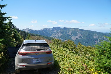
Once at the parking area, you can either park and walk the rest of the way (1-¼ miles), or navigate a very rutted, narrow (NF 4101) road east for ¼-mile to another parking area. I opted to drive the ¼-mile, which was not the best idea in my wife’s 4WD Kia.
From the second parking area, hike along the road to a heavily overgrown clearing just west of the summit (refer to your GPS) and head up the clearing (bushwack) to the ridge and then to the summit. The hike was just over ¼-mile, though you could make it shorter if you head straight up to the summit.
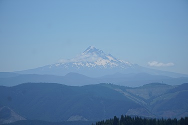
The summit is “open” to the south and provides nice views of Hood and Jefferson (it was a bit hazy in the distance). Views to the north are a bit obscured at the summit, though very nice along the road (St. Helens, Adams and Rainer). Set-up is easy with many smaller pines to Velcro masts and taller trees to throw wires.
Where I set-up must have been in some shadows, since I could hear a lot of one-sided 2-meter conversations and when I tried to break-in was marginally successful. Luckily getting my QSO contacts were easy since it was the CQ World Wide VHF Contest!