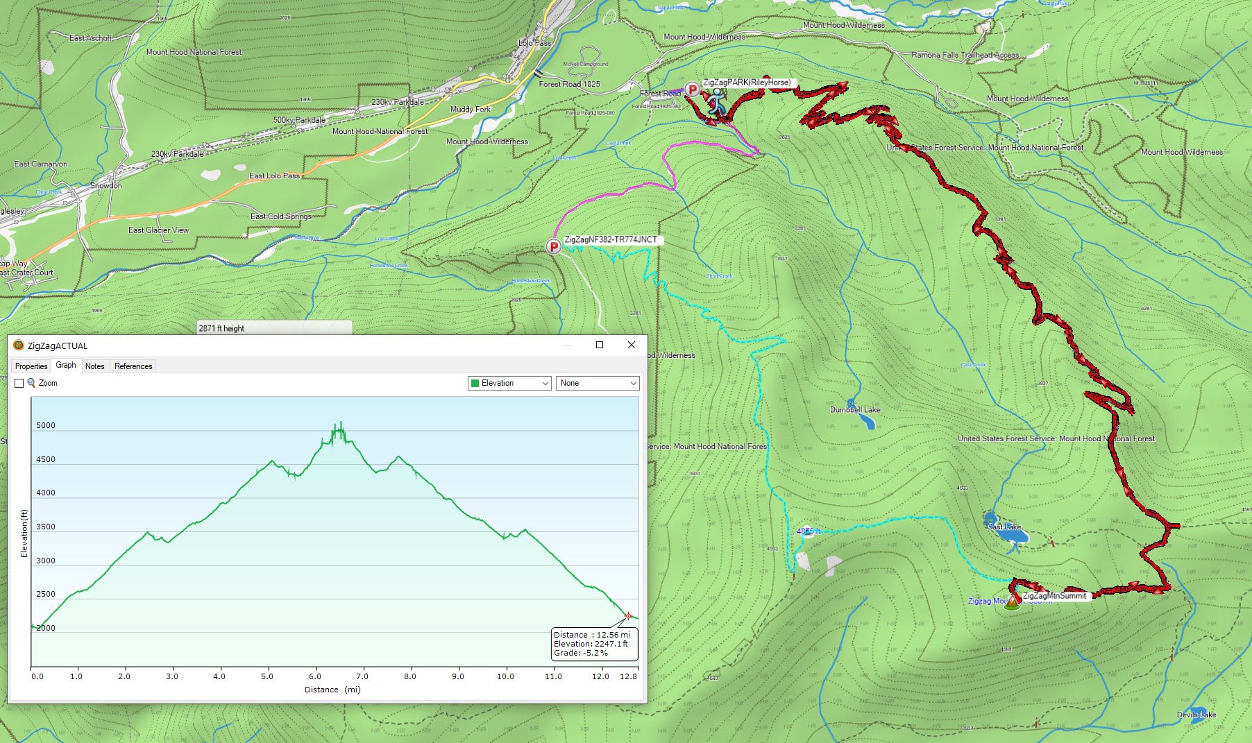
K7ATN reported poor road/driving conditions when attempting to get to the Zig Zag Mountain trailhead on the south side of Zig Zag Mountain. This report shares activation information for the north approach from Riley Horse Campground. The drive can easily be done in a passenger car (recreation permit to park). There are two options from this point, I took Cast Creek trail, and it was 12.8 miles RT with 3900 ft vertical climbing total.
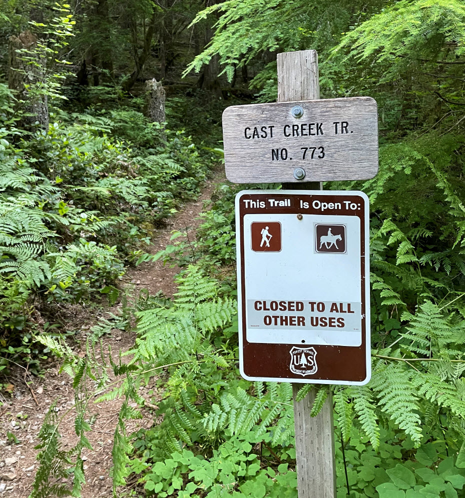
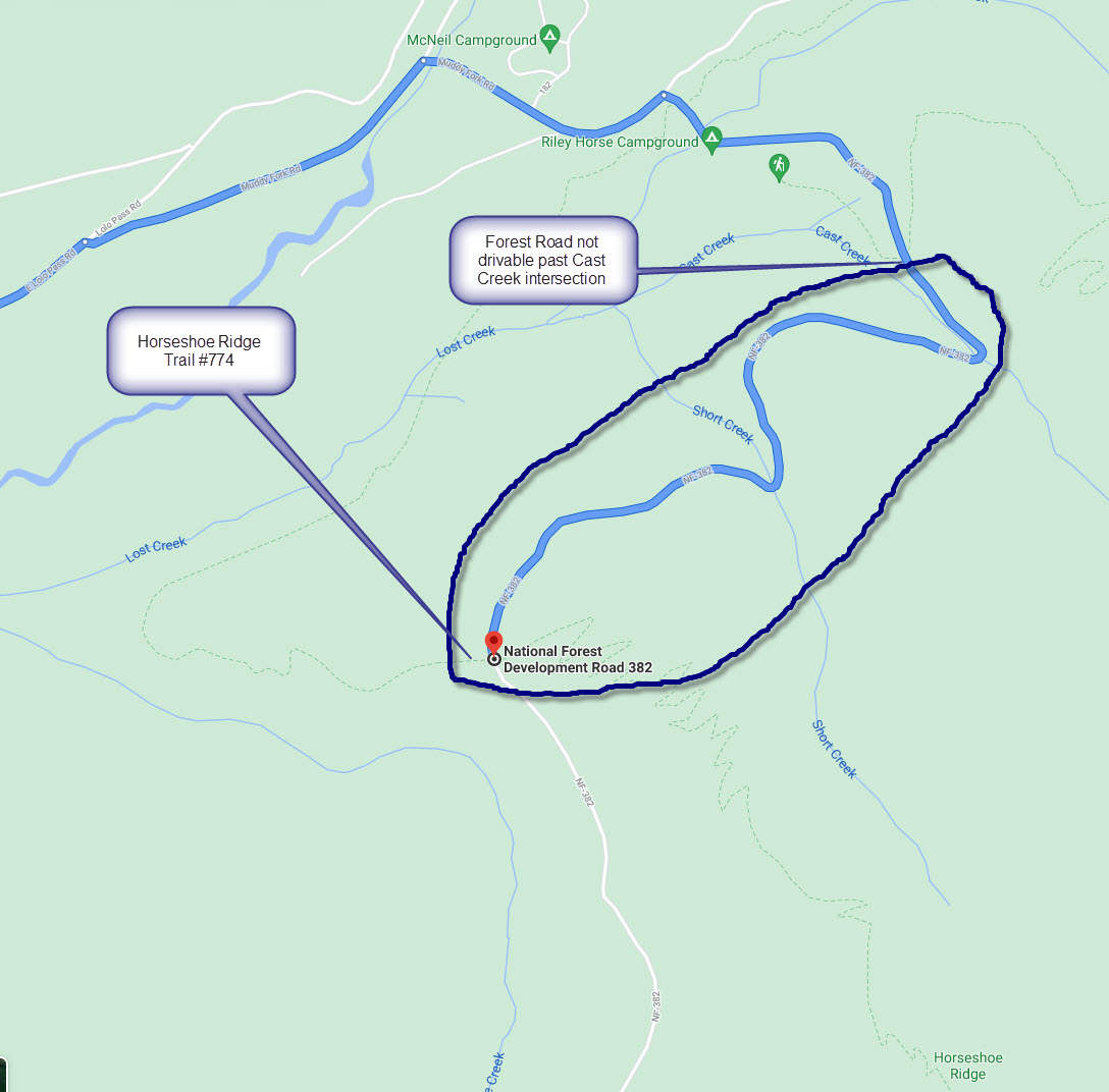
There are two trails that leave from this area, Horseshoe Ridge trail #774 and Cast Creek trail #773.
My original plan was to take NF-382 road to the intersection with the Horseshoe Ridge trail farther up, but this road no longer exists beyond just north of the intersection with Cast Creek trail. You can hike on it, but it has been dug up and is not drivable. From Riley Horse Campground, you can hike south on NF-382 and it takes you to Cast Creek Trail, or you can begin the trail directly from the campground. (see images below).
Cast Creek trail is easy to follow, but there were a lot of downed trees likely from the winter ’21 ice event. You will need to go over & under ~25-30 trees that have fallen on the trail. Cast Creek Trail intersects with ZigZag Mountain trail #775 that takes you just below the SOTA summit.
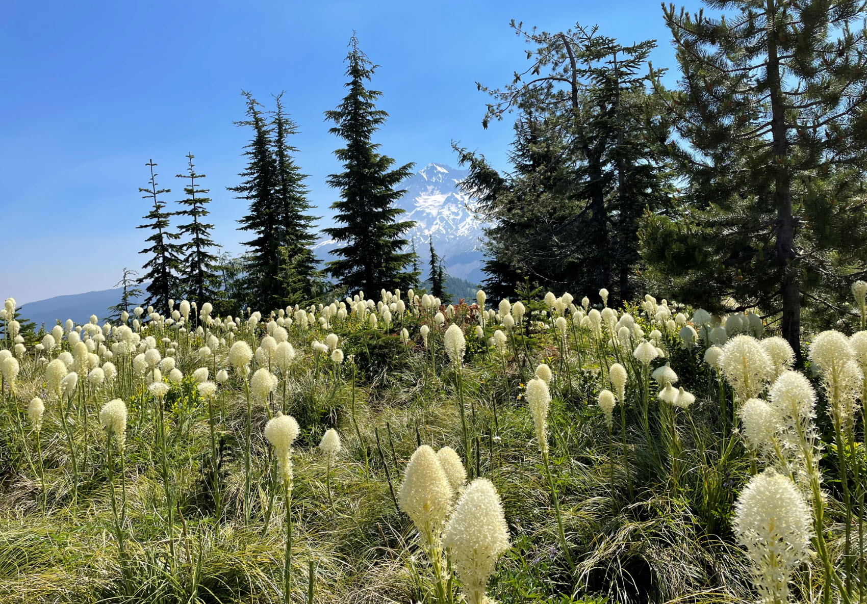
As K7ATN described, it is a short bushwhack to the top. It is a little intimidating looking up from the trail, but as soon as you go up a little, there are clear spots you can pick your way through. The top is a small meadow and I was rewarded in this early July activation with thousands of blooming Indian Basket Grass (Bear Grass). Trees on the perimeter of the meadow offer shade and good antenna supports.
I encountered very, very heavy mosquitos from the top of Cast Creek all the way to the bushwhack, but once on the summit they thankfully were far less of an issue.
I chose to return the way I came up, but after activating, you could continue on Zig Zag Mtn trail, and head back via Horseshoe Ridge trail.