2023 Update:
See latest update from Guy N7UN about DNR altering some roads in this area!
http://www.pnwsota.org/blog/n7un/2023-october-22/new-access-information…;
2021 Trip Report:
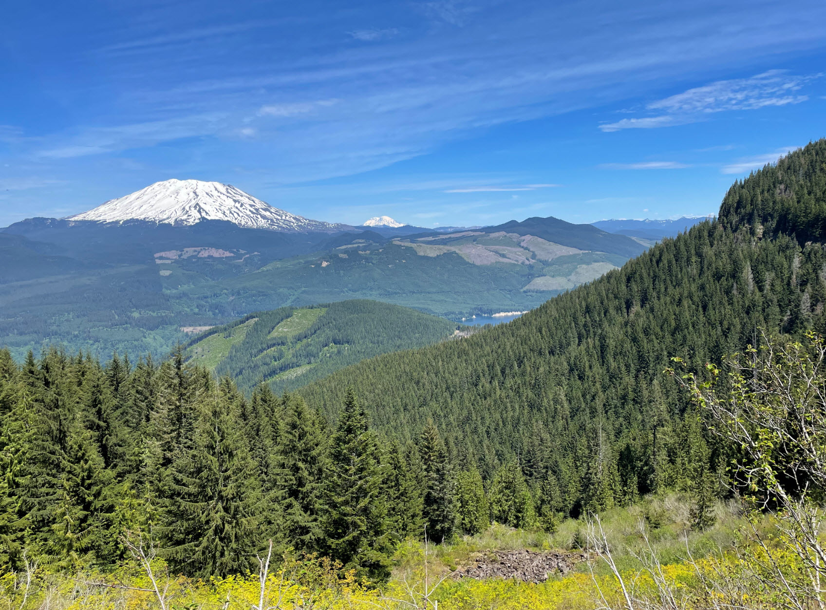
This is a SOTA gem! A landowner blocked access to the original trailhead in 2011, but a new trail has now been established. The new trail has some challenges but is easy to follow, with signs of regular maintenance. The summit offers a wonderful 360-degree panorama view with Mt St Helens looming large just North of the summit.
I found information about the new access to Mt Mitchell from the NW Hiker website (http://nwhiker.com/GPNFHike105.html). I reference some of that information here, with a few corrections, and supplement it with SOTA information.
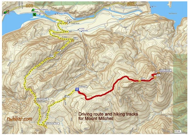
The access roads to the new TH are in good shape. A sign indicated “Discover Pass Required.” There are some potholes on the way, but you can navigate around them, so I think you can get to TH in a passenger car. To get to the trailhead get yourself to Cougar, Washington. From Cougar go East for ~3 miles on the Lewis River Road (Hwy 503), which becomes Forest Road 90. Near N46.05533° W122.24788° make a right turn and follow S-6000 for about 0.8 miles. Near intersection at N46.05113° W122.24788° turn right.
Continue up this road as it gains elevation, at the summit bear to the left at the top and head down the other side. Near N46.00497° W122.26038° make a hairpin, left turn and follow this one lane road about 1.9 miles until the road ends at a small parking area. No signs indicate that this is the trailhead, but you are there (N46.02268° W122.24154°).
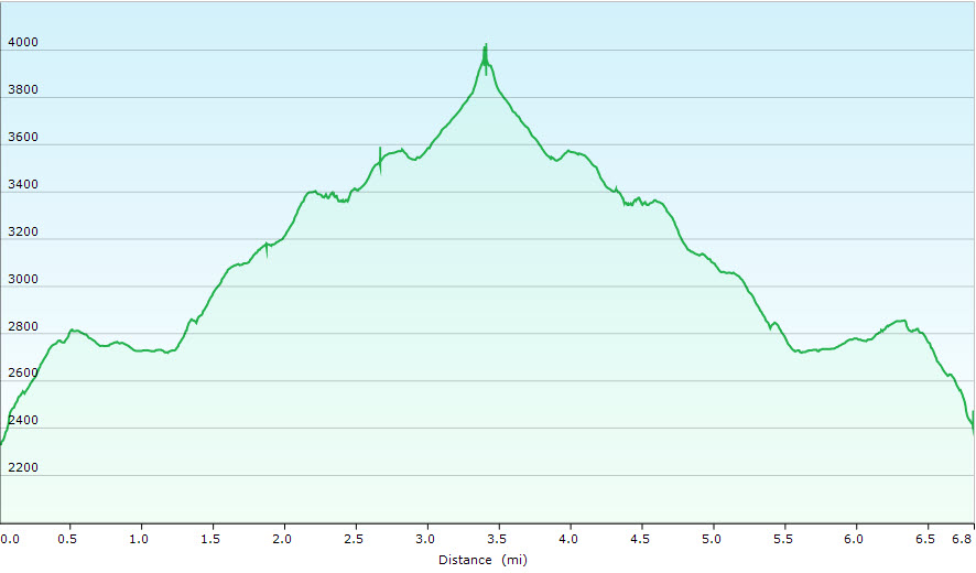
The hike is 6.8 miles roundtrip with 2140 ft total elevation gain. I found hiking poles extremely helpful for helping with two challenging sections. The first is right when you begin the hike. It is steep very early. You start out by walking uphill on an abandoned 4WD road which quickly turns into the trail after crossing a felled tree. The trail is very steep in the first section but will level out in less than 1/2 mile. There are some newer trail flags and old red blazes along much of the trail.
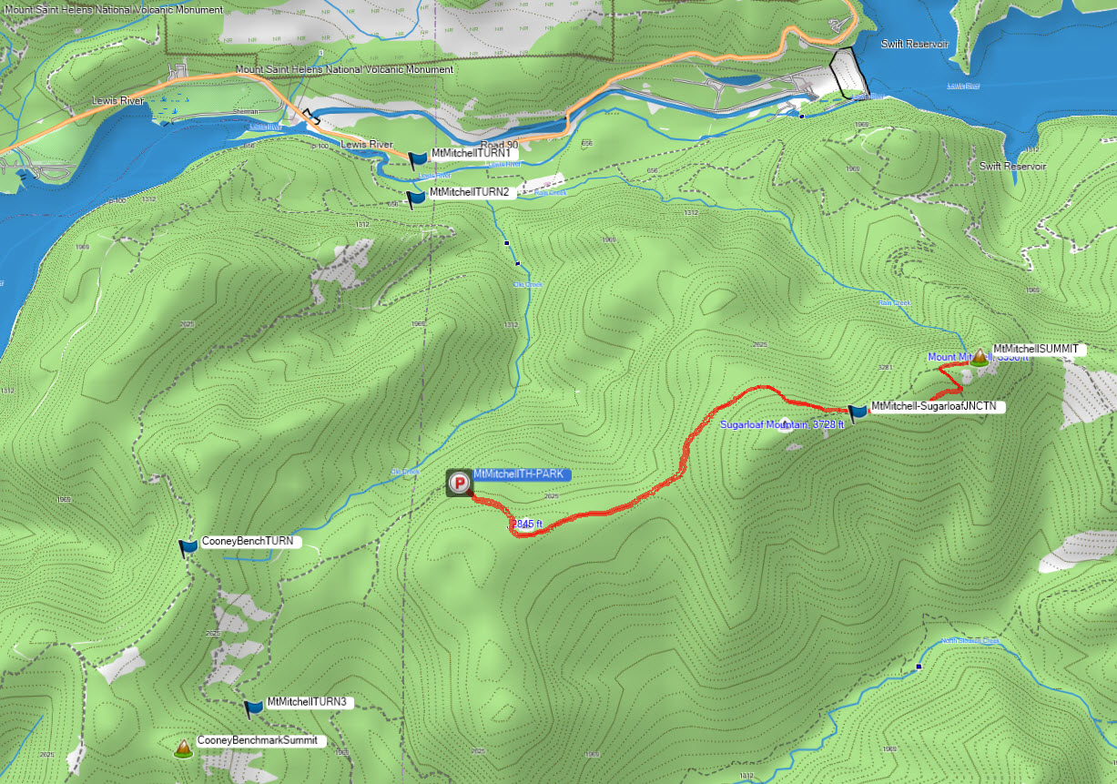
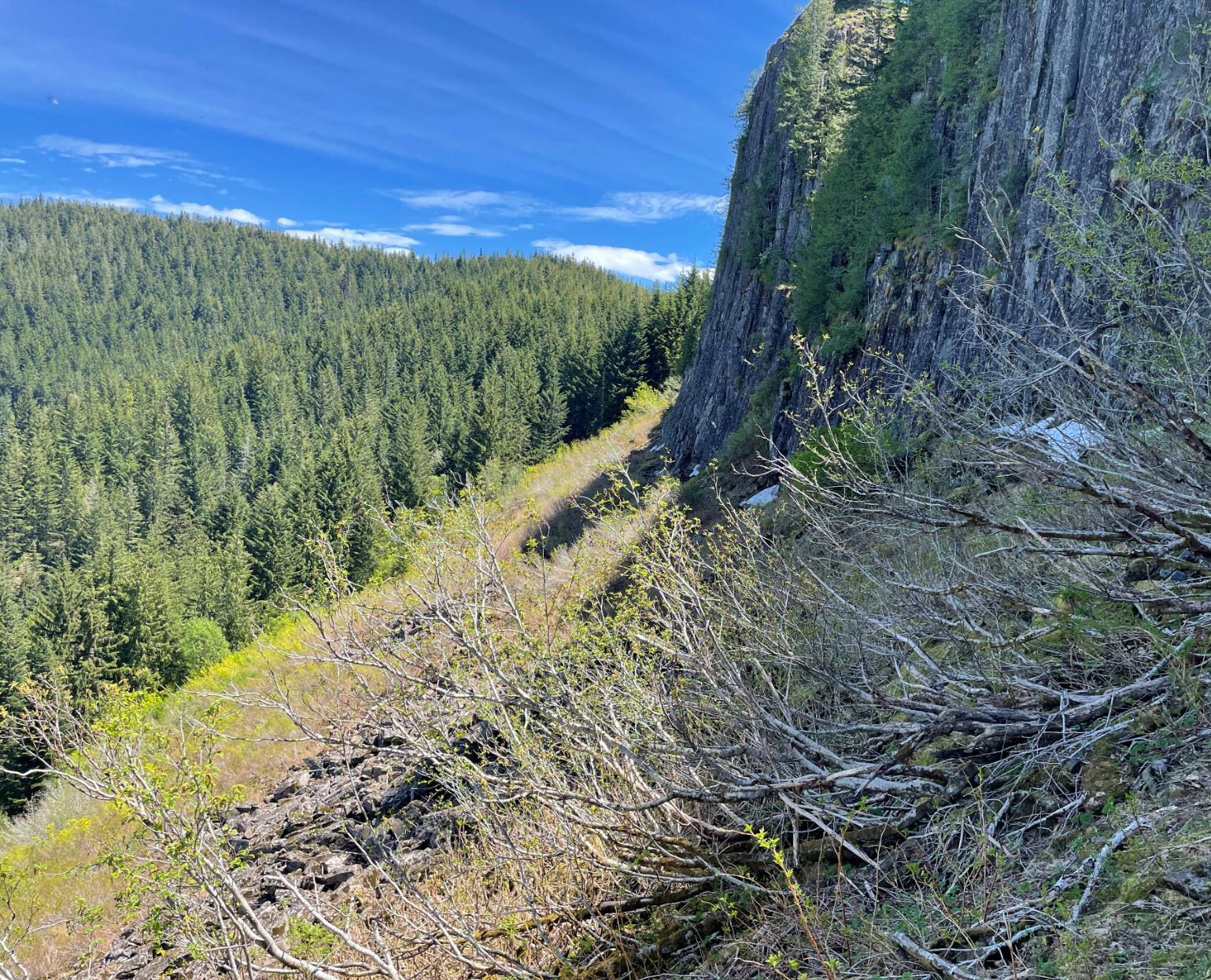
The trail is mostly under the tree canopy with no views until you get to a boulder field at the foot of a towering basalt wall, the bottom of Sugarloaf Mountain. This looks intimidating at first, but the trail picks its way through the rocks along the wall’s base. There are great views of Mount St. Helens in this section on a clear day and some flowers in season. There were still snow patches along the base of the rock wall in late May which made this traverse a little tricky.
Shortly after leaving the rock wall the trail joins up with the Sugarloaf Trail. Hike east 0.5 miles to reach the junction with the Mt. Mitchell trail, and then up the final 0.4 miles to the summit. When you break out onto the top of this peak, you will be rewarded with spectacular views.
The summit is completely exposed. It was only 80 degrees when I was there, and I was close to overheating my radio. If you go in Summer, think of setting up shade. There are rocks to sit on so consider trading chair weight for shading weight in your pack. The summit is a bit tight for a long wire HF antenna. I managed to get an end fed HF set up. You can tie a pole to a sturdy bush or an old lookout foundation pier. I successfully made S2S and Chaser contacts to Portland, Beaverton and North Coast on a 5W HT. There was 5G ATT phone and data service at the top for easy spotting.
Road access, trail info images below. I posted summit pictures on SOTA Atlas. I uploaded my GPS track of hike to http://www.pnwsota.org/content/mtmitchellw7w-lc-083-gpx-track-hike