NOTE: This route is only available during ski operations of Mt Bachelor Resort. The Summit Chair ski lift only runs during winter and spring ski operations.
Mount Bachelor offers one of the easiest 10-pointers in Oregon, if you want it. It is possible to buy a lift ticket and take the Summit Chair ski lift nearly to the activation zone. It is only a short hike to the summit proper from the top of the lift.
In proper Tim fasion, I opted for the hard way. NOTE: Always check the Mt Bachelor Resort website for current conditions and trail openings. Starting from the West Lodge parking lot, follow Leeway and uphill travel signs to the saddle above the Cinder Cone. The Cinder Cone isn't actually a cinder cone, it is a glacial moraine. Mt Bachelor is younger than the other Cascade volcanoes in the area, and thus escaped much of the glacial carving the others experienced.
From the top of the saddle, continue following the signage through the trees to the Pine Marten lodge. Cross the cat track and exit the groomed inbounds terraine for West Ridge. This is where the trail steepens. I had to make switchbacks on my skis, which slowed my progress. At around 8,600' I finally threw my skis on the backpack and put crampons on. It was a tad icy up high in the morning. I don't know if crampons were entirely neccessary, but they certainly made it easier to boot to the summit.
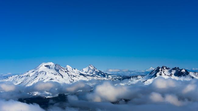
On top I took in great views of the Three Sisters, Broken Top, Mt Washington, and Jefferson.
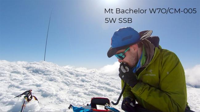
Time to get OTA. I strapped my mast to a metal railing/stake that was on the summit and raised a rollup J-pole. After a few CQs and a spot, the pileup came in. Most of my QSOs were in Bend and Eugene. The farthest 2m QSO of the day goes to K7GND on the Oregon Coast: ~120 miles!
On HF I set up a trapped wire with the QRPkits SOTA Tuner in an inverted V. On QRP SSB I got a few contacts (California and Utah) on 40m including a S2S with WC6J on W6/SS-421. I managed one contact on 20m in Arizona.
As I finished packing up skiers were hiking up the trail to ski off the summit. My ski skills are a bit rusty, so I opted for the inbounds route from the top of the chairlift. After a short hike I clipped in and rode soft groomers all the way back to my truck.
Links: Mt Bachellor Uphill map Strava: https://www.strava.com/activities/5242533567 Caltopo: https://caltopo.com/m/D7AM


