Double Peaks is a 4-point summit in the Mt. Hood National Forest, 2 miles west of Olallie Lake. The entire area is a burn scar, so expect loose dirt and rocks, burned treefall, and no shade. The area is 2 miles west of the Warm Spring Reservation and lies squarely in the National Forest.
From Clackamas, OR, I proceeded east on Hwy. 224 (aka Clackamas River Road) for 44 miles. Just after Ripplebrook Ranger Station, the road turns south and becomes NF-46 (45.07817, -122.04388). Proceed 14.7 miles to NF-42, turning left (44.98320, -121.88146). Proceed 4.3 miles to NF-4230 and turn right (44.95412, -121.83642). Continue 2.7 miles, turning right onto NF-4220 at (44.92460, -121.80751). Continue 9.1 miles to Ollalie Lake.
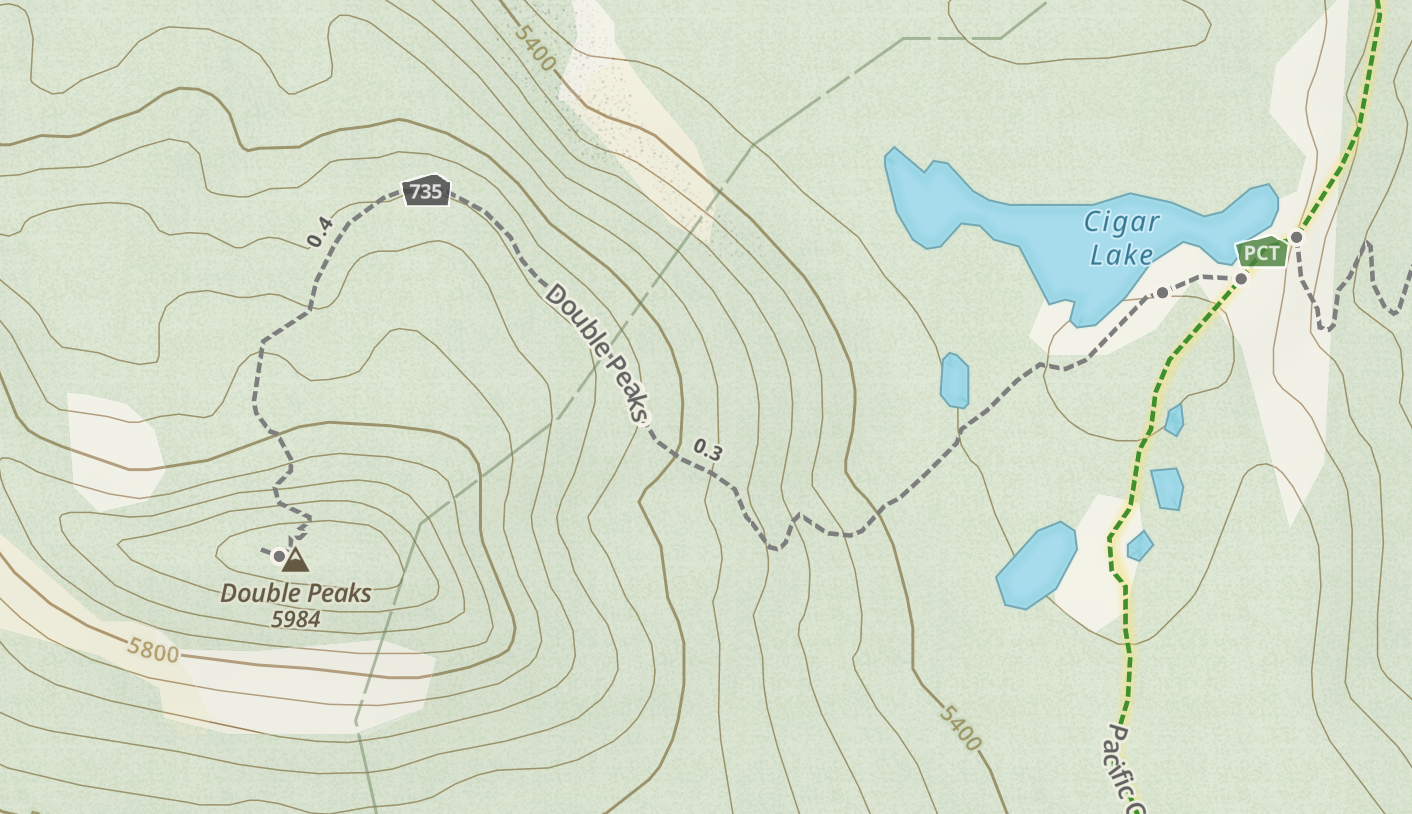
I parked at (44.81415, -121.79084) where you can pick up the PCT south for 1.8 miles. At roughly (44.80217, -121.81189), things get tricky. A remnant trail (735) proceeds roughly west here to the summit. However, it is now non-existant after the fire, so you will need to cross-county/bushwhack your way along roughly the old path using GPS. Alternately, use you best judgement pathfinding but be advised the area climbs steeply after the flats and is loose, dusty, dirty and treacherous in parts. The final scramble up to the summit is class 2/3 probably, due to conditions.
I've attached a map of the 735 trail. This is available as well in Gaia and other maps, no doubt. See also here.
I did work one 2m station in Madras here. Plenty of dead trees for a wire on top.