Doris Peaks is my name for a set of peaks above Doris Lake.
My stats:
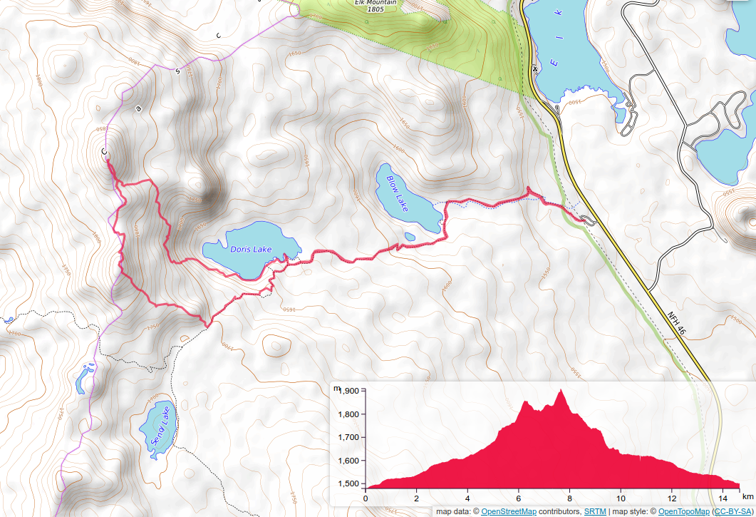
Distance: 9.1 miles
Elevation Gain: 2000 ft
On trail: 6 miles
Off trail: 3.1 miles
Difficulty: Arduous
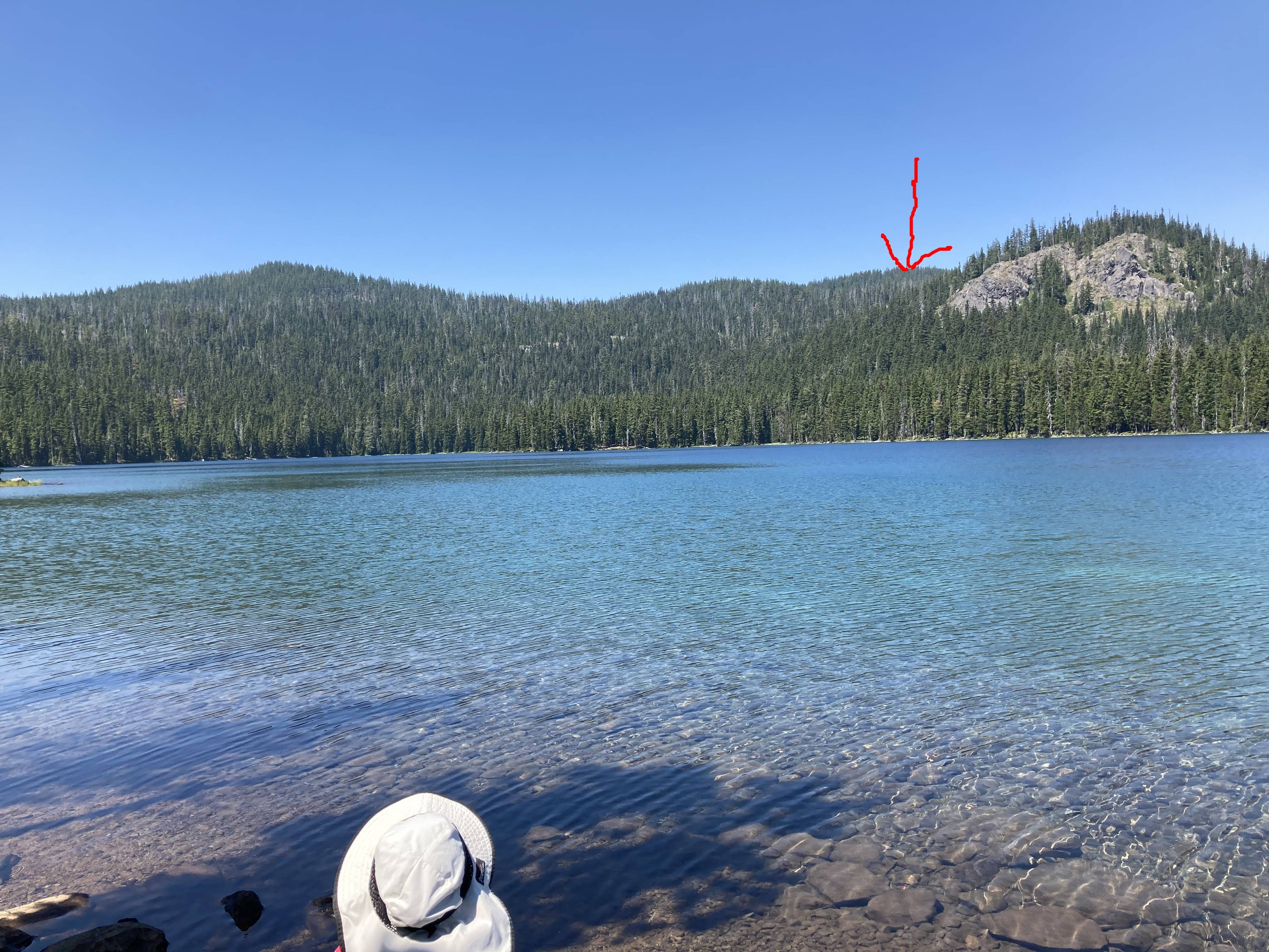
Out of Bend Oregon, on the Cascades Lakes highway, was a yet to be activated peak. Some of my extended family and I were camped at Hosmer Lake. When they decided to hike to Doris Lake, I tried to turn it into a SOTA activation. I had no internet at the camp ground but had listed some of the nearby peaks in advance for just such an opportunity. Given my lack of resources I decided the best way to approach the summit was to hike the trail until it intersected with the ridgeline and walk up that. Given that the topo map I was working from had less detail than I would have liked. This looked pretty good. The ridgeline looked like a long flat thing which would put me in the activation zone before I got to the summit proper. I also thought I would be able to play it by ear a bit when I got there and saw the lay of the land. However, this was an IFR activation. Bring your GPS. The trees are many and visibility is mostly short until you get to the top, which has great views. So my ridgeline walk turned into walking over a couple of other peaks one of which was not far short of the summit elevation. One of the saddles was crowded with fairly large diameter blow down and the other had a beautiful little pond and associated wetlands. Also associated with it was a cloud of hungry mosquitoes. On top it was pretty open, but there were plenty of various size trees to use as antenna supports. Activation went quite quickly as I was able to spot myself with my phone. I didn’t linger at the top as I needed to meet my family at the lake for a swim and ride back to the campsite. Coming down I decided I should drop down a bit and then contour back to the trail so I would not have to regain the other summits on the ridge. This worked well for a while and then the forest got quite young and dense and at times I felt like a full back pushing through a defensive line. At one point I tripped, but did not fall down as there were so many small trees holding me up. There was also one slightly exposed part where I crossed a rock outcropping over a drop off. Footing was good, so not too sketchy. I eventually hit a trail that was near the lake. I don’t know if it goes all the way around the lake, but if it does it would open some other, possibly better, ways to the top. Note that the picture below was taken on the return trip. I did not go to the lake on the way up. If I had I might have just stayed and swam.
So if you decided to do this I would not follow either of my tracks. There may be a better way up and back.