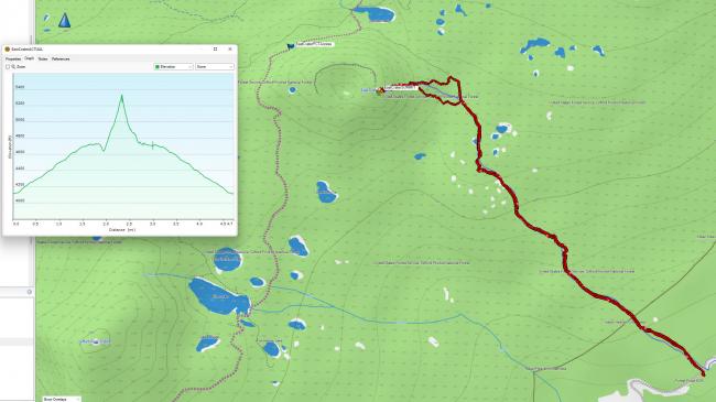
East Crater Summit can be accessed from the Northwest via PCT (See http://www.pnwsota.org/blog/k7ahr/2020-october-10/east-crater-wa-september-2020 ) or from the east side via East Crater Trail #48 (https://www.fs.usda.gov/recarea/giffordpinchot/recarea/?recid=31748). This report is for the east side access. It is 4.7 miles round trip with 1350 feet of vertical gain.
If you use Google Maps and search for “East Crater Trailhead” you will get routed correctly. The roads coming from Carson were in decent shape and able to be navigated in a passenger car. For me the route was:
- Carson -> Wind River Hwy
- Turn Right on NF-65
- Turn Right on NF-60
- Pass Goose Lake Campground
- Turn LEFT on NF-6035 (Forlorn Lakes Road)
Note: I drove out via NF6035 -> NF-6020 towards Trout Lake and there was a very large washout that requires high clearance. So if you come from the Trout Lake side, you will need high clearance!
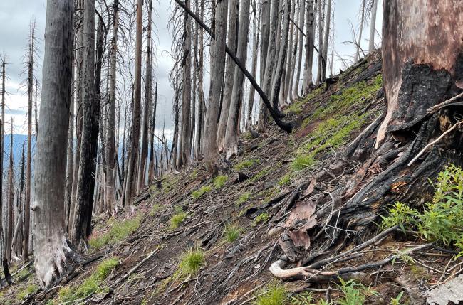
Trail #48 is very nice. It is well-maintained and takes you into the really beautiful setting of the Indian Heaven Wilderness. The trail traverses along the bottom of the crater; you have to bushwhack through burned out forest to the summit. Because of the burn, the forest floor is not dense. I chose to depart the trail at ~1.8 miles at 45.99866, -121.77938. When I returned, I found it a bit easier going by getting to the trail at 46.00025,-121.78034 (GPS track image below).
Once you leave the trail, it gets very steep. ~700 feet in .3 miles. (pic below). The top is red lava rock with burnt tree stags. The view to Mt Adams was a bit clouded over for me, but if clear it would be a stunning close up of Mt Adams. (Summit pics posted to SOTA Atlas)


