DISCLAIMER: This summit should not be attempted without knowledge of rope systems, crevasse rescue and snow travel. It is a serious climb that should not be taken lightly.
Little Tahoma Peak is a sister summit of Mt Rainier. At 11,138' it is the 3rd tallest peak in Washington State. It is far less popular than Rainier due to the fact that the final few hundred feet is some of the loosest rock in the state.
My partners and I met at the White River Ranger Station at 7:15 AM. A line was forming at the door in anticipation of the stations opening at 7:30. The climb is entirely within Mt Rainier National Park and as such requires permits for parking, climbing and overnight stays. After endless paperwork we departed with permits in hand and parked at the Fryingpan Creek trailhead to Summerland.
From the trailhead we made quick work of the initial 4 miles of well groomed trail to the Summerland meadows. Here we refilled water and surveyed the route to high camp at Meany Crest. We also caught our first clear view of our objective. The rocky spire with clinging glaciers was an imposing sight from 6,000' below the summit. The rest of the climb from here is off trail. All felt guilty cutting across the picturesque meadows but soon we arrived at the bottom of a steep, rocky slope. Scrambling here was tedious with heavy overnight packs.
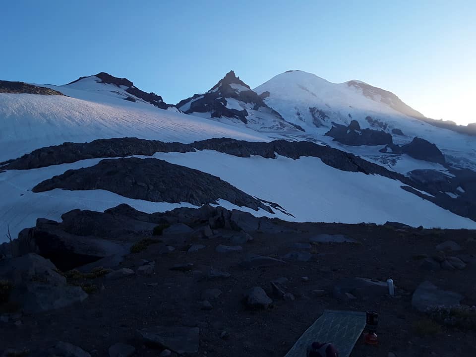
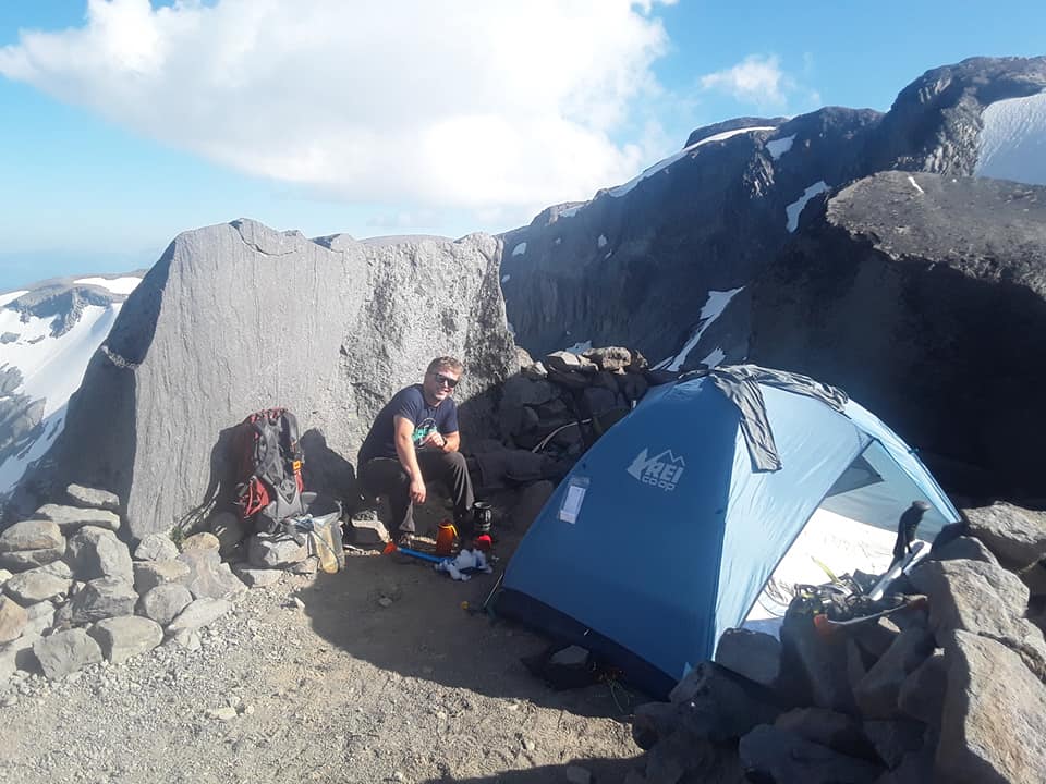
Finally we popped over the last boulders to see yet another steep trailless slope. This one was mostly deep sand that flowed into my shoes with every step. A few hundred yards of ridge scrambling brought us to Meany Crest and one of the most spectacular campsites I've ever had the pleasure to stay. We also met a couple of other parties who described the route as being in mostly good condition. We spent the afternoon and evening lounging around camp, taking photos and melting gallons of snow. After some discussion we agreed to try to leave at 2 AM. This would allow us to cross the crevassed glacier while the snow was at its strongest.
As night approached I decided I would sleep under the stars. I had carried a tent but the mountain and sky were too inviting to sleep inside a tent. I've never been able to sleep much on the mountain anyway.
Slowly the last late light faded on Rainier and the stars appeared. I dozed. The Milky Way glowed softly. I awoke. Satellites wheeled overhead. A meteorite blazed a bright green trail. Again I slept. A light wind swept camp, made fierce by elevation and blowing dust. Awake again I spotted strings of headlamps high on Rainier. A continuous line of climbers ascend the standard Disappointment Cleaver. Midnight already. A few hardy rope teams brave the Emmons Glacier with gaping crevasses.
Finally my alarm rang. 1:15 AM. Slowly the team ate, gathered gear, packed bags and tied into the rope. We set off across the Fryingpan Glacier at 2:20 AM. It was mostly a flat glacier- easy travel except for a few small cracks which were easily stepped over. One crossing between multiple deep crevasses was a little exciting but manageable. Almost to the Whitman Crest we heard a loud rockfall event nearby. Everyone stopped and listened. No one could see it in the dark. As the rocks came to rest we continued on and reached the snow to rock transition at the notch on Whitman Crest. 1:40 had passed and we took a short break to refuel and hydrate.
Managing food and water can be very challenging at higher elevations. One often does not feel hungry but must still force down a few bites or else face the dreaded "bonk". Same with water.
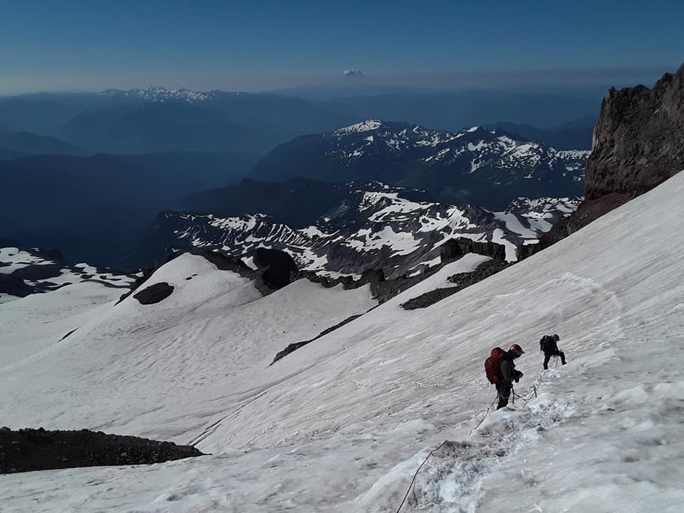
We started again, hiking down to another rock to snow transition and made short work of the lower Whitman Glacier. Not many crevasses but large loose cliffs overhead motivated us to move quickly. Rounding a corner we spied the last section of the Whitman Glacier. From below it looked tame but as we climbed higher the slope became more steep to an angle around 35°. The snow was still quite firm which felt a bit insecure and a little scary. Finally we reached the top of the glacier and one by one stepped off the snow.
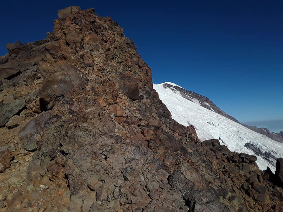
The transition here was also tricky with crampons (foot spikes). The exposed rock was quite smooth with a layer of loose rocks big and small. There were no solid edges to grab with the spikes so we each scrabbled for a bit before reaching a secure ledge to take off the spikes. Here we left the spikes, ice axes and rope with only a few hundred feet of rock scrambling to go.
From this point to the summit was continuous steep loose rock with a few steeper sections on solid-ish rock. The true summit is a few feet higher that the ridge and requires some scary scrambling with mind-bending exposure several thousand feet above massive glaciers. Fortunately the activation zone allows one a comfortable perch with an excellent view.
At first I used my whip to make 4 quick QSO's with Jason KV7DX, Jeff KJ7TTZ, Tim KG7EJT and Victor KI7MMZ. Then I put together the yagi and made 6 more QSO's: Chris WX7EMT, Darryl WW7D, John K7JRO, John N0PBR, James WA7JNJ and Clint KJ7LLS. Many thanks to all chasers for the quick contacts.
The descent was much the same as the way up except in reverse. We were all happy to step off the glacier into high camp. From there it was a blissful walk back to the cars.
About the open bivy: when I got home my eyes were super red. My 2 tent bound partners reported no such problems. Pretty sure it was from sleeping in the open with all the blowing dust.
Thanks for reading!