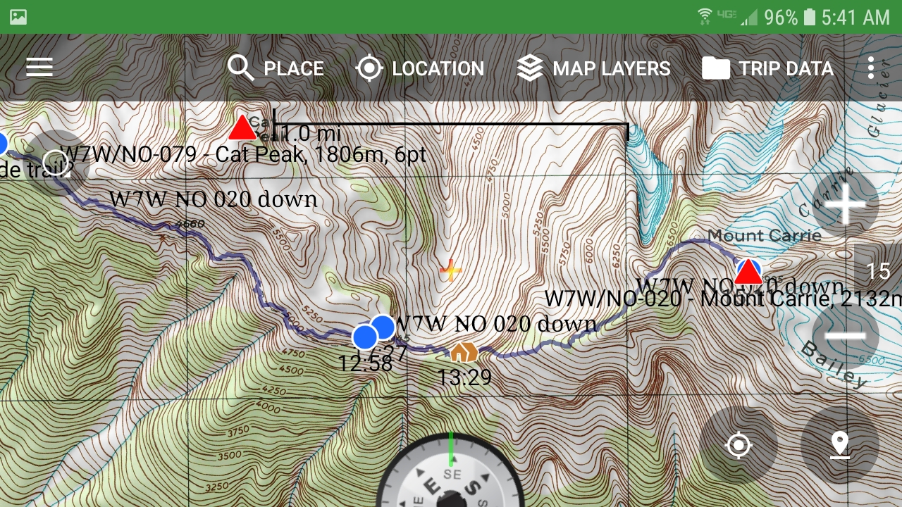
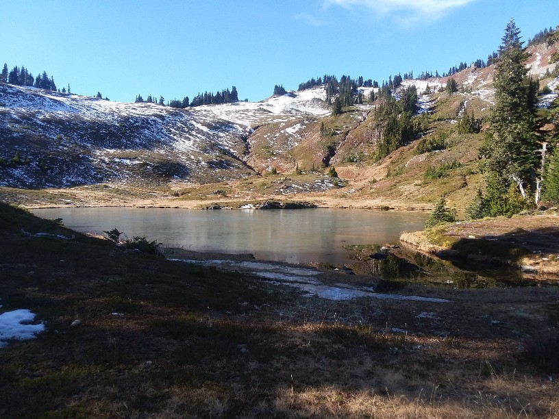
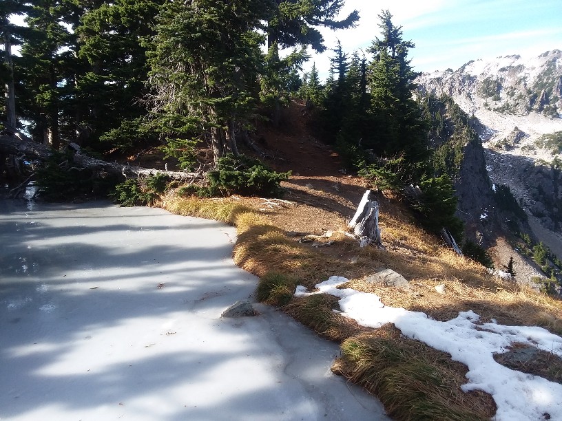
Nov 2, 2019 was the perfect day for climbing Mt. Carrie. The weather was cool and clear. Some snow up above Heart lake, but the Cat Walk (the unmaintained trail and scramble east of Heart Lake) was free of snow. That area would be very challenging with snow, and an ice axe and crampons would be a must.
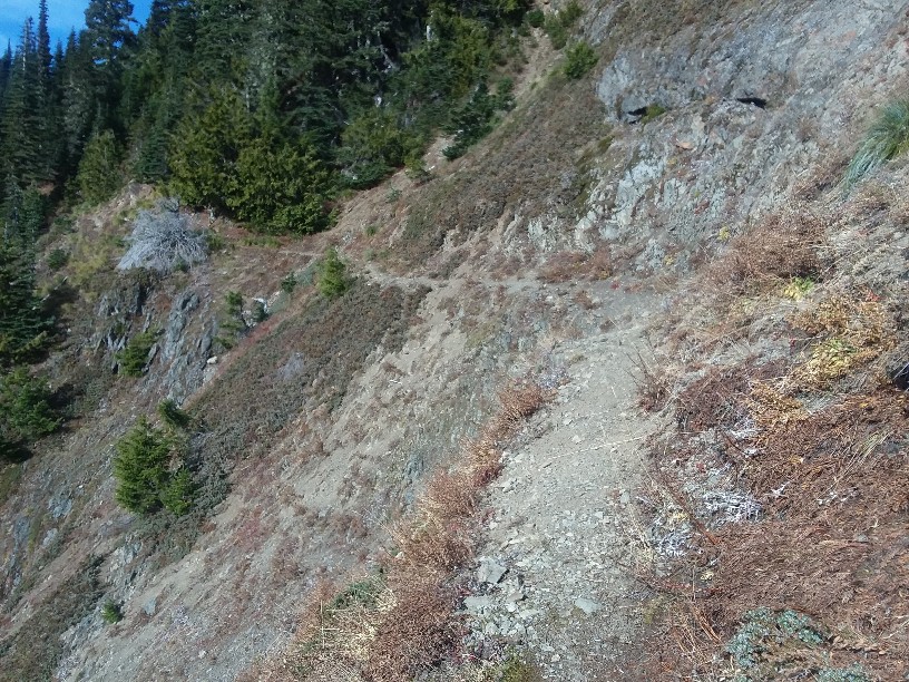
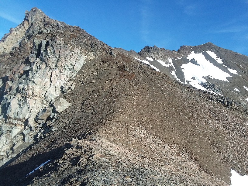
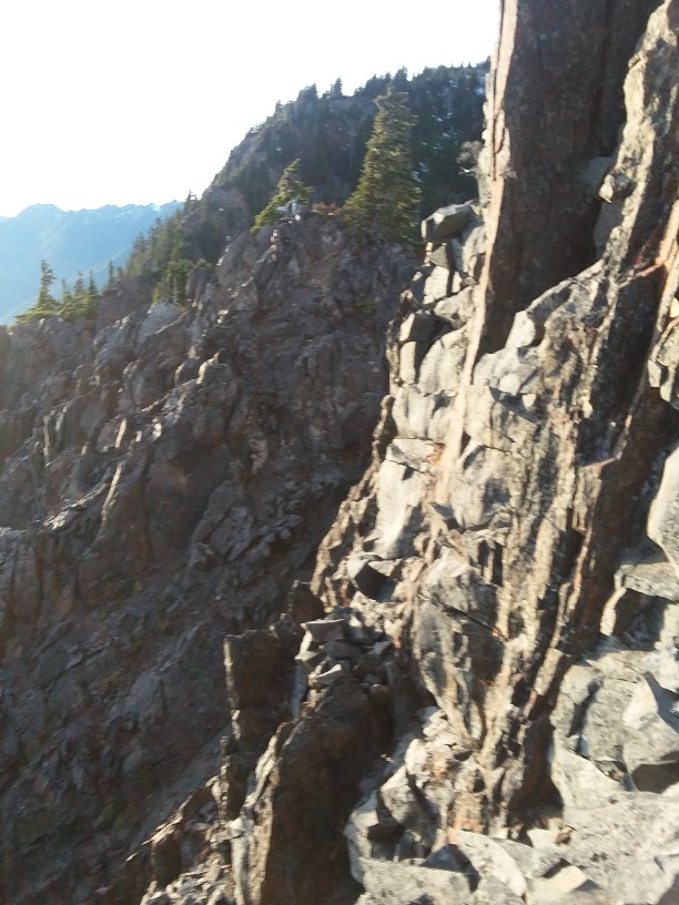
The trail is maintained about a mile past Heart Lake, but it is still very good for about 3 miles. The Cat Walk is fun, sometime a 8-12 inch path along avalance chutes. It ends abruptly and then the very UNmaintained path continues up the slope about 300 feet verticle. It then continues back down to about 5000 feet across the more tricky cat walk--some would consider parts of it a scamble. I hike down on trips at night frequently, but I didn't want to be coming across this section in the dark if I could avoid it.
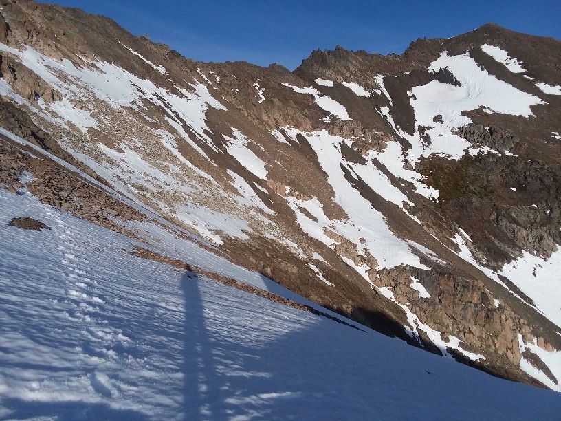
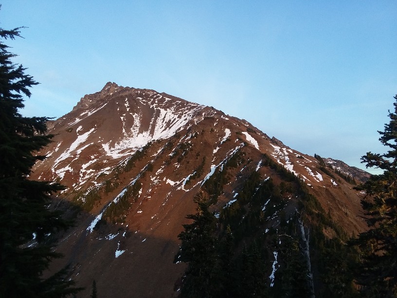
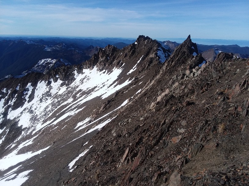
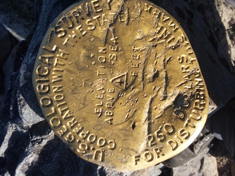
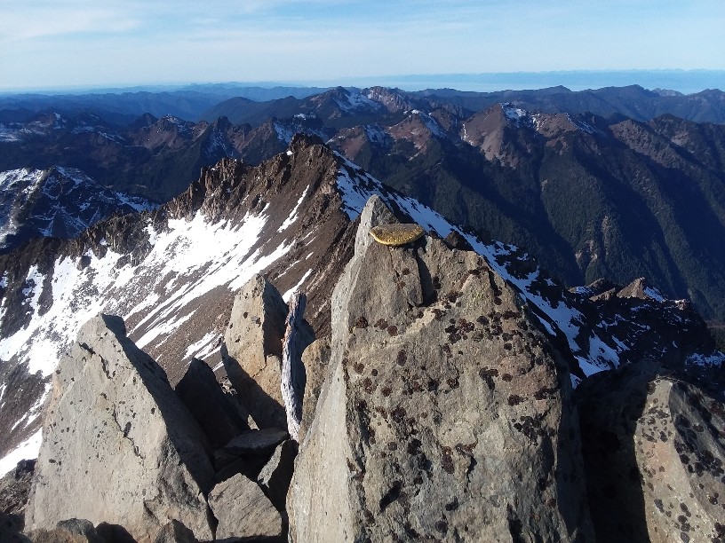
Once across the Cat Walk, it is mostly a straight shot up the west ridge line of Mt. Carrie. At 6500 feet it becomes a large boulder field, and the ridge line is a knife's edge--impossible to climb. At this point I traversed on the south face across the rock and scree to the summit. A few small cairns marked a usable route. But much had snow. I didn't use crampons, but with more snow I would have--the consequences of a slip would not be good.
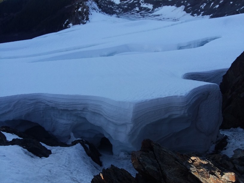
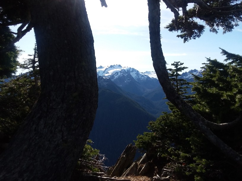
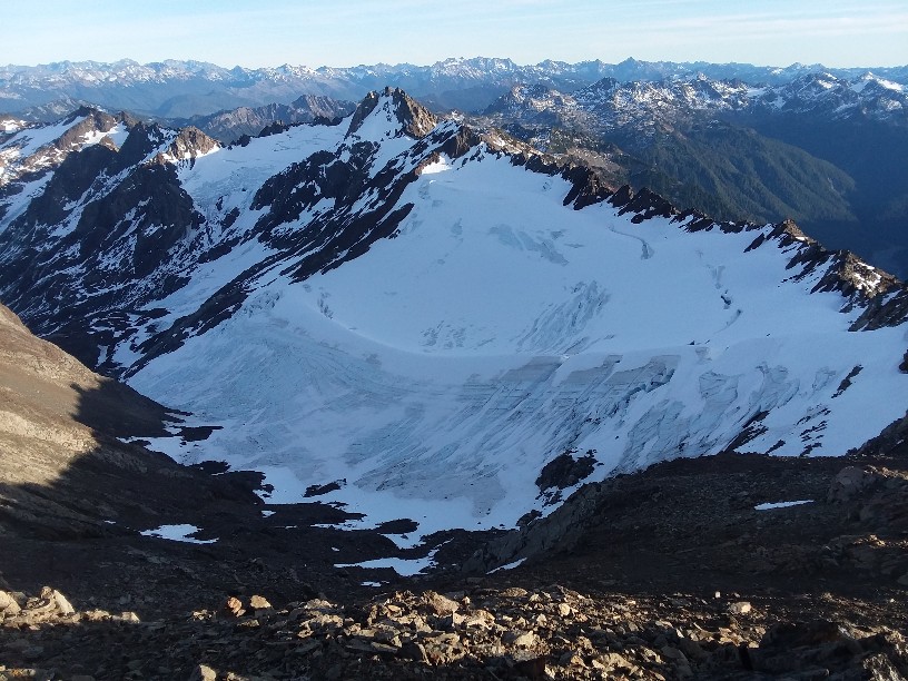
The views of Carrie glacier and Fairchild glacier are awesome. As is the view of the Mt Olympus range and the Hoh valley. I could see Victoria and Mt Baker.
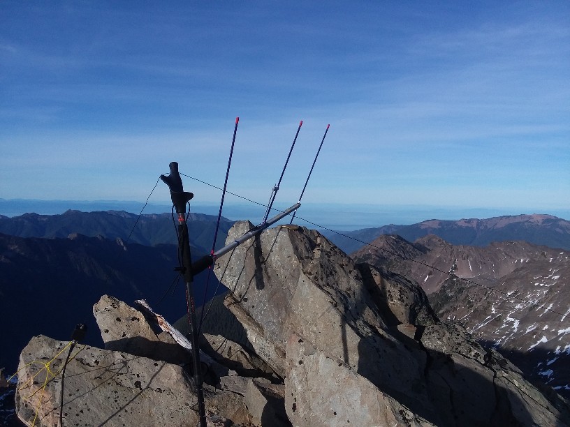
I only got four contacts on 146.52. I was suprised about that with the view of Victoria. But Vancouver, Port Angeles, Sequim, Seattle, and all other towns are very well blocked by mountains.
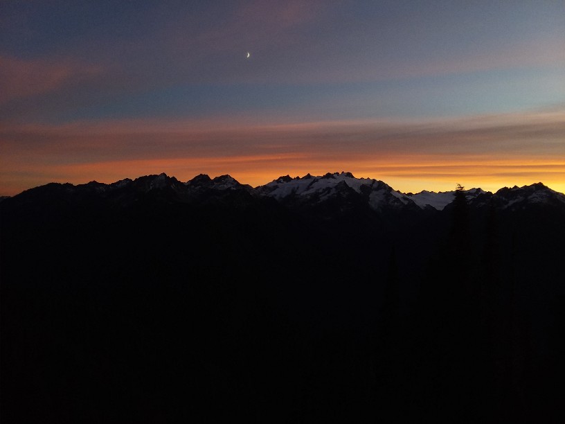
I briefly tried 20 m, but the band was completely occupied by a contest, I assume. Nearly everyones CQ was faster than my ability and nobody returned my call sign. I was able to get 2 contacts on 40 m, but I couldn't hold a frequency there either before others would start blazing away. By they I had been on the summit an hour, and I needed to head down. It had taken me 7 hours (8am until 1500 to get to the summit) and I wanted to be across the cat walk before dark.
By the time I was done melting snow for water and having hot chocolate, I left the summit at 1620. I was done the 2000 feet and across the tricky part of the cat walk in one hour. But I still had 12 miles to go. The entire hike up was 14 miles, with 7200 feet of elevation gain. It took me just over 7 hours from summit back to the car. Even though it was down, I was getting tired and slowing down.
I wanted to summit Cat mountain on the way back, but I glad I didn't try. One, I would have missed the sunset while on the Cat Walk. Two, I would have been hiking down Cat mountain (with no trail at all, over a route I had never done) in the dark. And 28 miles in a day is probably enought! Next time I want to camp and do Cat Mt, Mt. Carrie, and Mt Fairchild. I think I could get to Mt Fairchild from the Summit of Carrie by going down the east side of Carrie, and hugging the top of Fairchild glacier. The ridge line between Carrie and Fairchild looks too rugged to go directly, at least while hiking quickly. It
I was suprised I had voice and data coverage from on Mt Carrie, and even on the Cat walk. I didn't try APRS, but I suspect it would work with Victoria repeaters.