Even more updated here: http://www.pnwsota.org/blog/k7atn/2021-june-07/updated-monte-carlo-wa-june-2021
This was also another case for me finding roads or trails at the summit when I could not find any such information online until AFTER the activation. It appears that Gifford Pinchot Forest Trail #52, Monte Carlo, starts at the Oklahoma Campground to the west and crosses this peak. I came from the east side with a shorter drive and a shorter hike. Check out www.wta.org/go-hiking/hikes/monte-carlo.
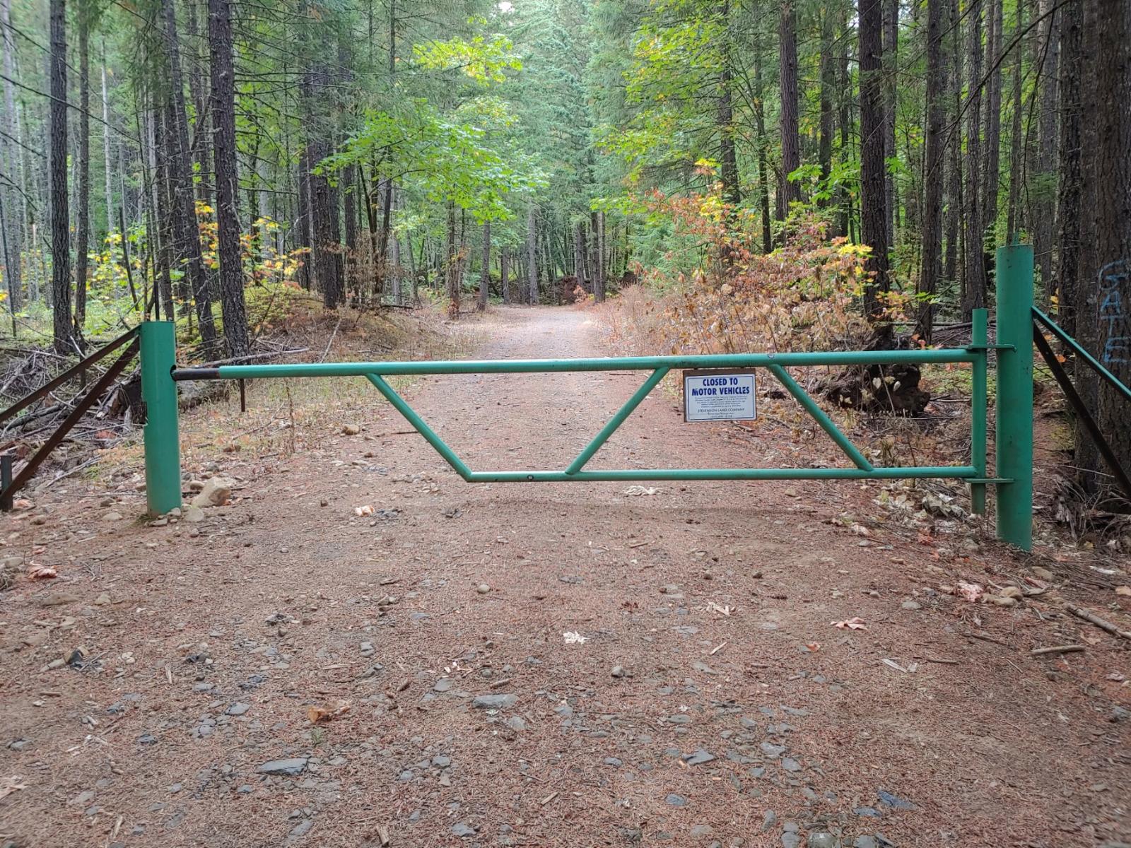
UPDATE October 2020: A gate has been installed on this shorter approach (see photo) allowing non-motorized traffic only - making this nearly 8 miles RT. You should check which route is best for you.
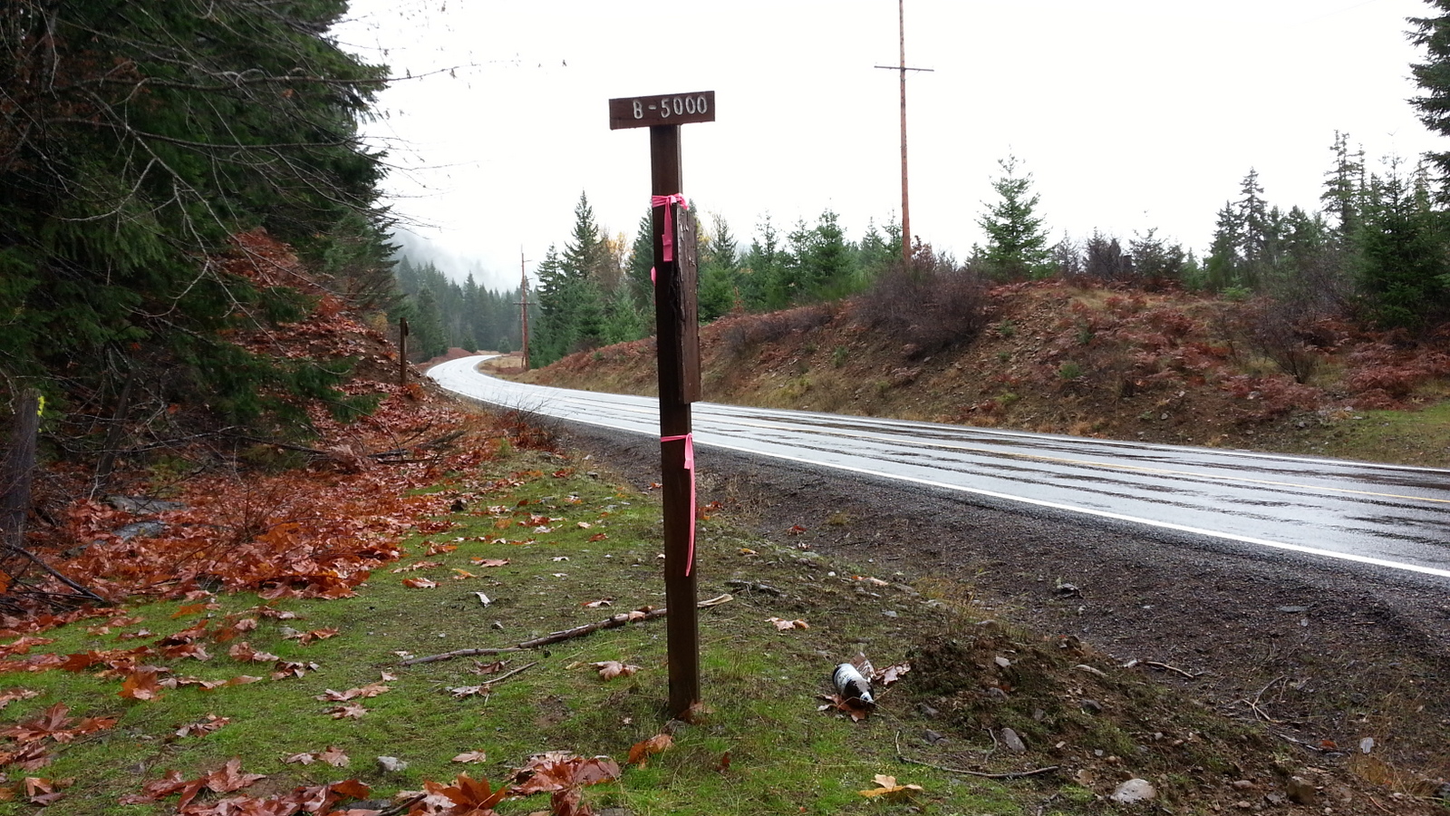
To get to the "short" trailhead from Portland, take I-84 west to Hood River and cross the toll bridge (alternatively you can cross the Bridge of the Gods at Cascade Locks - it's $2). Find Washington 141 Alternate and go north for 2.2 miles and then continue north another 10 miles on Washington 141. Around MP-14 turn left onto a road marked "B-5000" and drive about 2.8 miles to a wide spot in the road that is between two drainage humps. This road can be navigated in a thoughtfully driven passenger car.
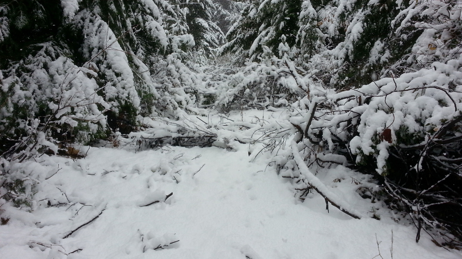
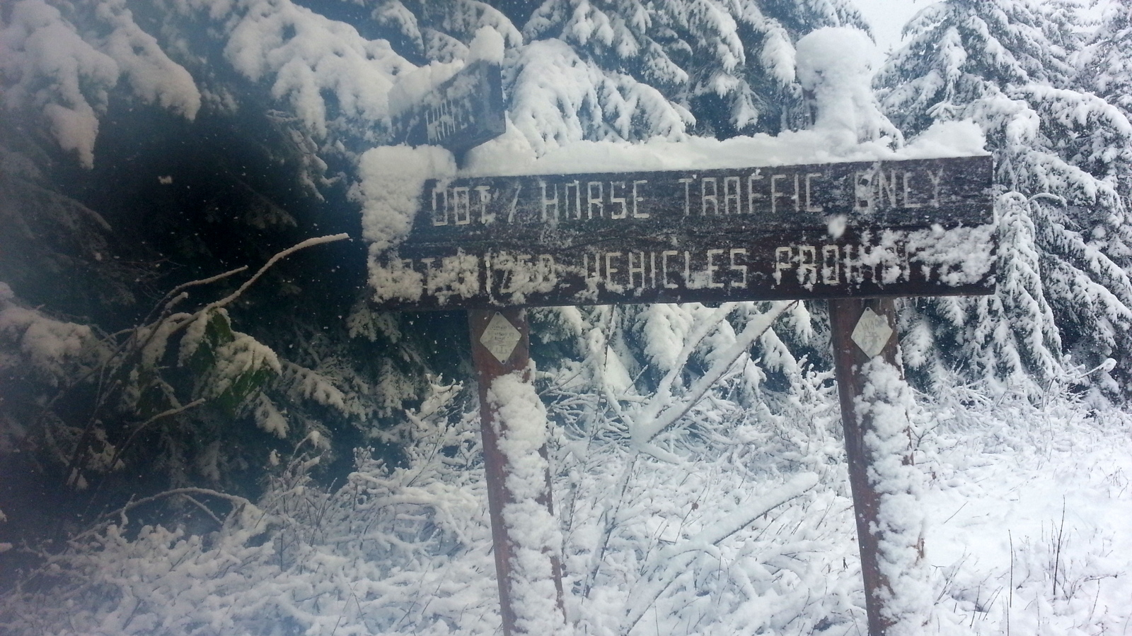
The "trail" that I found near the parking spot was an abandoned cat track that leads almost directly to the summit (start near 45.8812, -121.5614). It's about 0.8 miles of climbing over 1100 vertical feet to another "road" or trail, turn right here a short distance to the summit proper. There is a trailhead sort of sign there (see photos). With six inches of snow and lots of brush there were some times that the cat track was not at all apparent - see the photos. And note that you can just barely make out the diagonal slash of this cat track in Google Earth photos.
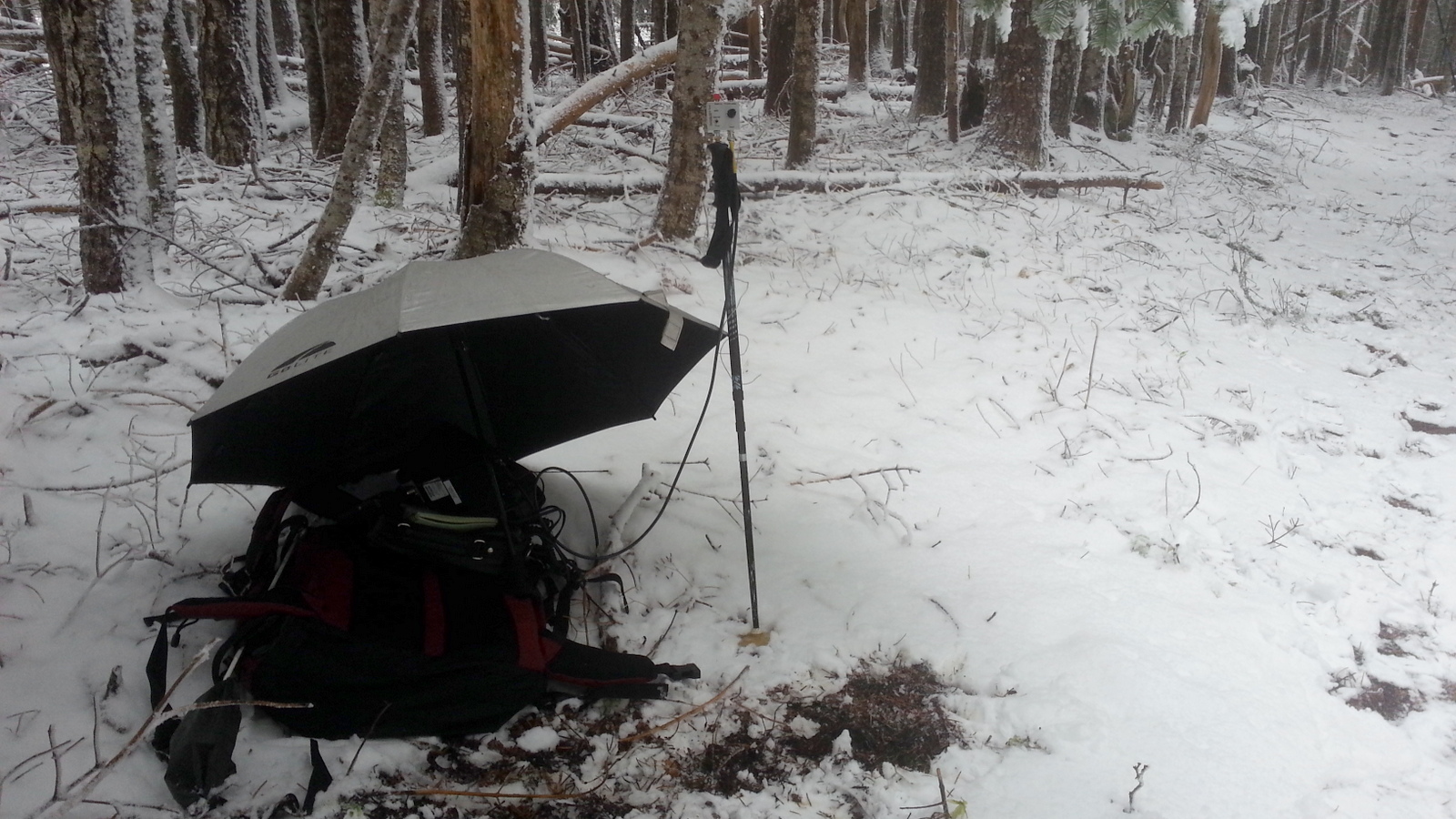
I set up in the woods for some shelter from the snow but if the weather is better you could use the trailhead sign to support your antenna. APRS coverage was some digi echos from the summit, but otherwise nil.
You might appreciate the shorter hike to nearby Monte Cristo HP. W7W/MC-056.