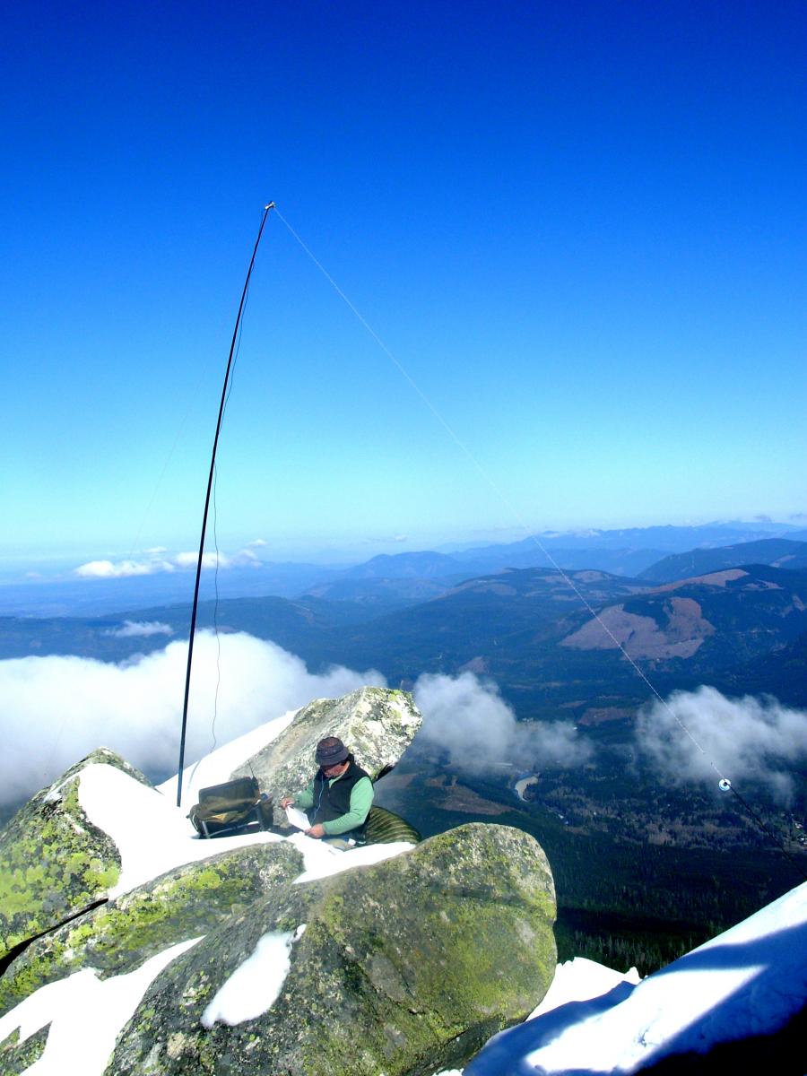
Pearls On A Necklace – SOTA Adventures in W6/CT. Strung along the Angeles Crest Highway (SR 2, Los Angeles County, California), which runs through the San Gabriel Mountains, on the stretch between the Pasadena / Glendale area to the south, and the Apple Valley / Victorville area to the north, lie more than 20 SOTA listed summits. Most of these SOTA list mountains are 6 to 8 point summits. Proximity to Los Angeles, relatively easy access and beautiful terrain, similar to east slope Washington and Oregon Cascades, make this a “SOTA tourist delight” area. On 3 separate days, between October 31, 2014 and November 4, 2014, I activated five (5) of these SOTA summits. This report is #1 of 5.
Good Parking At Trailhead
SOTA Activation: Mt. Williamson, Los Angeles County, California - November 3, 2014
Browder Ridge North, October 11, 2014
Directly across Hwy 20 from Iron Mountain at Tombstone pass is peak 5436, CM-127. Its really a part of Browser Ridge extending towards the northwest from the other Browser Ridge peak CM-056.
Access to CM-127 is via NF-15 which turns off US Hwy 20 about 1000m west of Tombstone pass. Take NF-15 to the trailhead for trail 3409 which is located right where NF-080 splits off.
Cowap Pk Activation 2014 N7RR & W7TAO
Total elevation gain from the Damfino Lakes Trail 625 northwest trailhead on FS 31 via the northwest ridge trail of Cowap Pk to the activation location just northwest of Cowap Pk summit: 413 m (1356 feet). Approximate trail distance each way: 3.4 km (2.1 miles). The activation is a reasonable one-day trip, and, except for one spot just northwest of the actual summit, a problem-free climb. The activation zone northeast of the summit is easily accessible, and a great family destination.
Huckleberry Ridge activation with KR7W, 10/8/2014
During the first week of October, I was delighted to receive an invitation from accomplished SOTA activator KR7W to accompany him to the not-yet-activated Huckleberry Ridge summit. I expected to take my HB1B along, but testing my equipment, the day before our outing, I managed to toast something inside while trying to get a good antenna match. So I petitioned Rich to let me pack along his trusty KX3 as an alternative to the HW7 he was planning to bring for his own use.
First SOTA Activation: Earl Peak, Kittitas County, Washington - October 19, 2014
Seeing Red...and orange, yellow, blue and green. The reference here is to fall colors and the ongoing hunting season. Beautiful fall day, with mostly sunny weather, fall foliage on display. Several hunting parties in the Teanaway, Beverly and Bean creek valleys necessitated wearing bright colored clothing, and making our presence known.
SOTA Activation: Mount Catherine, Kittitas County, Washington - September 21, 2014
Last full day of summer, 2014 - A short Activation hike to a beautiful mountaintop view from the somewhat smallish summit area of Mount Catherine.
A last minute decision to attempt a SOTA Activation on the last full day of summer 2014, led us to choose Mount Catherine, behind the Summit East (Hyak) ski area, near Snoqualmie Pass.
Nason Ridge West
This peak is 68.5 miles east of Interstate 5 along State Route 2. Go over Stevens Pass and very soon after the highway divides, turn left on Smithbrook Road #6700. Travel in, over and around the potholes for about 3.7 miles to a wide left-hand curve at about 4600' in a saddle of the Nason Ridge. Park along the road or on a nearby spur road and you'll find the trail for access on the east side signed as Nason Ridge Trail #1583. No permits required here.
Dock Butte Activation - Sept 14, 2014
Dock Butte has great views of it's Mount Baker-Snoqualmie National Forest home. There is plenty of antenna room on the summit and it's only a short 3-mile roundtrip hike. The trail is great - a bit steep and requires just a very short scramble near the top. It took us about an hour from the trailhead.
Angeline-Heart Activation Aug 21, 2014
Located in the Alpine Lakes Wilderness off the West Fork Foss River Trail #1064 near Skykomish, this peak is between Big Heart and Angeline lakes. Big Heart Lake is about a 7.3 mile hike in, and the trail is steep and rocky at times. You'll also pass Trout, Copper and Little Heart Lakes on your way with wonderful scenery at all times.
Surprise Mtn Activation - Sept 2, 2014
Surprise Mountain is right off of Section J of the Pacific Crest Trail #2000 in Washington. We were hiking south from the Steven’s Pass trailhead and camped at Deception Lakes - about 17.5 miles from the trailhead. From that point, it is only 1.3 miles and a 1300’ gain up the Surprise Mountain Trail #1063 to the summit. Following the horse camp signs along a very well maintained trail got me on the right path.