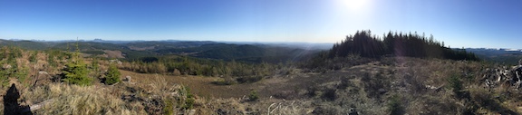
DIRECTIONS NOTE: Google Maps may try to send you on "Rd 20" off of HWY 26. Unfortunately the bridge that crosses Still Creek is CLOSED. Take Still Creek Rd, off of HWY 26. 
For the 2021 Willamette Valley S2S party I wanted something that would get my heart rate up and I finally settled on Devil's Peak (W7O/CN-033). After a detour in Rhodedendron (see above), I parked at the trailhead and started up. That's what this trail does. It goes up. 
Good Views From Summit
Devils Peak 2021 WV S2S Party Snowshoe
Old Blue Mountain Oregon
Looking over the map and seeing a named peak with no activations is just more than I can handle, especially when K7ATN's blog post left the slightest hope that there may be a way to get there. After hours of poring over maps, I came up with a plan.
Activating Mt Hood via South Side Route | March 31st, 2021
NOTE: Conditions on Mt. Hood can change weekly, even daily. Consult up-to-date weather, avalanche, and beta reports.
On March 31st, 2021 I took advantage of a weather window and reasonable avalanche forecast to activate Mt. Hood (W7O/CN-001) via the standard South Side route.
Green Mountain, ID | September, 2020
Drive-Up on a spur road from the Magruder Corridor
Moose Ridge, ID| September, 2020
16.2 miles, +4,300 ft; -4,200 From Elk Mountain TH
1.2 miles, +300, - 200 ft ft from Trail 562 Junction
I activated this on the 14th day of a 15-day backpacking from the Elk Mountain Trailhead, via Mink Ridge & Marten Creek with a side-trip up Marten Creek to Marten Hot springs; but the route description is the more direct route across Goat Creek and along the Square Rock & Moose Ridge.
Mount Saint Helens, WA | March 2021
This was the second activation of LC-001 for both WE7CAT and KL0NP. The first year WE7CAT had just gotten her tech license and was too shy to talk on the radio. The next year she activated it without me with using an Anytone 878 with stock rubber duck antenna and was able to do a S2S with me while I was on Mt. Townsend in the Olympics. This year WE7CAT/AE had just passed her Extra Class exam, and was ready to make contacts.
Wylies Peak, ID | September, 2020
10.7-miles, +3,800 ft; -2,900 From Elk Mountain TH
1.2 miles, +1,000 ft from Trail 562 Junction
I activated this on the 12th day of a 15-day backpacking from the Elk Mountain Trailhead, via Mink Ridge & Marten Creek with a side-trip up Marten Creek to Marten Hot springs; but the route description is the more direct route across Goat Creek and along the Square Rock ridge that we took on our way out.
Vermillion Peak, ID | August, 2020
24.2 miles, +7,500 ft; - 6,800 From Elk Mountain TH
5.2 miles, +3,800; -500 ft from Buck Lake Creek
Horseshoe Lookout (6985), Idaho - 19July2018
This summit is the old Horseshoe Lookout Site. It had a primitive platform on a rock pinnacle from 1921-1961. A standard L-4 structure, 1962-1983. Both structures succumbed to wildfires and were not rebuilt. Concrete blocks from the L-4 lookout remain. The access road, USFS #588 is 4 miles off FS #500.
Blue Mt, WA | March 2021
The winter activation is much more challenging than the summer one. In the summer, it is a drive-up until the last quarter-mile walk. In the winter the road is closed 9 miles down at 2000' elevation. So that means and 4000' climb over 8 miles up.


